Weather
MA Weather: Timeline Of Showers, T-Storms Tuesday
It's going to be gray and rainy all day. Here's when it's expected to get bad.

Tuesday will be another rainy, gray day before the skies begin to clear up for the rest of the week. Thunderstorms are expected to punctuate today's on-and-off precipitation.
Temperatures will be mostly in the 50s to lower 60s Tuesday, forecasters said. It will be drizzly and foggy until later in the afternoon, when some locally heavy rainfall may occur during the commute home.
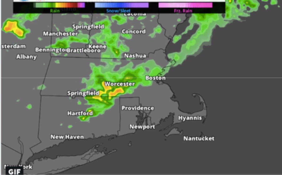
A round of isolated thunderstorms will make their way through late Tuesday. They don't appear to be long-lasting. You can see an estimated timeline via the National Weather Service simulated radar below:
Find out what's happening in Bostonfor free with the latest updates from Patch.
Another round of showers with isolated thunderstorms expected this afternoon and evening. Here's a look at the rough timing based on one of our computer models: pic.twitter.com/TL1TU5Dfw1
— NWS Boston (@NWSBoston) October 2, 2018
This week's Boston-area forecast, via NWS:
Tuesday - A chance of showers and thunderstorms, mainly after 4pm. Patchy fog. Otherwise, cloudy, with a high near 64. Calm wind. Chance of precipitation is 30%. New rainfall amounts between a tenth and quarter of an inch, except higher amounts possible in thunderstorms.
Find out what's happening in Bostonfor free with the latest updates from Patch.
Tuesday night - A chance of showers and thunderstorms before 10pm, then showers likely and possibly a thunderstorm between 10pm and 2am, then a chance of showers and thunderstorms after 2am. Patchy fog before 11pm, then patchy fog after midnight. Otherwise, cloudy, with a low around 61. South wind around 6 mph. Chance of precipitation is 70%. New rainfall amounts between a half and three quarters of an inch possible.
Wednesday - A chance of showers, mainly before 7am. Mostly cloudy through mid morning, then becoming sunny, with a high near 70. Northwest wind 3 to 5 mph. Chance of precipitation is 30%. New precipitation amounts of less than a tenth of an inch possible.
Wednesday night - Patchy fog. Otherwise, partly cloudy, with a low around 50. Calm wind.
Thursday - Patchy fog before 10am. Otherwise, partly sunny, with a high near 76. Calm wind becoming southwest 5 to 8 mph in the afternoon.
Thursday night - Patchy fog. Otherwise, partly cloudy, with a low around 54.
Friday - Mostly sunny, with a high near 62.
Friday night - Partly cloudy, with a low around 45.
Saturday - Mostly sunny, with a high near 64.
Saturday night - Partly cloudy, with a low around 52.
Sunday - Mostly sunny, with a high near 74.
Sunday night - Partly cloudy, with a low around 57.
Columbus Day - Partly sunny, with a high near 71.
-1538486520-2337.jpg)
Image via NWS screenshot
Get more local news delivered straight to your inbox. Sign up for free Patch newsletters and alerts.


