Weather
MA Weather: Volatile Weather Incoming Wednesday
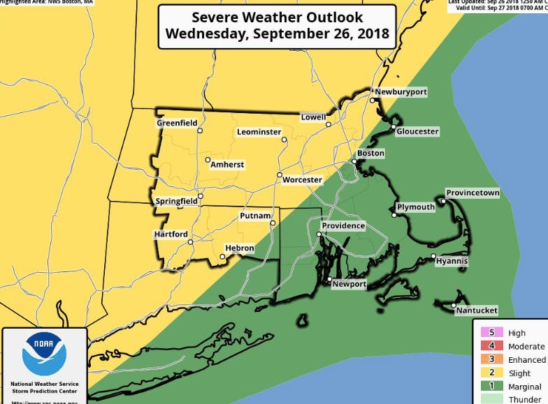
It's calm now, but expect potentially serious storms tonight. There is even "a very low risk for an isolated tornado," forecasters say.


Potentially volatile, ever-changing weather is expected Wednesday. A hazardous weather outlook encompasses the whole state in advance of major winds, thunderstorms, and even a the slight possibility of a tornado.
There were some downpours Wednesday morning south of Boston, but the rain is in a holding pattern across much of Massachusetts right now, even giving way to partly cloudy skies. Later this evening the state will get showers and thunderstorms, some with heavy downpours. That will be from roughly 6-11 p.m.
The weather could produce potentially damaging wind gusts, and there is even "a very low risk for an isolated tornado," the National Weather Service said.
Find out what's happening in Bostonfor free with the latest updates from Patch.
[Today] Heavy downpours this morning over SE New England then a lull @ midday - afternoon prior to a line of showers & t'storms, w/ embedded heavier downpours, pushes through S New England this evening. Note, radar derived forecast model projection, not to be taken verbatim. pic.twitter.com/oxA4tY0SoB
— NWS Boston (@NWSBoston) September 26, 2018
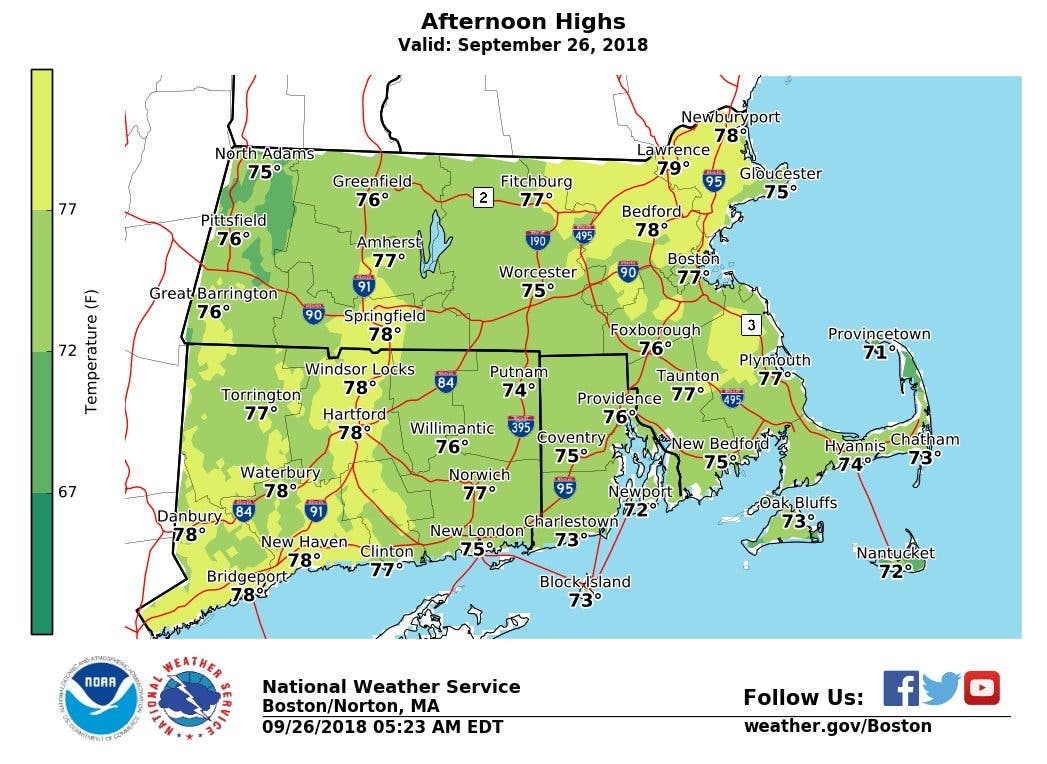
It's not all as bad as it sounds. High temperatures today are going to be some 10-15 degrees higher than Tuesday, almost mirroring summer temps. There will be a nice window to get out there and enjoy the day if you can manage it.
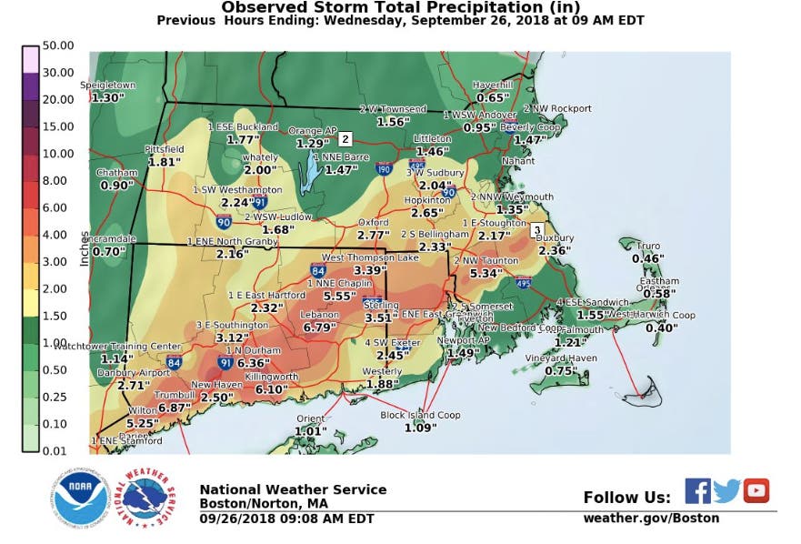
Forecasters nailed Tuesday, which saw a glut of rain come down throughout the day. Some areas of Southeastern Mass. saw more than 5 inches.
Find out what's happening in Bostonfor free with the latest updates from Patch.
NWS images
Get more local news delivered straight to your inbox. Sign up for free Patch newsletters and alerts.


