Weather
Will It Be A Snowy Scene For Patriots Playoff Game Sunday?: See Latest Forecast
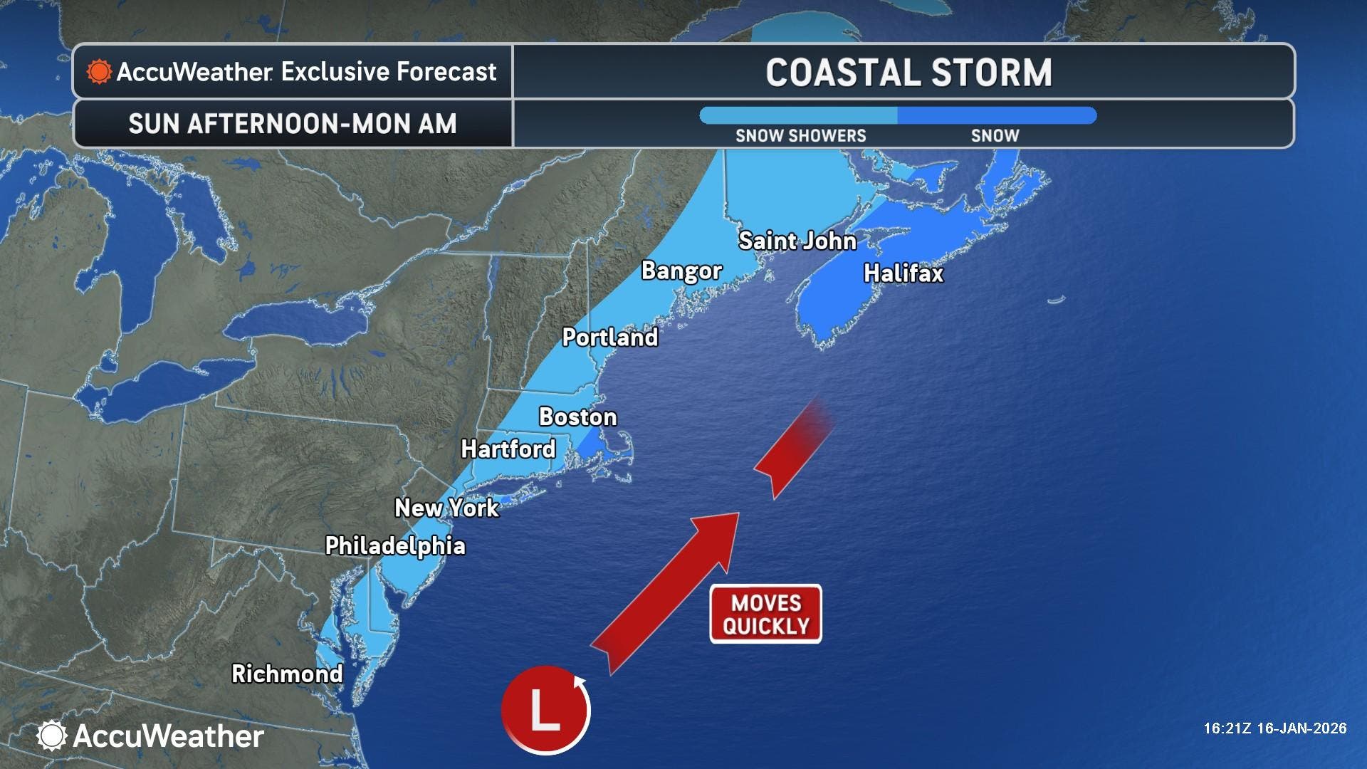
A developing coastal storm will be a close call for parts of Massachusetts Sunday afternoon into Sunday night.


FOXBOROUGH, MA — It could be a winter wonderland for the New England Patriots playoff game against the Houston Texans on Sunday, depending on the timing and track of a coastal storm that may also bring snow as far south as Georgia.
Storm track models, which appeared to ticket any heavy snow well offshore as of Thursday, trended more westerly on Friday, increasing chances that flakes will fly later in the game, and that plowable snow is possible for parts of southeastern Massachusetts.
Kickoff at Gillette Stadium is 3 p.m.
Find out what's happening in Foxboroughfor free with the latest updates from Patch.
"The storm is expected to move quickly up the East Coast Sunday night into early Monday," AccuWeather Senior Meteorologist Dan Pydynowski said. "The storm could track close enough to the coast to bring some snow showers to parts of the Interstate 95 corridor in the Northeast."
The track of the storm is expected to become more defined later Friday into Saturday.
Find out what's happening in Foxboroughfor free with the latest updates from Patch.
The National Weather Service said on Friday that snow could develop around 4 p.m. and continue through the evening hours.
The NWS is forecasting between 1 and 3 inches of snow with the heaviest amounts on the Cape, Islands and South Coast. A closer track of the storm would increase those numbers and bring the chance for measurable snow north and west of Boston.
That storm is the second of two threats this weekend, with the first moving in early Saturday into Saturday afternoon, along with some warmer air.
The southwest wind will cause snow to mix with rain in Greater Boston, with 1 to 2 inches expected in northern Worcester County into the Berkshires. A slushy coating is forecast for areas inside Route 495.
Behind the weather systems will be a brutal shot of cold air, with the most frigid days of the season likely ahead on Tuesday and Wednesday.
Monday will be mostly sunny with wind gusts to 36 mph and a high of 34 degrees. Wind chills will be in the teens.
Highs will struggle to get out of the teens and low 20s on Tuesday and Wednesday, with harsh west winds making it feel closer to zero both days.
(Scott Souza is a Patch field editor covering Beverly, Danvers, Marblehead, Peabody, Salem and Swampscott. He can be reached at Scott.Souza@Patch.com. X/Twitter: @Scott_Souza.)
Get more local news delivered straight to your inbox. Sign up for free Patch newsletters and alerts.