Health & Fitness
Weather Whys--More Snow Possible Friday
Hingham went from 60º to snow in just two days, and more snow may be on the way.
Monday's high cracked 63 degrees in Hingham. Phoenix's high for the same day was just 45.
Now, two days later, we're dealing with 1-2" of fresh snow.
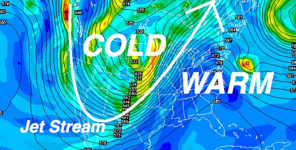
The jet stream, or river of fast moving air at 20,000 ft. that steers weather across the nation, is in the process of recovering from a huge dip across the western US. That dip in the west provided the shot of bitter air to places like California and Arizona while we enjoyed a surge of southern warmth. As the jet stream reconfigures we will be exposed to chillier air and more storms over the next week.
Find out what's happening in Hinghamfor free with the latest updates from Patch.
In fact, a sizable Nor'Easter will be slipping just offshore Thursday night into early Friday morning. For now it looks like the main thrust of the storm will miss to our south, but some light snow is likely to spread onto the Cape and Islands. I wouldn't be surprised to see some light snow across the South Shore early Friday as well.
I'll keep a close eye on it, and have more updates at www.HinghamWeather.com.
Find out what's happening in Hinghamfor free with the latest updates from Patch.
In the meantime, please submit your weather or climate questions to me in the comments section and they may be answered here on Hingham Patch!
-Meteorologist Michael Page