Community Corner
2 New Lexington Bike Trails Open
One is a 2.6-mile loop that runs through Arlington's Great Meadows. The other goes through Lexington's Whipple Hill.

Two new bike trails are open in Lexington.
One is a 2.6-mile loop that runs through Arlington’s Great Meadows. The other goes through Lexington’s Whipple Hill.
Here’s more from ACROSS Lexington:
Find out what's happening in Lexingtonfor free with the latest updates from Patch.
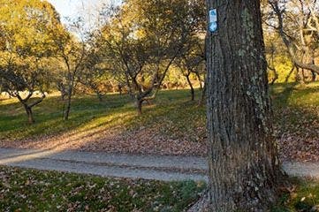
Two new loop walks through Lexington are now open, just in time for spring. The Lexington Greenways Corridor Committee has completed two new trail loops as part of ACROSS Lexington: The Rick Abrams Memorial Trail Network. ACROSS Lexington offers residents an opportunity for exercise and outdoor enjoyment while exploring the town’s beautiful conservation lands and historic points of interest.
The new 2.6-mile “C” loop runs through Arlington’s Great Meadows, the largest area of undeveloped land in Lexington and home to 400 plant and animal species. The loop continues past the meadows into East Lexington neighborhoods, and skirts the western side of the Arlington Reservoir. The trail is easily accessible from the parking lot for the Cataldo Reservation off of Bow Street and the Arlington Reservoir parking lot on Summer Street.
Find out what's happening in Lexingtonfor free with the latest updates from Patch.
The 3.4-mile “D” loop runs through Lexington’s Whipple Hill conservation area and connects with the LexFarm property. Its eastern side runs along sections of Orchard, Fairlawn, and Locke Lane, and its southern end is shared with the route of the “C” loop. Convenient access is available at the Johnson Road entrance to Whipple Hill and also at the Arlington Reservoir lot.
“We invite Lexington residents to get out and enjoy these trails, and use them as an opportunity to discover our town’s conservation lands,” said Keith Ohmart, chair of the Greenways Committee.
Maps of the entire 16-mile ACROSS Lexington trail network will soon be available at www.acrosslexington.org. A new brochure, featuring the map, points of interest, and history of the trail network will also be available by late April through local businesses, Cary Library, the town Information
Work will take place this year to connect the Minuteman Bikeway with the Battle Road Trail in the Minuteman National Historical Park, the Meagherville Conservation area and the Hayden Recreation Center, adding another 3+ miles to the trails network, according to Ohmart. The Greenways Committee is also considering ways to further extend the trails network to connect the town’s Wright Farm, Paint Mine and Simonds Brook Conservation properties and connect with the Western Greenway Trail on the Massachusetts Department of Conservation and Recreation (DCR) Beaver Brook North property.
Get more local news delivered straight to your inbox. Sign up for free Patch newsletters and alerts.