Weather
2 More Days Of Suffering: MA Heat Advisory Continues
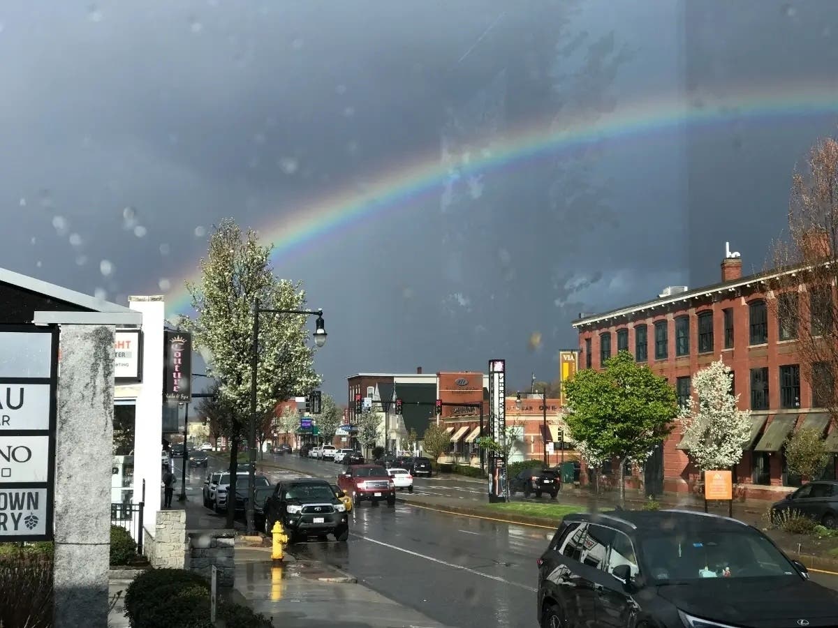
Massachusetts has been under a heat advisory for five days — but the end is in sight.

WORCESTER, MA — The bad news: the heat is still around. The good news: the end is in sight.
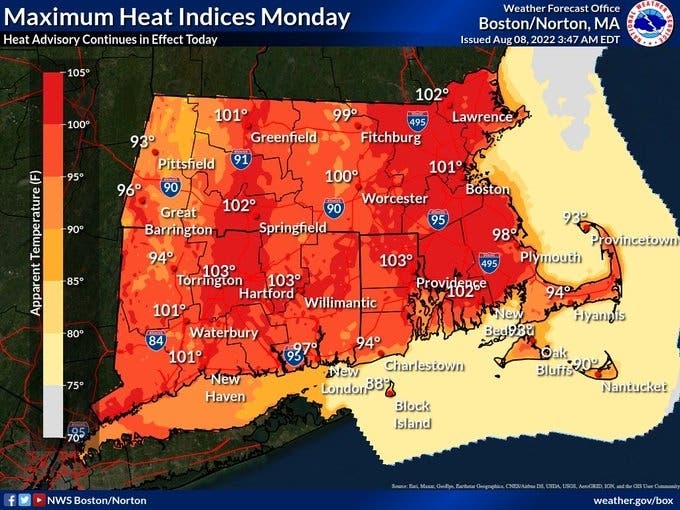
Massachusetts hit its fifth day under a heat advisory on Monday, but the National Weather Service is planning to lift the warning on Tuesday night with cooler temperatures in the forecast.
The heat index — a combo of temperature and humidity values — on Monday will hit 100 in Worcester, and a few degrees higher in the Merrimack Valley and around Boston. It will feel even hotter in heat island areas: parts of cities and towns with little shade, but plenty of concrete and asphalt.
Temperatures will stay pretty much in the 90-degree range across the state on Tuesday. But on Wednesday, temperatures will only reach into the high 70s and low 80s across the state, according to AccuWeather.
Here's what to expect from the end of the heat wave across Massachusetts, according to the National Weather Service:
Worcester Area
Monday: A chance of showers and thunderstorms, mainly after 5pm. Mostly sunny, with a high near 93. Heat index values as high as 100. Southwest wind 8 to 11 mph, with gusts as high as 21 mph. Chance of precipitation is 30%. New rainfall amounts of less than a tenth of an inch, except higher amounts possible in thunderstorms.
Monday Night: A chance of showers and thunderstorms before 1am, then a slight chance of showers between 1am and 2am. Mostly cloudy, with a low around 75. Southwest wind around 9 mph, with gusts as high as 21 mph. Chance of precipitation is 40%. New precipitation amounts of less than a tenth of an inch, except higher amounts possible in thunderstorms.
Tuesday: A chance of showers before 1pm, then a chance of showers and thunderstorms between 1pm and 2pm, then showers likely and possibly a thunderstorm after 2pm. Partly sunny, with a high near 92. Southwest wind around 10 mph, with gusts as high as 21 mph. Chance of precipitation is 60%. New rainfall amounts between a tenth and quarter of an inch, except higher amounts possible in thunderstorms.
Tuesday Night: Showers likely and possibly a thunderstorm before 10pm, then a chance of showers and thunderstorms between 10pm and midnight, then a chance of showers after midnight. Mostly cloudy, with a low around 67. Light and variable wind. Chance of precipitation is 70%. New precipitation amounts between a tenth and quarter of an inch, except higher amounts possible in thunderstorms.
Boston Area
Monday: A chance of showers and thunderstorms, mainly after 5pm. Mostly sunny, with a high near 95. Heat index values as high as 102. Southwest wind 9 to 13 mph. Chance of precipitation is 30%. New rainfall amounts of less than a tenth of an inch, except higher amounts possible in thunderstorms.
Monday Night: A chance of showers, mainly before 9pm. Partly cloudy, with a low around 78. Southwest wind 9 to 11 mph, with gusts as high as 22 mph. Chance of precipitation is 30%. New precipitation amounts of less than a tenth of an inch possible.
Tuesday: A chance of showers before 1pm, then a chance of showers and thunderstorms between 1pm and 2pm, then showers likely and possibly a thunderstorm after 2pm. Partly sunny, with a high near 94. Heat index values as high as 100. Southwest wind 9 to 11 mph, with gusts as high as 21 mph. Chance of precipitation is 60%. New rainfall amounts between a tenth and quarter of an inch, except higher amounts possible in thunderstorms.
Tuesday Night: Showers likely and possibly a thunderstorm before 11pm, then a chance of showers and thunderstorms between 11pm and 1am, then a chance of showers after 1am. Mostly cloudy, with a low around 70. Northwest wind around 6 mph becoming northeast after midnight. Chance of precipitation is 70%. New rainfall amounts between a tenth and quarter of an inch, except higher amounts possible in thunderstorms.
Cape Cod
Monday: Mostly sunny, with a high near 90. Breezy, with a southwest wind 15 to 20 mph.
Monday Night: A slight chance of showers between 2am and 3am. Mostly cloudy, with a low around 75. Southwest wind around 18 mph, with gusts as high as 30 mph. Chance of precipitation is 20%.
Tuesday: A chance of showers, mainly after 3pm. Partly sunny, with a high near 89. Southwest wind around 18 mph, with gusts as high as 28 mph. Chance of precipitation is 30%. New precipitation amounts of less than a tenth of an inch possible.
Tuesday Night: A chance of showers and thunderstorms before 8pm, then showers likely and possibly a thunderstorm between 8pm and 9pm, then a chance of showers and thunderstorms after 9pm. Mostly cloudy, with a low around 70. Southwest wind 5 to 10 mph becoming north after midnight. Chance of precipitation is 60%. New rainfall amounts of less than a tenth of an inch, except higher amounts possible in thunderstorms.
Get more local news delivered straight to your inbox. Sign up for free Patch newsletters and alerts.