Weather
Minnesota's Heat Wave Expected To Ease By Late Next Week, Outlook Shows
Forecasters see above-normal temperatures continuing through July 23, before conditions trend back toward normal.



MINNEAPOLIS, MN — Minnesota's stretch of dangerous heat is expected to persist into next week before easing, according to new outlooks from the National Weather Service.
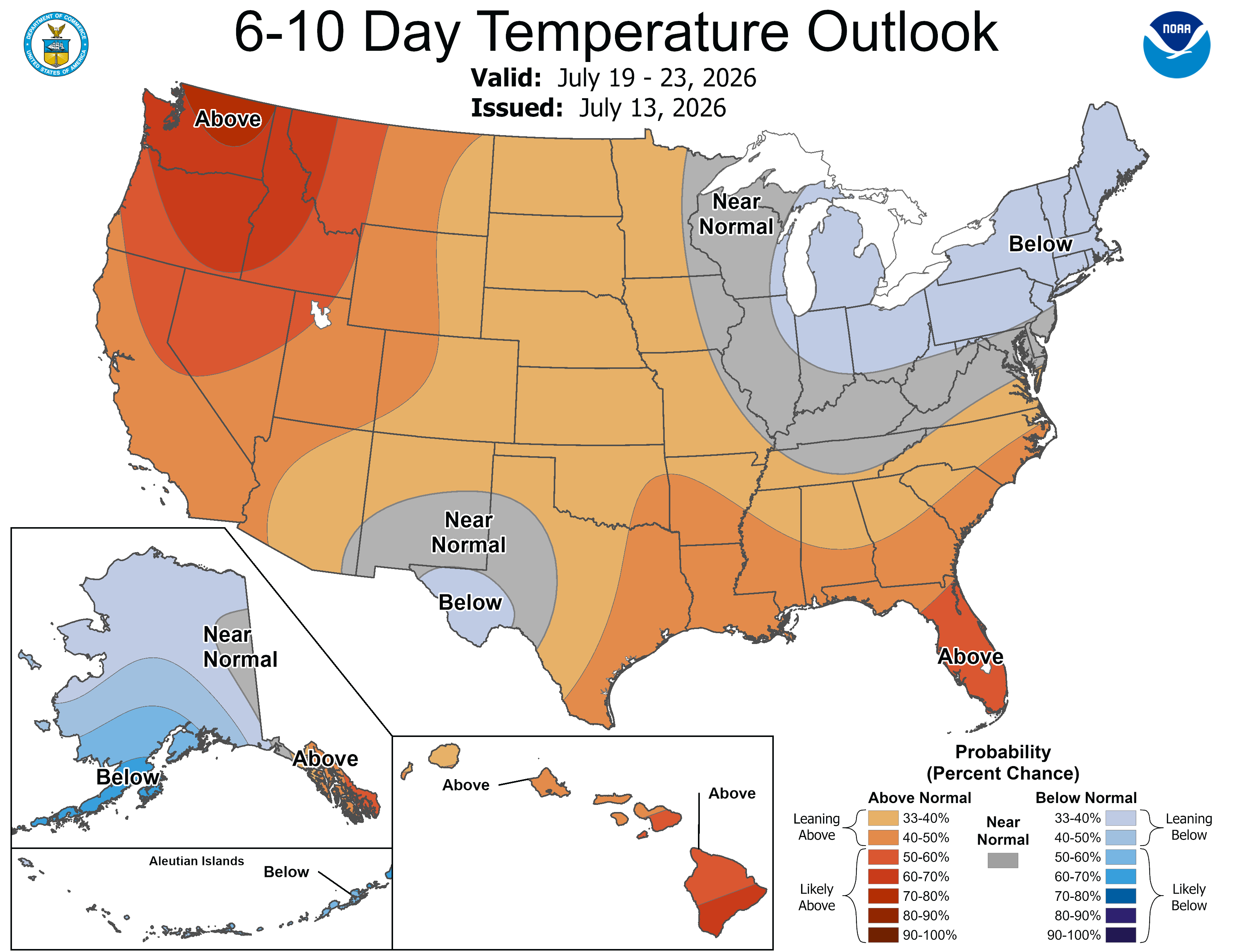
A 6 to 10 day outlook issued Monday, covering July 19 through 23, places nearly all of Minnesota in an above-normal temperature zone, meaning the state is likely to see continued hot conditions into the following week.
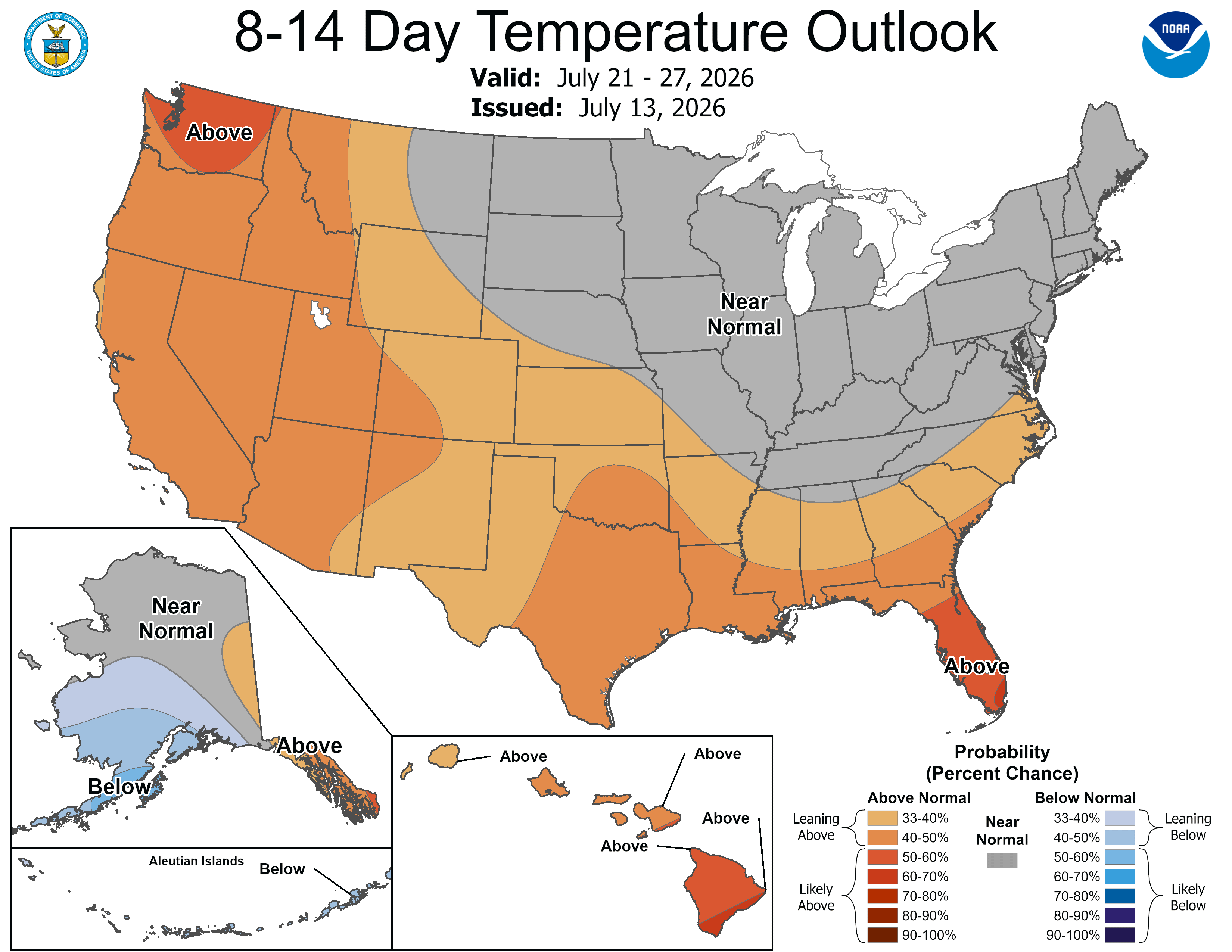
A separate 8 to 14 day outlook, covering July 21 through 27, shows temperatures trending back toward normal across Minnesota, Wisconsin, and much of the Upper Midwest, suggesting the heat wave could break in the back half of next week.
Find out what's happening in Minneapolisfor free with the latest updates from Patch.
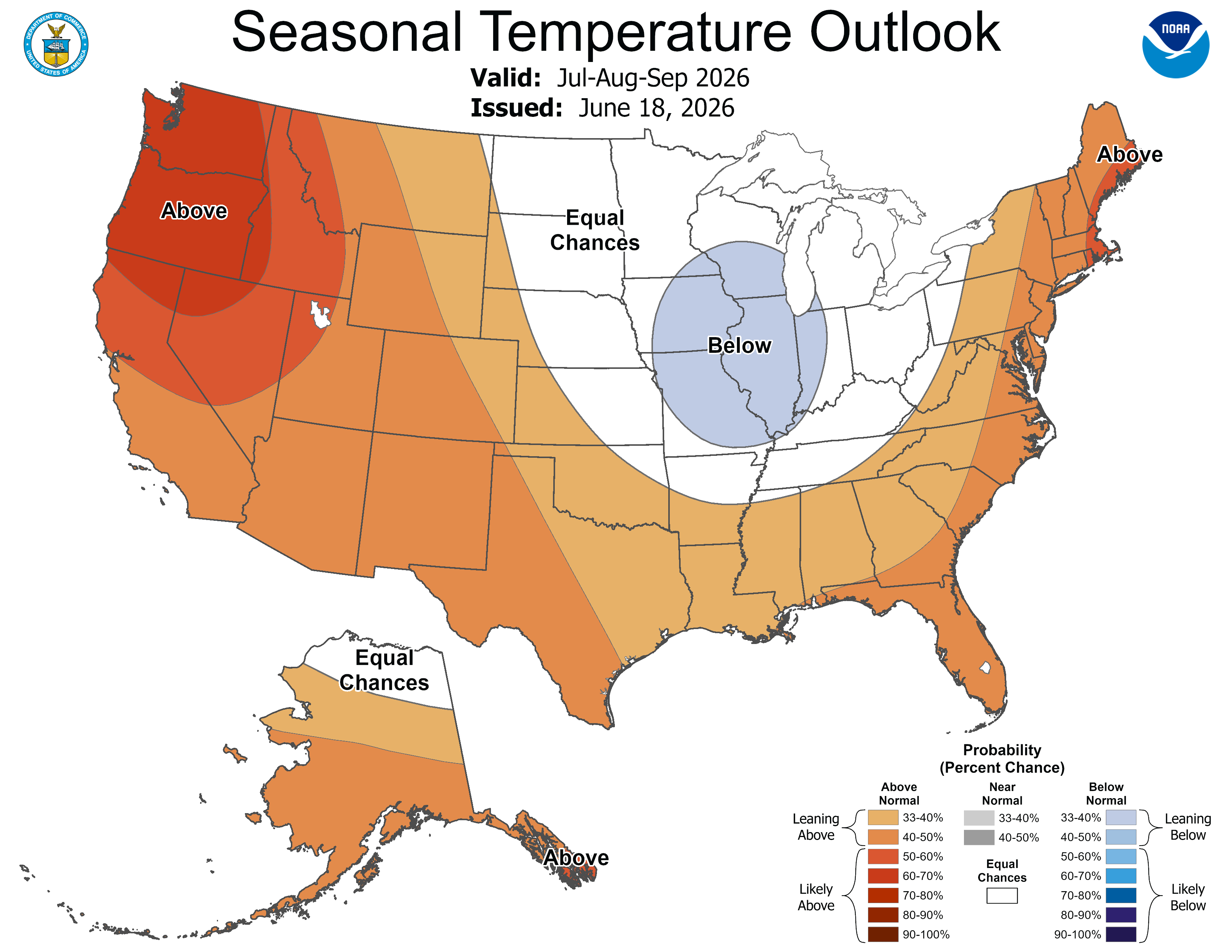
Longer-range seasonal outlooks for the Twin Cities region show no strong signal either way for the remainder of summer
Outlooks covering July through September, and August through October, both place Minnesota in an equal chances zone, meaning forecasters see no clear lean toward above or below normal temperatures over that stretch, even as neighboring states to the west and south are favored to run warmer.
Find out what's happening in Minneapolisfor free with the latest updates from Patch.
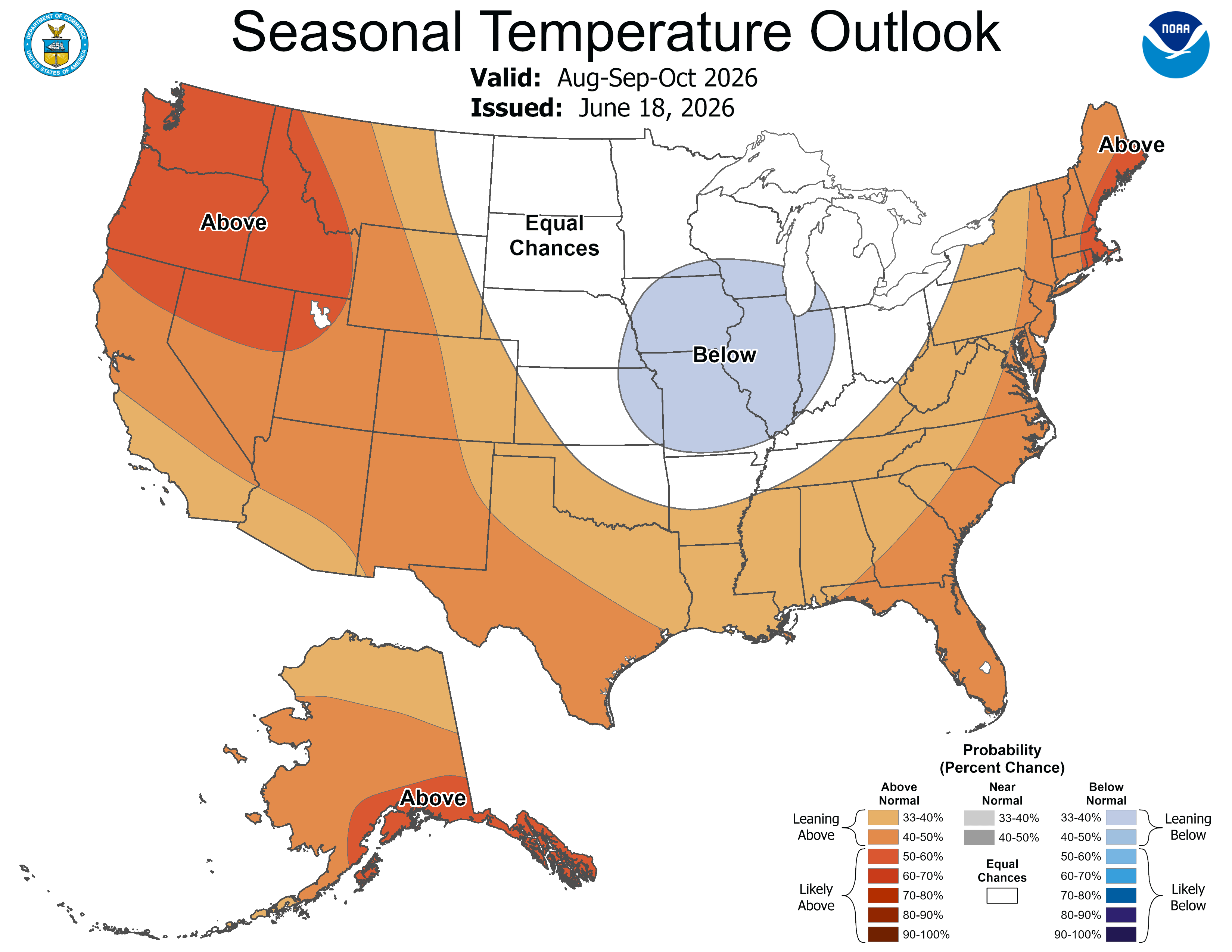
The extended outlook comes as an Extreme Heat Warning remains in effect for the seven-county Twin Cities metro through 9 p.m. Thursday.
The National Weather Service in Chanhassen said heat index values will climb as high as 100 degrees, with overnight lows only dropping into the mid 70s, offering little relief before temperatures rise again the next day.
The warning covers Anoka, Carver, Dakota, Hennepin, Ramsey, Scott and Washington counties, including Minneapolis, St. Paul, Chaska, Chanhassen, Shakopee, Victoria, Hastings, Stillwater and Blaine.
Check out the full NWS forecast from the MSP Airport below:
Today: Sunny and hot, with a high near 96. Heat index values as high as 100. West southwest wind around 10 mph.
Tonight: Clear, with a low around 76. West southwest wind 5 to 10 mph.
Wednesday: Sunny and hot, with a high near 97. West wind 5 to 10 mph.
Wednesday Night: Mostly clear, with a low around 76. West southwest wind 5 to 10 mph becoming south southeast after midnight.
Thursday: Sunny and hot, with a high near 96. South southeast wind 5 to 10 mph.
Thursday Night: Mostly clear, with a low around 76. East southeast wind around 10 mph.
Friday: A 20 percent chance of showers and thunderstorms after 1pm. Sunny and hot, with a high near 95. South southwest wind 10 to 15 mph.
Friday Night: A 20 percent chance of showers and thunderstorms before 1am. Mostly clear, with a low around 74. South wind 5 to 10 mph.
Saturday: Sunny, with a high near 92. Northwest wind 5 to 10 mph.
Saturday Night: Mostly clear, with a low around 70. North northwest wind 5 to 10 mph becoming northeast after midnight.
Sunday: Sunny, with a high near 89. East northeast wind 5 to 10 mph becoming west in the afternoon.
Sunday Night: Mostly clear, with a low around 68. Southwest wind 5 to 10 mph.
Monday: Mostly sunny, with a high near 87. West wind 5 to 10 mph.
Get more local news delivered straight to your inbox. Sign up for free Patch newsletters and alerts.