Weather
MN Heat Advisory: High Of 98 In Twin Cities, Heat Index Over 100
The dangerously high temperatures on Monday will increase the likelihood of heat-related illness in the Twin Cities metro area.

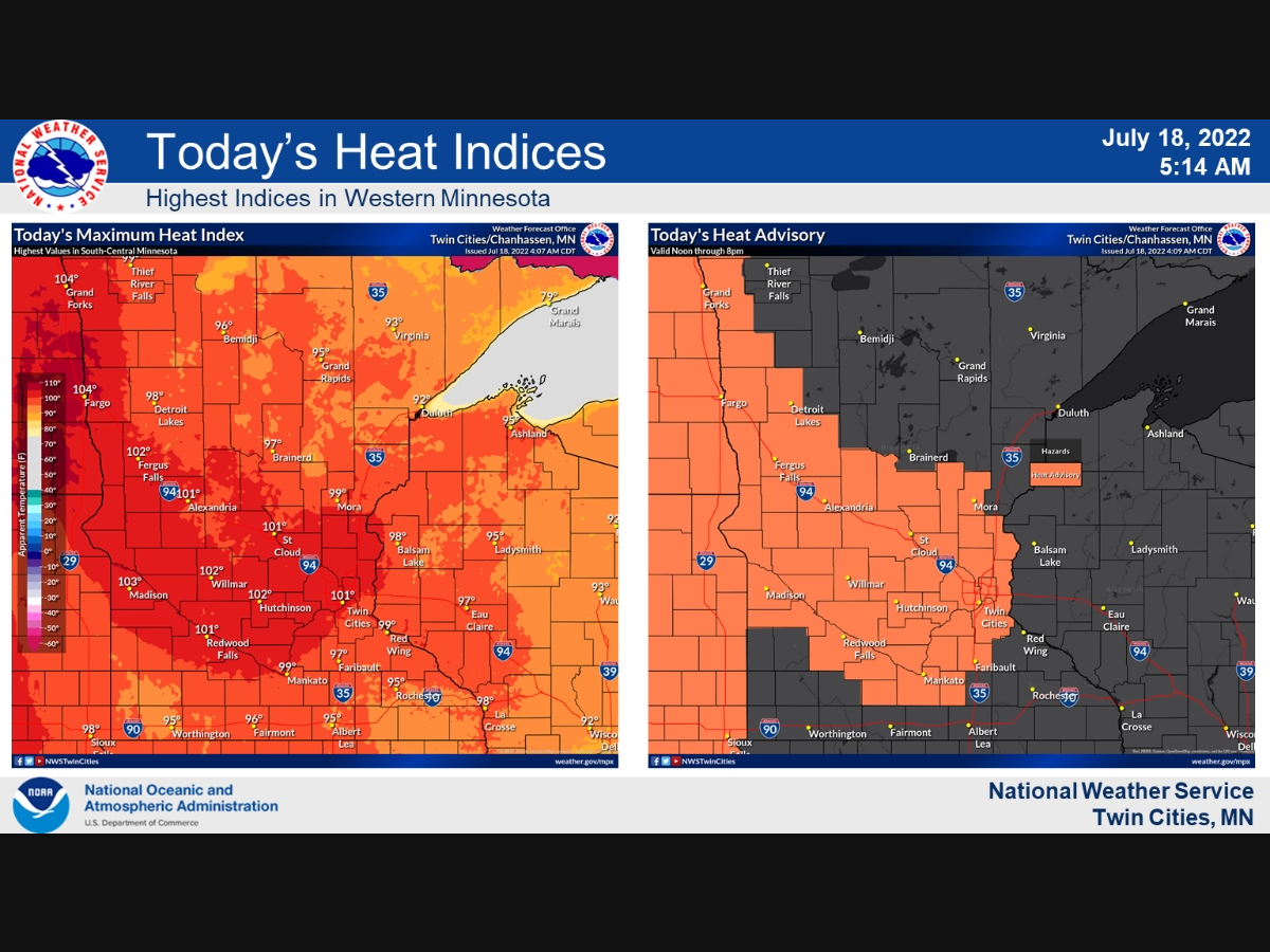
TWIN CITIES, MN — The National Weather Service has issued a heat advisory for all of the Twin Cities metro area and most of central Minnesota for Monday.
The advisory is in effect from 12 p.m. Monday through 6 p.m. Tuesday
"Heat index values peak in the upper 90s to low 100s with light winds and sunshine today and tomorrow," the NWS said. "Above normal temperatures are favored through the end of July."
Find out what's happening in Minneapolisfor free with the latest updates from Patch.
The dangerously high temperatures on Monday will increase the likelihood of heat-related illness in the Twin Cities metro area.
Find out what's happening in Minneapolisfor free with the latest updates from Patch.
Here's the full NWS forecast from the Minneapolis-St. Paul International Airport:
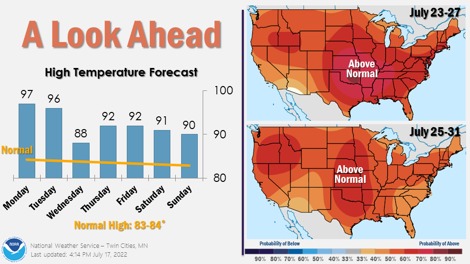
Monday: Sunny and hot, with a high near 98. Heat index values as high as 101. West southwest wind 5 to 15 mph.
Monday Night: A 10 percent chance of showers and thunderstorms after 5am. Partly cloudy, with a low around 76. South southwest wind 10 to 15 mph, with gusts as high as 25 mph.
Tuesday: A 20 percent chance of showers and thunderstorms before 9am. Mostly sunny and hot, with a high near 97. Breezy, with a south wind 10 to 20 mph becoming west southwest in the afternoon. Winds could gust as high as 35 mph.
Tuesday Night: Mostly clear, with a low around 72. Breezy, with a west wind 10 to 20 mph, with gusts as high as 30 mph.
Wednesday: Mostly sunny, with a high near 90. Breezy, with a northwest wind 15 to 20 mph, with gusts as high as 30 mph.
Wednesday Night: Clear, with a low around 70. West northwest wind 10 to 15 mph decreasing to 5 to 10 mph after midnight. Winds could gust as high as 25 mph.
Thursday: Sunny, with a high near 92. West northwest wind 5 to 15 mph.
Thursday Night: Clear, with a low around 68. Northwest wind 5 to 15 mph becoming south southwest after midnight.
Friday: Sunny, with a high near 92. West southwest wind 5 to 10 mph.
Friday Night: A 20 percent chance of showers and thunderstorms. Mostly clear, with a low around 69. West wind 5 to 10 mph becoming south southeast after midnight.
Saturday: A 20 percent chance of showers and thunderstorms. Mostly sunny, with a high near 91. Southeast wind 5 to 10 mph.
Saturday Night: A 30 percent chance of showers and thunderstorms. Partly cloudy, with a low around 69. Northeast wind 5 to 10 mph.
Sunday: A 20 percent chance of showers and thunderstorms. Partly sunny, with a high near 88. Northwest wind 5 to 10 mph.
Get more local news delivered straight to your inbox. Sign up for free Patch newsletters and alerts.


