Weather
More Snow + Single Digit Temps Are Coming: MN Weather Forecast
Following another round or two of snow, arctic temperatures will land in the Minneapolis-St. Paul metro area.

MINNEAPOLIS — Twin Cities residents should keep that shovel handy this week. Another couple of rounds of snow are set to arrive this week.
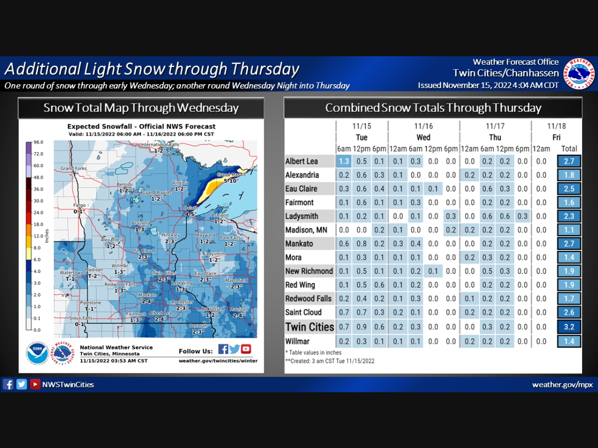
"Two additional rounds of snow are expected through Thursday," the National Weather Service said.
"One will continue through early Wednesday, followed by a break Wednesday afternoon before another round of snow comes Wednesday night into Thursday. Overall, the snow will not amount to much, generally 3 inches or less for central-southern MN and western WI through Thursday. However, travel will continue to be impacted, including morning and evening commutes, so motorists are urged to use extra caution."
Find out what's happening in Minneapolisfor free with the latest updates from Patch.
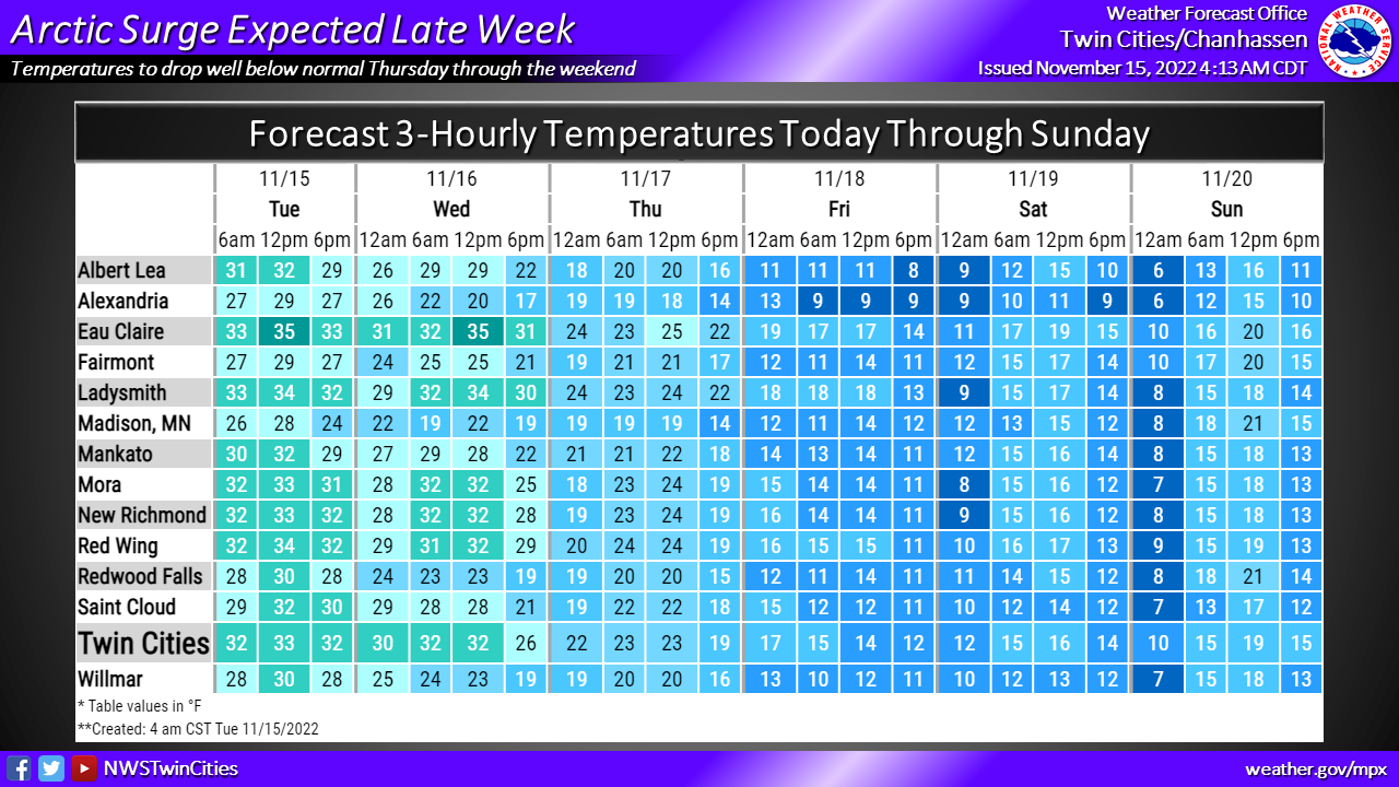
Following the snow, bitter-cold temperatures will land across Minnesota Thursday and will stick around into the weekend.
The high temperature will only be in the teens on Friday and Saturday, while the low temperatures will dive into the single digits.
Find out what's happening in Minneapolisfor free with the latest updates from Patch.
Here's the full NWS forecast from the Minneapolis-St. Paul Airport:
Tuesday: Snow. High near 33. Southeast wind 5 to 10 mph. Chance of precipitation is 100%. Total daytime snow accumulation of 1 to 2 inches possible.
Tuesday Night: Snow, mainly before 5am. Low around 29. East wind around 5 mph becoming north after midnight. Chance of precipitation is 100%. New snow accumulation of less than one inch possible.
Wednesday: A 40 percent chance of snow, mainly before 9am. Cloudy, with a high near 32. North wind 5 to 10 mph becoming west in the afternoon.
Wednesday Night: Cloudy, with a low around 19. West wind 5 to 10 mph.
Thursday: A 30 percent chance of snow. Cloudy, with a high near 26. Blustery, with a west northwest wind 10 to 15 mph increasing to 15 to 20 mph in the afternoon. Winds could gust as high as 30 mph.
Thursday Night: Cloudy, with a low around 12. Blustery, with a west northwest wind 15 to 20 mph, with gusts as high as 30 mph.
Friday: Cloudy, with a high near 17. West northwest wind 10 to 15 mph.
Friday Night: Mostly cloudy, with a steady temperature around 13. West southwest wind 5 to 10 mph.
Saturday: Mostly cloudy, with a high near 19. West northwest wind 10 to 15 mph.
Saturday Night: Mostly cloudy, with a low around 8. West wind 5 to 10 mph.
Sunday: Mostly sunny, with a high near 22. West wind 5 to 10 mph.
Sunday Night: Partly cloudy, with a low around 10. Southwest wind 5 to 10 mph.
Monday: Mostly sunny, with a high near 28. South southwest wind 5 to 10 mph.
Get more local news delivered straight to your inbox. Sign up for free Patch newsletters and alerts.