Weather
NWS-Twin Cities: 'Maybe Spring Will Arrive In May. Maybe'
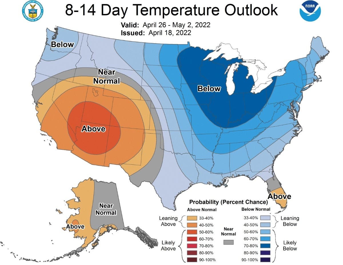
The NOAA long-range forecast shows that Minnesota will continue to have below-normal temperatures through at least May 2.

TWIN CITIES, MN — Minnesota's cold spring will continue into at least the start of May, according to the latest forecasts from the National Weather Service and National Oceanic and Atmospheric Administration.
The NOAA long-range forecast shows that Minnesota will continue to have below-normal temperatures through at least May 2.
"Maybe spring will arrive in May. Maybe," the Twin Cities branch of the NWS tweeted Tuesday.
Find out what's happening in Minneapolisfor free with the latest updates from Patch.
Find out what's happening in Minneapolisfor free with the latest updates from Patch.
Here’s the full NWS forecast from the Minneapolis-St. Paul International Airport:
Tuesday: Increasing clouds, with a high near 47. North wind 5 to 10 mph becoming south southeast in the afternoon.
Tuesday Night: A slight chance of rain and thunderstorms between 8pm and 9pm. Mostly cloudy, with a low around 40. Southeast wind 10 to 15 mph. Chance of precipitation is 20%.
Wednesday: Rain and thunderstorms likely, then rain after 10am. High near 49. Breezy, with a south southeast wind 15 to 20 mph, with gusts as high as 30 mph. Chance of precipitation is 100%. New precipitation amounts between a half and three quarters of an inch possible.
Wednesday Night: A 30 percent chance of rain, mainly before 7pm. Mostly cloudy, then gradually becoming mostly clear, with a low around 37. West wind around 10 mph.
Thursday: Sunny, with a high near 57. West northwest wind 10 to 15 mph.
Thursday Night: A 20 percent chance of showers after 2am. Partly cloudy, with a low around 42. North wind around 10 mph becoming east after midnight.
Friday: Showers likely, mainly after 2pm. Mostly cloudy, with a high near 57. Breezy, with an east southeast wind 15 to 20 mph, with gusts as high as 30 mph. Chance of precipitation is 70%.
Friday Night: Showers likely, then showers and possibly a thunderstorm after 8pm. Low around 52. Breezy, with an east southeast wind 15 to 20 mph, with gusts as high as 30 mph. Chance of precipitation is 80%.
Saturday: Showers likely and possibly a thunderstorm. Mostly cloudy, with a high near 71. Breezy, with a south wind 15 to 20 mph, with gusts as high as 35 mph. Chance of precipitation is 70%.
Saturday Night: Showers likely, mainly before 2am. Mostly cloudy, with a low around 46. Breezy, with a south southwest wind 15 to 20 mph, with gusts as high as 35 mph. Chance of precipitation is 70%.
Sunday: A 30 percent chance of showers. Partly sunny, with a high near 55. Breezy, with a south southwest wind 15 to 20 mph, with gusts as high as 30 mph.
Sunday Night: A 30 percent chance of showers. Mostly cloudy, with a low around 36. Breezy, with a west wind 15 to 20 mph.
Monday: Partly sunny, with a high near 46. Breezy, with a west wind 15 to 20 mph.
Get more local news delivered straight to your inbox. Sign up for free Patch newsletters and alerts.


