Weather
Winter Weather Advisory Issued For Twin Cities Metro: Timing, Amounts
Here are the timing and forecasted amounts for Thursday's snowstorm. A second, potentially bigger snowstorm is still on track for Sunday.


MINNESOTA — A winter weather advisory was issued for a large swath of central Minnesota and western Wisconsin.
Minnesota counties include Douglas, Todd, Morrison, Mille Lacs, Kanabec, Stevens, Pope, Stearns, Bento, Sherburne, Isanti, Chisago, Wright, Hennepin, Anoka, Ramsey, Washington, Carver, Scott, Dakota.
Scroll down for info on round two, coming Sunday.
Find out what's happening in Minneapolisfor free with the latest updates from Patch.
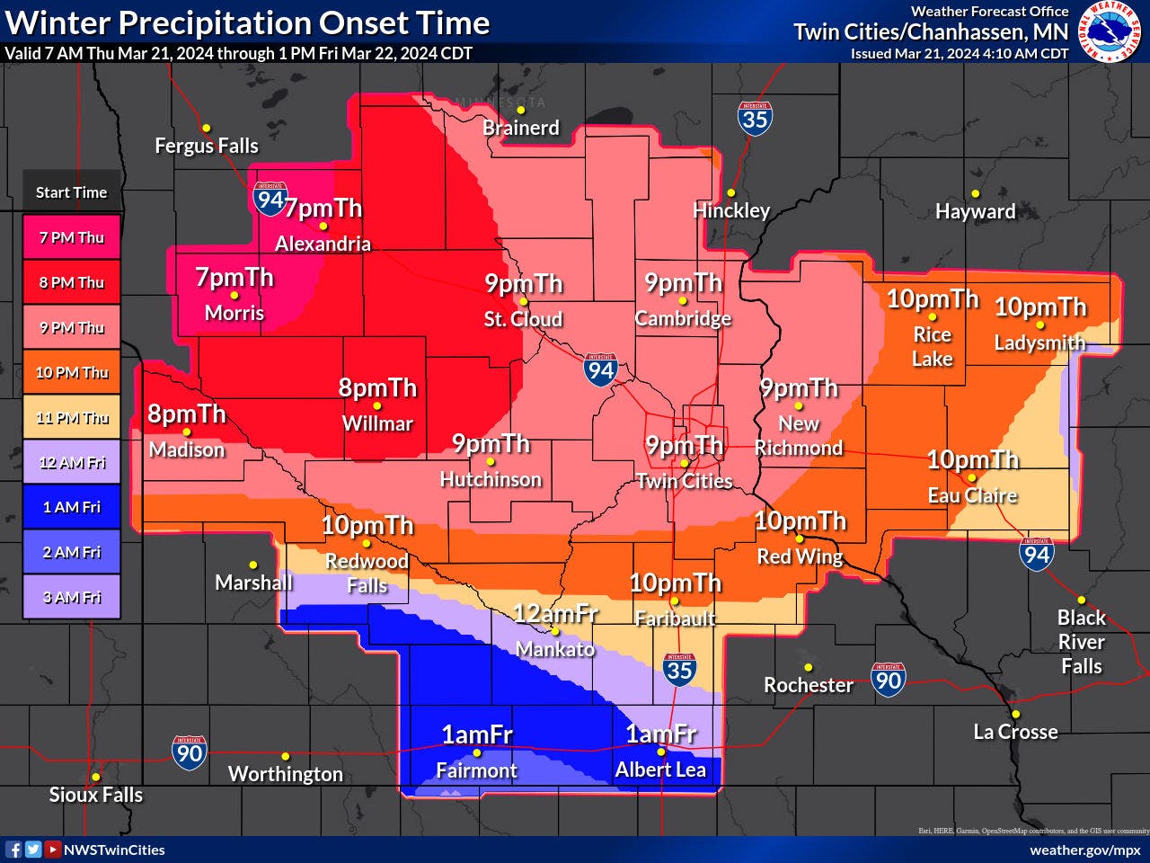
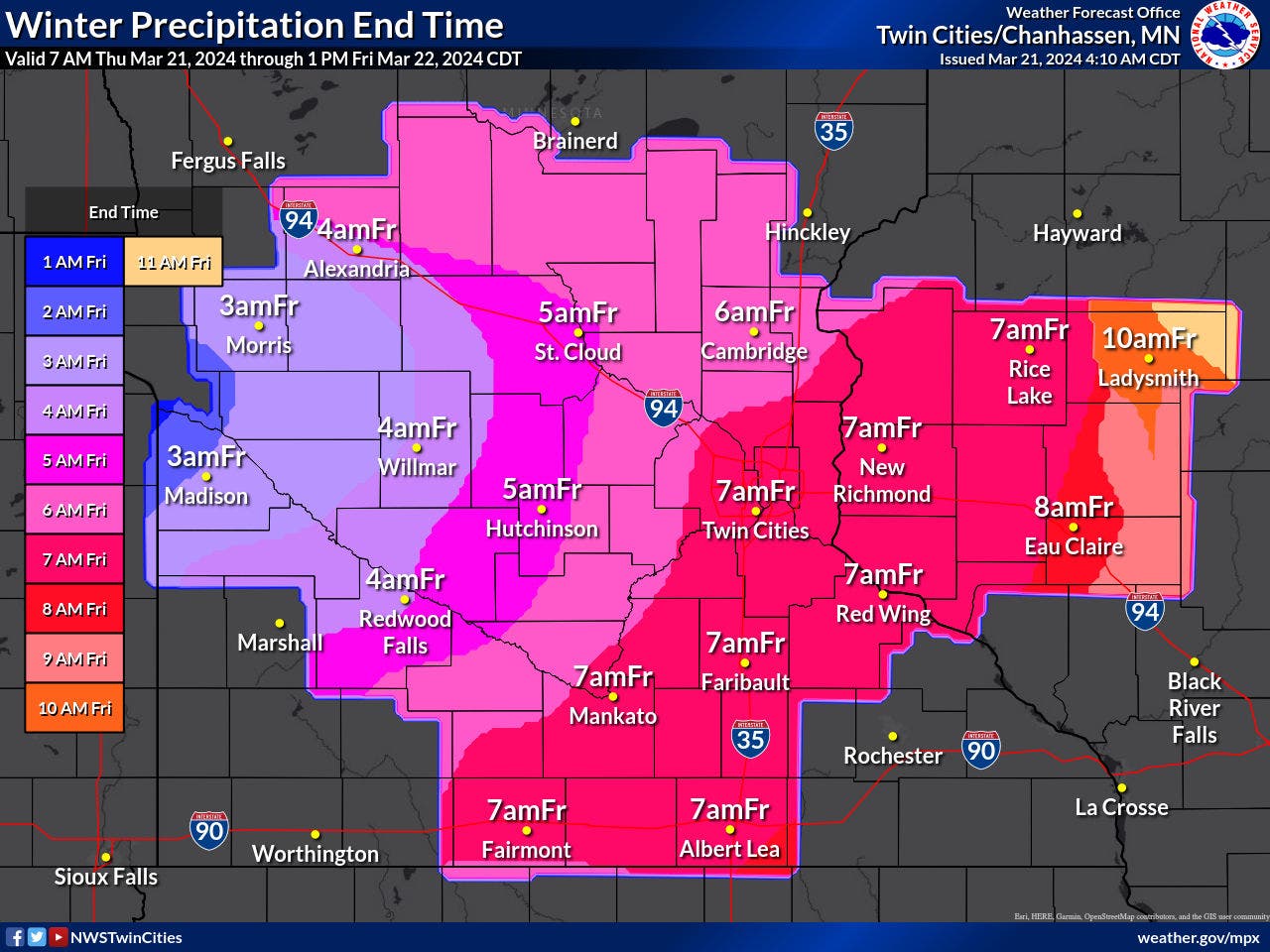
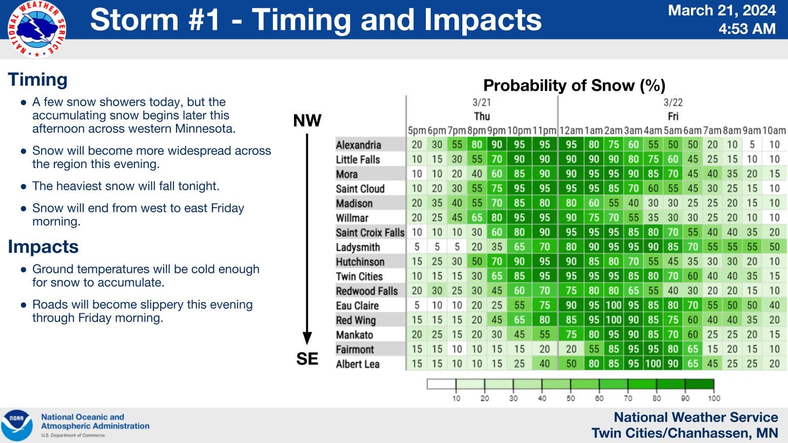
The advisory for the Twin Cities metro will go into effect at 7 p.m. Thursday and end at 10 a.m. Friday. Total snow accumulations of 3 to 5 inches are expected, bringing slippery road conditions impacting the Friday morning commute.
Sunday snow system
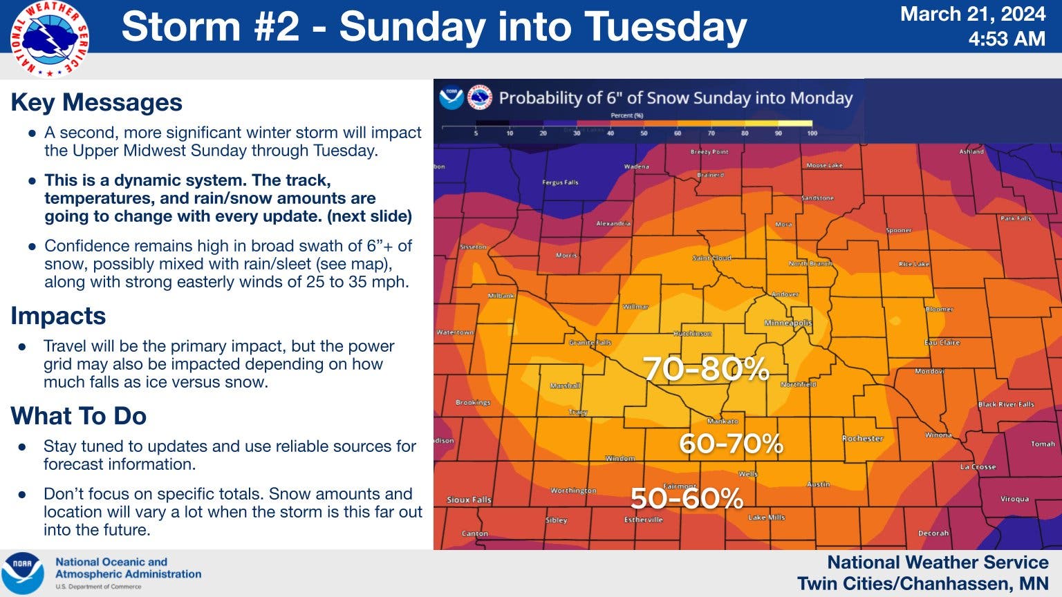
A second, potentially bigger snowstorm is on its way and will arrive Sunday. The Twin Cities metro has between a 70 and 80 percent chance of getting 6 inches of snow.
Find out what's happening in Minneapolisfor free with the latest updates from Patch.
Here's the specific NWS forecast from the Minneapolis-St. Paul Airport:
Thursday: Mostly cloudy, with a high near 36. East wind around 5 mph becoming south southeast in the afternoon.
Thursday Night: Snow, mainly after 9pm. The snow could be heavy at times. Low around 26. East wind 5 to 10 mph. Chance of precipitation is 100%. New snow accumulation of 2 to 4 inches possible.
Friday: Snow likely, mainly before 10am. Mostly cloudy, with a high near 36. East northeast wind 5 to 15 mph becoming north northwest in the afternoon. Chance of precipitation is 60%. New snow accumulation of less than a half inch possible.
Friday Night: Mostly clear, with a low around 17. North northwest wind 5 to 15 mph.
Saturday: A 20 percent chance of snow after 1pm. Increasing clouds, with a high near 33. North wind around 5 mph becoming east southeast in the afternoon.
Saturday Night: Snow likely, mainly after 1am. Cloudy, with a low around 24. East southeast wind 10 to 15 mph. Chance of precipitation is 60%. New snow accumulation of less than one inch possible.
Sunday: Snow. The snow could be heavy at times. Patchy blowing snow between 8am and 5pm. High near 36. Breezy, with an east southeast wind 15 to 20 mph, with gusts as high as 30 mph. Chance of precipitation is 90%.
Sunday Night: Snow before 9pm, then snow, possibly mixed with rain. The snow could be heavy at times. Patchy blowing snow after 9pm. Low around 31. Breezy, with an east wind around 20 mph, with gusts as high as 30 mph. Chance of precipitation is 90%.
Monday: Rain, possibly mixed with snow. High near 43. Breezy, with an east wind 20 to 25 mph, with gusts as high as 35 mph. Chance of precipitation is 90%.
Monday Night: Rain, possibly mixed with snow. Low around 29. Breezy, with a south wind 15 to 20 mph, with gusts as high as 30 mph. Chance of precipitation is 80%.
Tuesday: Rain and snow likely. Mostly cloudy, with a high near 37. Breezy, with a west southwest wind 15 to 20 mph, with gusts as high as 30 mph. Chance of precipitation is 60%.
Tuesday Night: A slight chance of rain and snow. Mostly cloudy, with a low around 19. West wind around 15 mph, with gusts as high as 25 mph. Chance of precipitation is 20%.
Wednesday: Partly sunny, with a high near 39. West wind 10 to 15 mph.
Get more local news delivered straight to your inbox. Sign up for free Patch newsletters and alerts.