Community Corner
Snow, Rain, Sleet Heading to NH
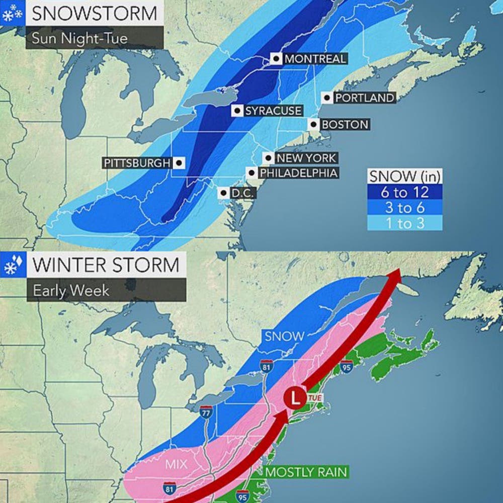
Early estimates say as much as five inches of snow are possible on Monday with flooding, freezing rain, traffic problems to follow.

A strong storm system is expected to bring snow and rain to the region on Monday night and continue through Wednesday when the temperatures start to warm up, according to the National Weather Service.
AccuWeather.com is warning of possible flooding as the temperatures begin to warm up as the storm moves north. The morning commute on Tuesday is expected to be difficult.
Find out what's happening in Bedfordfor free with the latest updates from Patch.
ALSO READ:
The National Weather Service says the snow could be as much as five inches in Concord and the southern part of the state; AccuWeather.com suggests it might be closer to one to three inches.
Find out what's happening in Bedfordfor free with the latest updates from Patch.
The forecast
Here is the Sunday afternoon forecast from the National Weather Service:
Tonight: Clear and freezing with temps below zero and wind chill factors anywhere from -10 to -20 below zero.
President’s Day: Slightly warmer temperatures with high winds and snow expected in the afternoon through the evening with accumulations of as much as five inches.
Tuesday: Freezing rain in the morning with highs in the 40s and a light wind. Rain is expected to continue and turning to sleet and snow during the evening.
Wednesday: Showers are expected to continue but then the sun appears in the afternoon with highs in the upper 30s and low 40s.
Thursday: Sunny skies with highs in the 30s.
Weather updates can be found on the front page of every Patch.com across the United States including the 12 New Hampshire Patch news and community websites.
Get more local news delivered straight to your inbox. Sign up for free Patch newsletters and alerts.