Politics & Government
Concord Storm Likely Not a Microburst
Freak thunderstorm from July 19-20, that caused major damage in the region was probably "straight-line wind."


A freak thunderstorm that ripped through Concord over the weekend of July 20, was more than likely not a microburst.
The fast-moving storm, which damaged trees across the capital region, knocked out electricity to thousands around New Hampshire, and ripped up Market Days tents and displays on Main Street, was reported to be a microburst with winds as high as 80 mph. Market Days organizers alerted vendors and spent the morning cleaning up from the storm in order to get the third day of the festival in.
But the storm may not have been a microburst after all. A microburst is defined as a sudden and violence downdraft of air that lasts less than 30 minutes and can cause winds as high as 160 miles per hour, according to dictionary.com. The term was first coined to define the weather phenomenon in the 1980s.
Find out what's happening in Concordfor free with the latest updates from Patch.
However, according to an archive of National Weather Service alerts from the center in Gray, Maine, the unit that covers Concord, no microburst alert was issued for Concord. The storm was reported as a “TSTM WND DMG” or thunderstorm with wind damage, with trees and wire down, as well as power outages. The alert was reported for Concord at 12:02 a.m. on July 20, about 10 minutes after the storm hit the city. The NWS sent out other alerts as the storm moved east but none were declared microbursts.
The only microburst reported by the NWS in recent days was a “PSBL MICRO BURST” – or possible microburst – the day before, around 9:30 a.m. on July 19, in Jackman, Maine, from another storm system.
Find out what's happening in Concordfor free with the latest updates from Patch.
Later in the day on July 20, Patch checked in with Dan Andrus, the chief of the Concord Fire Department involved in emergency response for the city, to see if it was determined to be a microburst. Andrus checked “some sources” but was unable to confirm whether or not the storm was officially a microburst.
“Amazing recovery by Market Days folks,” he added, in an email.
Weather forecasters on WMUR-TV on the evening July 20, reported that the storm was more than likely a “straight-line wind.” A straight-line wind is a wind gust that comes out of thunderstorms that “meet or exceed 58 miles per hour,” according to Meteorologist Jeff Haby of theweatherprediction.com.
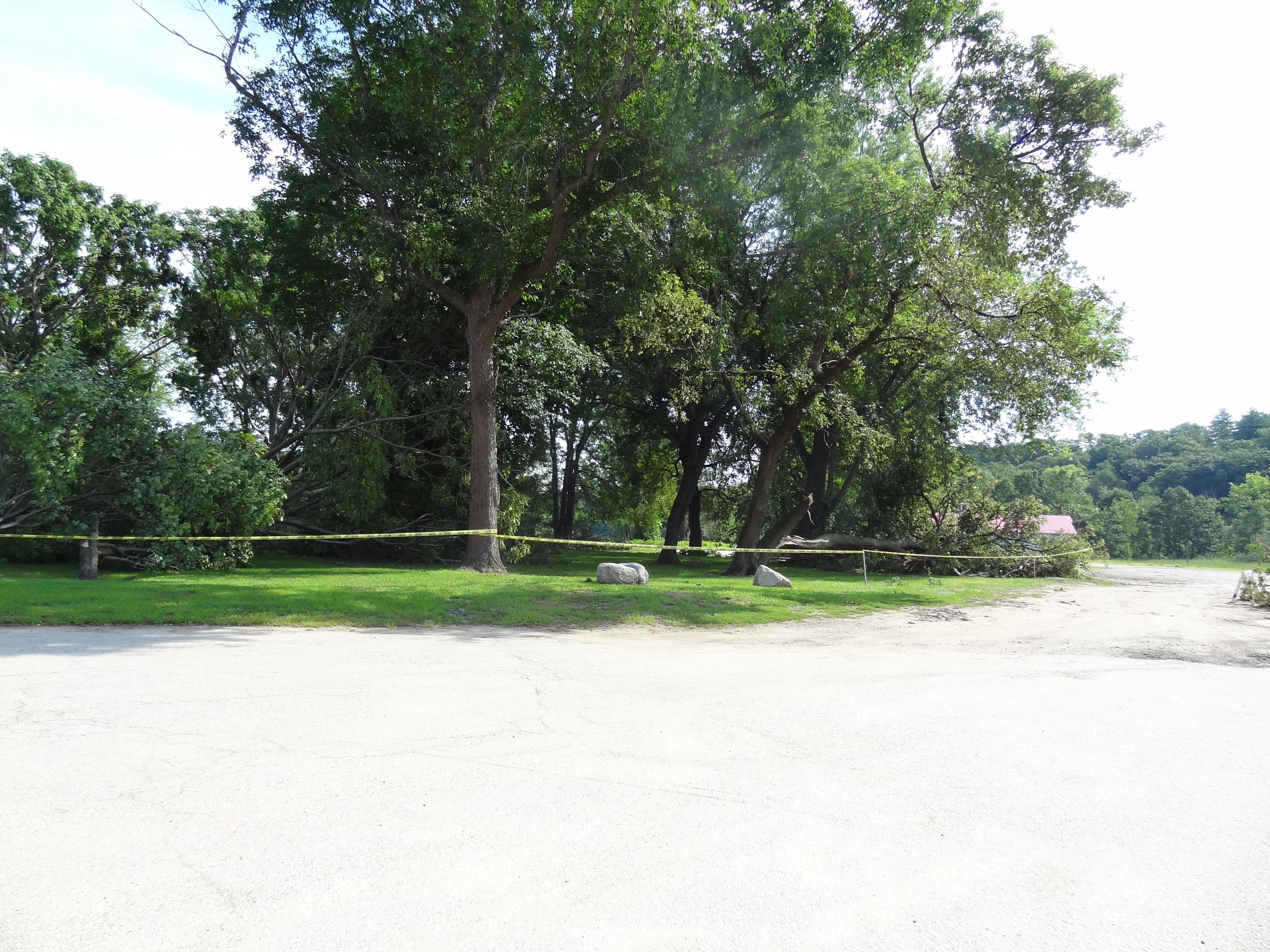
Following the trajectory of the worst damage of the storm – running from the western part of the city, across Main Street, and then along the Merrimack River near the Everett Arena, as shown in these pictures – seems to support the straight-line wind theory.
The National Weather Service regularly assesses damage from storms in order to determine whether or not a storm is a tornado or microburst. There's no word yet from the NWS as to whether or not damage in the city will be surveyed.
Get more local news delivered straight to your inbox. Sign up for free Patch newsletters and alerts.