Weather
More Snow For NH This Week: 6-8 Inches On Tuesday
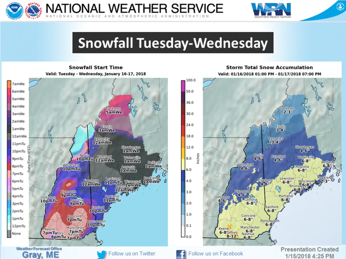
A Winter Storm Watch was issued this afternoon by the NWS: Get ready for snow beginning on Jan. 16.

GRAY, ME — The National Weather Service issued a winter storm watch this afternoon warning of colder temperatures and snow beginning on Tuesday. The alert was issued at just before 3 p.m. on Jan. 15, 2018. The alert covered most of the state including southern and central New Hampshire.
“Low pressure is expected to develop off the Mid-Atlantic coast Tuesday afternoon then move northeastward into the Gulf of Maine on Wednesday,” the alert stated. “Light snow may begin overspreading the Connecticut River Valley late Tuesday afternoon, then overspread the rest of the watch area Tuesday evening. The snow could be heavy at times late Tuesday night and Wednesday morning before ending during the afternoon hours.”
Commuters should plan on “difficult travel conditions” during the morning on Wednesday due to heavy snow, from 6 to 8 inches. Visibility is also expected to be reduced.
Find out what's happening in Concordfor free with the latest updates from Patch.
“The snow could be wet for a time Wednesday morning along the immediate coast,” according to the alert. “The islands and some necks may see a mix with rain.”
The storm watch is in effect from 7 p.m. on Tuesday through 5 p.m. on Wednesday.
Find out what's happening in Concordfor free with the latest updates from Patch.
The latest weather conditions can be found on the front page of every Patch.com site in the United States including the 12 New Hampshire Patch news and community websites. Local, four-day weather reports for New Hampshire are posted on Sundays and Wednesday or Thursdays. Alerts are posted when needed.
Image via NWS.
Get more local news delivered straight to your inbox. Sign up for free Patch newsletters and alerts.