Health & Fitness
All Eyes on Irene
Hurricane Irene, the first hurricane in the Atlantic this season, will impact the East Coast this weekend and may play a role in our weather eventually.
Perhaps you've heard about Hurricane Irene by now. She's actually the first hurricane in the Atlantic so far this season. A record was set for the most number of named systems (seven) not becoming hurricanes. I suppose this is a good record to set!
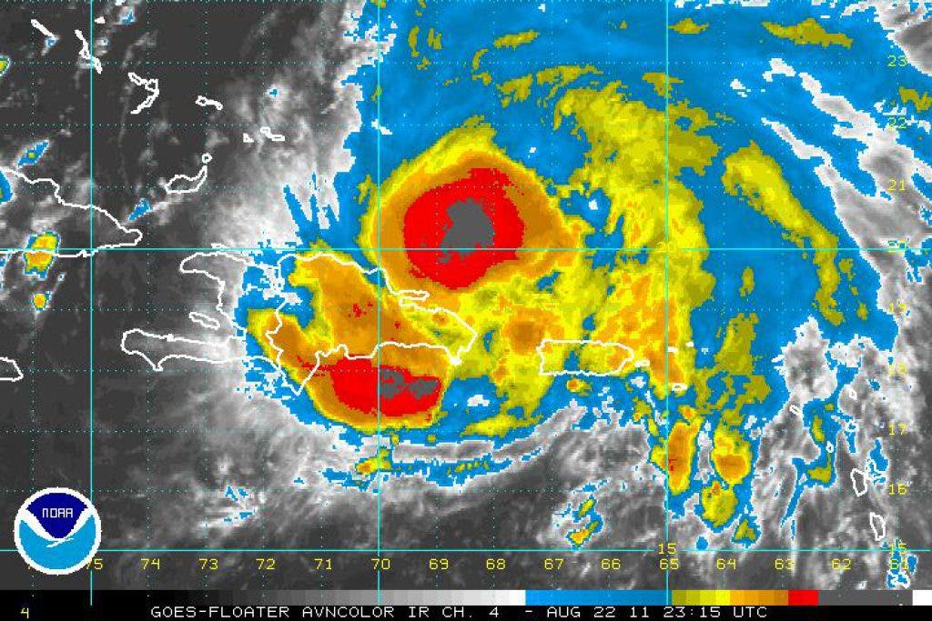
Irene became a hurricane early Monday morning while slamming Puerto Rico. Several inches of rain fell on the island and over 800,000 homes lost power as a result of hurricane-force winds.
Over the next few days, Irene will track south of the Turks and Caicos Islands and eventually through the Bahamas. Water temperatures are very warm and conditions should be quite favorable for further strengthening of Irene. The current forecast from the National Hurricane Center calls for Irene to strengthen to a category three major hurricane by Thursday. At that point, Irene is expected to be roughly 150 miles off of the east coast of Florida. The Bahamas will see significant impacts from Irene. It is likely that the east coast of Florida will see some impacts as well. How severe the impacts will be remains to be seen.
The trend in the computer guidance products over the past 36 hours has been for a more easterly track of Irene. The National Hurricane Center has followed suit and shifted their extended projected path several hundred miles east. The expectation now is that Irene may make landfall in the Carolinas. It is important to remember that hurricane forecasts four and five days out have average errors of 200 to 250 miles. Consequently, the forecast will likely change.
How Irene tracks through the southeastern United States will have big impacts on our weather. For example, if she makes landfall in South Carolina, it is possible that she remains over land as opposed to the ocean, weakening quite a bit and resulting in a windswept rainstorm from the Mid-Atlantic to New England. Conversely, if Irene makes landfall near Cape Hatteras or the Outer Banks of North Carolina and then moves northward over the Atlantic Ocean, impacts could be much more significant here in New England.
The likely timeframe of any impact here appears to be Sunday or Monday.
The bottom line: stay tuned to forecasts over the next several days. Irene could bring very little impact to us or she could bring something more serious. It is far too early to be 'worried' about Irene, but being cognizant of the fact that Irene exists is important. I'll do my best to update the blog here on Patch when time allows. Otherwise, I invite you to follow me on AtkinsonWeather.com, Twitter and Facebook.
Ryan Breton