Weather
Potential Increasing For Another Significant Winter Storm This Weekend In NJ, Forecasters Say
As New Jersey digs out from a foot of snow in much of the state, forecasters say a new system could bring another round over the weekend.

As New Jersey digs out of a storm that blanketed the state with as much as 17 inches of snow and ice on Sunday, forecasters are keeping an eye on a weather pattern that could mean another round of snow this coming weekend.
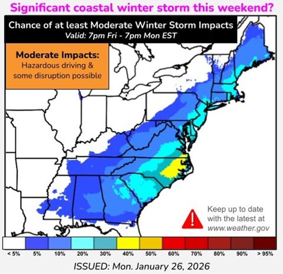
The National Weather Service's Weather Prediction Center said the potential is rising for another significant storm affecting the East Coast and possibly as far inland as parts of Tennessee and West Virginia.
"It is too early to know the details," the prediction center said, but said forecasters are looking at several factors, including very cold temperatures that will continue into next week. High temperatures in the teens and 20s during the day with wind chills at or below freezing are forcing people to bundle up as they tackle snow removal from the weekend.
Find out what's happening in Across New Jerseyfor free with the latest updates from Patch.
In addition, the forecasters are watching a "high-altitude disturbance" that they say will dive out of Canada on Thursday and "deepen across the East by Saturday, leading to a strong surface low-pressure system."
The combination of the surface low and the very cold airl "will result in widespread heavy precipitation," the prediction center said.
Find out what's happening in Across New Jerseyfor free with the latest updates from Patch.
The details on the timing and the track of the disturbance from Canada and the surface low are still very unclear, forecasters said, but will determine how much precipitation happens on land and how much happens offshore, the weather service said.
"Please keep updated with the latest forecasts this week," the weather service said.
Get more local news delivered straight to your inbox. Sign up for free Patch newsletters and alerts.