Weather
Tornado Warning Issued In North Jersey As Severe Weather Rolls Through The State
Flash flood watches and warnings have been issued as storms prepare to drench New Jersey.


A tornado warning was issued from the National Weather Service Tuesday afternoon for portions of the Garden State through 3:45 p.m. while all of New Jersey is under a tornado watch until 9 p.m.
Severe thunderstorms are expected to lash New Jersey Tuesday, bringing heavy rain, damaging winds, flash flooding, large hail and potentially even tornadoes, according to the latest forecast.
"Some showers and a thunderstorm around through this morning, with more widespread storms later this afternoon and this evening," National Weather Service forecasters said Tuesday morning. "Severe thunderstorms and flash flooding possible mainly this afternoon and evening."
Find out what's happening in Across New Jerseyfor free with the latest updates from Patch.
According to NWS severe thunderstorm and tornado warnings were issues for south central Sussex County in northwestern New Jersey, east central Warren County in northwestern New Jersey. Areas impacted include Morristown, Dover, Hopatcong, Hackettstown, Wharton, Rockaway, Morris Plains, Mount Arlington, Mountain Lakes, Stanhope, Netcong, Victory Gardens, Allamuchy-Panther Valley, Succasunna, Succasunna-Kenvil, Parsippany, Lake Telemark, Green Pond, Budd Lake, and Randolph. This includes Interstate 80 between mile markers 18 and 43 and Interstate 287 between mile markers 38 and 41.
Quarter-sized hail and 60 mph winds are the biggest threats in this storm.
Find out what's happening in Across New Jerseyfor free with the latest updates from Patch.
"Minor hail damage to vehicles is possible," the National Weather Service said. "Expect wind damage to trees and power lines."
Morris, Hunterdon, Middlesex, Somerset, Monmouth, Mercer, Gloucester, Camden, northwestern Burlington, Passaic, Hudson, Bergen, Essex and Union counties are under a flood watch through late Tuesday.
"Some heavy showers and thunderstorms will produce torrential rainfall, with 2 to 3 inches of rain per hour possible," the National Weather Service said.
A flash flood warning is in effect until 1 p.m. in southwestern Sussex County and northern Warren County.
Areas that were already saturated by this past weekend's storm are especially at risk of flash flooding, according to the National Weather Service.
The greatest risk of severe storms comes between 2 p.m. and 9 p.m.
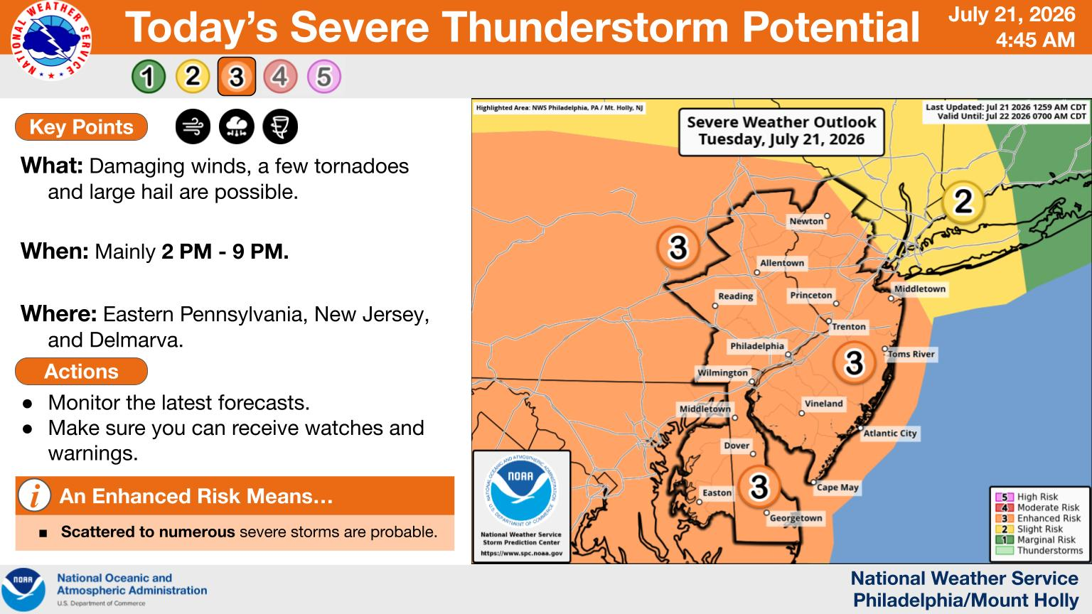
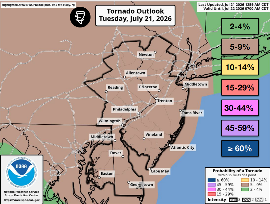
"A few tornadoes possible, causing tree damage, structural damage, and power outages," forecasters said.
Damaging winds, quarter-sized hail, lightning and tornadoes are a threat statewide.
Some areas may get 2 to 4 inches of rain total, forecasters said.
Additional showers and thunderstorms may linger into Wednesday. This will mainly be focused on South Jersey, though it's possible that they extend northward a little.
.png)
Again, locally damaging wind gusts will be the greatest threat. The severe risk is lessened compared to Tuesday.
"Some locally excessive rainfall is possible with some local flash flood risk, however this looks to be less compared to today given the shift farther south and more into the coastal plain," the National Weather Service said. "Once the front moves away by later Wednesday, it turns drier for Thursday/Friday and right into the weekend."
Get more local news delivered straight to your inbox. Sign up for free Patch newsletters and alerts.