Weather
Will Rain Clear Wildfire Smoke In NJ? See Latest Weekend Forecast
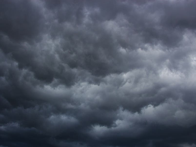
Showers and a few thunderstorms are expected to move through the region, as New Jersey remains under a "Code Orange" air quality alert.


NEW JERSEY — Air quality is improving in New Jersey, and smoke and haze from Canadian wildfires will not be as heavy Friday as scattered showers move in, according to weather experts.
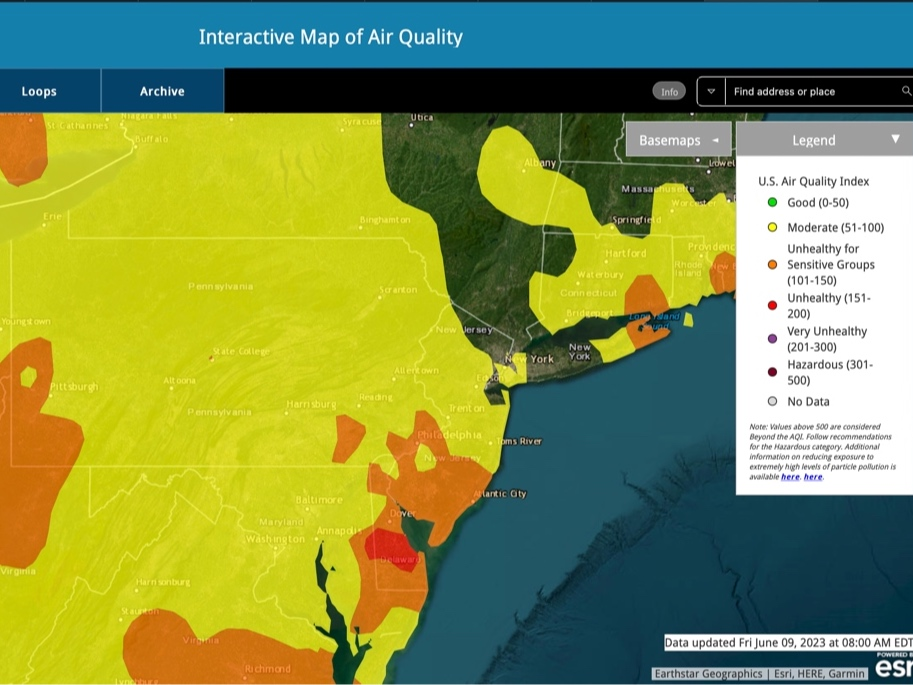
Still, air quality alerts are in effect in all 21 counties of the Garden State, with a “Code Orange Air Quality Action Day” in effect, according to the New Jersey Department of Environmental Protection. A code orange air quality alert means that air pollution concentrations within the region may become unhealthy for sensitive groups, such as children, the elderly and those suffering from asthma or heart disease.
On Friday, the highest concentrations of smoke from the millions of acres burning in Canada will be “from Philadelphia on south,” added the National Weather Service.
Find out what's happening in Across New Jerseyfor free with the latest updates from Patch.
“Smoke/haze is not expected to be as extreme compared to previous days though,” NWS forecasters said. “Take proper precautions if planning to be outside for an extended period of time, especially for at-risk groups!”
As of Friday morning, air quality monitors throughout the state were registering between 55 to 134 AQI, or up to the “moderate” air quality level, according to AirNow.gov. That’s compared to AQI values peaking at 350-450, the “hazardous” category, just 24 hours ago.
Find out what's happening in Across New Jerseyfor free with the latest updates from Patch.
A Particulate Matter Action Day has been declared for June 9, meaning levels of fine particulates remain in the “unhealthy” category across the state. Some members of the public may experience health effects; those in sensitive groups may experience more serious effects, according to the New Jersey Department of Environmental Protection.
After 2 p.m. Friday and in the evening, showers and a few thunderstorms are expected to move through the region. Gusty winds and small hail are possible with this closed low, and forecasters with the NWS believe precipitation “will be able to punch through any smoke layers.”
The precipitation will not clear the smoke, and forecasters say some will remain until at least Sunday, with air quality levels continuing to get better. A shift in the winds is causing the smoke to drift eastward on Friday, closer to the Great Lakes region according to weather experts.
“Current RAP near-surface smoke model guidance has improving air quality for Sunday as well,” said the NWS.
“Ozone levels are forecast to drop into the good/moderate threshold on Friday as chances for rain are expected to help limit ozone formation in northern portions of the state,” the DEP added.
Beyond the weekend, forecasters are looking toward some “much needed rainfall” possible in the region, from late Sunday night into Tuesday morning.
Related articles:
- Will The Smoke Clear Friday? NJ's Weekend Air Quality Forecast
Canada Wildfire Smoke In NJ: Expert Answers Common Questions (VIDEO)
Here is a look at the forecast through the weekend around New Jersey.
North Jersey
Today
A chance of showers before 11am, then a chance of showers and thunderstorms between 11am and 2pm, then showers likely and possibly a thunderstorm after 2pm. Some of the storms could produce small hail and gusty winds. Mostly cloudy, with a high near 72. Northwest wind around 7 mph. Chance of precipitation is 60 percent. New rainfall amounts of less than a tenth of an inch, except higher amounts possible in thunderstorms.
Tonight
Showers and thunderstorms likely before 11pm, then a slight chance of showers between 11pm and 2am. Some of the storms could produce small hail and gusty winds. Mostly cloudy, with a low around 50. South wind around 6 mph becoming light and variable. Chance of precipitation is 60 percent.
Saturday
A 20 percent chance of showers after 2pm. Mostly sunny, with a high near 78. Northwest wind 8 to 10 mph.
Saturday night
Partly cloudy, with a low around 56. Northwest wind 5 to 7 mph becoming calm in the evening.
Sunday
Mostly sunny, with a high near 85. Calm wind becoming southwest 5 to 8 mph in the afternoon.
Sunday night
A 30 percent chance of showers after 2am. Mostly cloudy, with a low around 61.
Central Jersey
Friday
A slight chance of showers between noon and 2pm, then a chance of showers and thunderstorms after 2pm. Mostly sunny, with a high near 75. Northwest wind around 5 mph. Chance of precipitation is 30 percent. New rainfall amounts of less than a tenth of an inch, except higher amounts possible in thunderstorms.
Friday night
A chance of showers and thunderstorms, mainly before 8pm. Widespread haze before 9pm. Partly cloudy, with a low around 52. West wind around 5 mph. Chance of precipitation is 30 percent. New precipitation amounts of less than a tenth of an inch, except higher amounts possible in thunderstorms.
Saturday
Sunny, with a high near 80. Northwest wind 5 to 10 mph.
Saturday night
Partly cloudy, with a low around 60. Northwest wind around 5 mph becoming calm in the evening.
Sunday
Mostly sunny, with a high near 88. Calm wind becoming southwest around 5 mph in the afternoon.
Sunday night
A chance of showers, mainly after 2am. Mostly cloudy, with a low around 64. Chance of precipitation is 40 percent. New precipitation amounts of less than a tenth of an inch possible.
South Jersey
Friday
A slight chance of showers between 1pm and 2pm, then a chance of showers and thunderstorms after 2pm. Widespread haze after 10am. Mostly sunny, with a high near 75. Northwest wind around 5 mph becoming west in the afternoon. Chance of precipitation is 30 percent. New rainfall amounts of less than a tenth of an inch, except higher amounts possible in thunderstorms.
Friday night
A chance of showers and thunderstorms, mainly before 8pm. Widespread haze. Patchy smoke before 2am, then patchy smoke after 3am. Partly cloudy, with a low around 58. West wind 5 to 10 mph. Chance of precipitation is 30 percent. New precipitation amounts of less than a tenth of an inch, except higher amounts possible in thunderstorms.
Saturday
Sunny, with a high near 77. Northwest wind around 10 mph.
Saturday Night
Partly cloudy, with a low around 64. Southwest wind around 5 mph.
Sunday
Mostly sunny, with a high near 79. South wind 5 to 10 mph.
Sunday night
A chance of showers after 2am. Partly cloudy, with a low around 66. Breezy. Chance of precipitation is 30 percent.
Get more local news delivered straight to your inbox. Sign up for free Patch newsletters and alerts.