Two ordinances dealing with the ongoing “return to normal” in the borough were dealt with at last Tuesday’s borough council meeting.
The first, introduced on first reading was to adopt the newly issued Preliminary Flood Insurance Rate Maps issued by the Federal Emergency Management Agency (FEMA) last month.
The second approved the bonding of $250,000 to continue ongoing infrastructure repairs while waiting for anticipated additional FEMA funds to be sent to the borough.
According to Mayor William Huelsenbeck, the new FEMA maps eliminate the V or velocity zone designation for approximately 95% of the borough’s properties that were placed there on the advisory maps the agency released shortly after Sandy.
Find out what's happening in Barnegat-Manahawkinfor free with the latest updates from Patch.
Most properties have been returned to their prior A or AE zone designation, which eases the regulations for property owners looking to repair or rebuild, he said.
Properties located in a V zone are restricted to only being able to be raised on pilings that can not be enclosed.
Find out what's happening in Barnegat-Manahawkinfor free with the latest updates from Patch.
Those in A or AE zones may be raised on other types of foundations, such as block. The raised portion can be enclosed and used as a garage, storage, etc. but not living space.
Looking at the FEMA map web site (http://www.region2coastal.com/sandy/table,) Susan Kilcheski, head of the borough’s building, construction and zoning department, said on Thursday that the majority of the properties still in the V zone are bay front or close by in the low lying areas south of the Causeway.
The Web site is available to the public and can search any property simply by typing in the address.
Kilcheski said most properties returned to the A or AE zones also had their required elevations lower, but the maps still call for heights on average about one foot high than prior to Sandy.
The ordinance and current building codes also require that the elevations are to be one foot above the new map heights.
That means if a home was previously was in AE-8 (ft.) and went to V-10, it may now be a AE-9 and need to have the subfloor of the first level to be at 10 feet to be in compliance.
The new map heights will not be in effect until the council votes on final approval at next month’s meeting on Aug. 27, she added.
The timing will be close to when residential home owners looking to raise their homes will be able to move them out in to the street while being raised, she said.
Another recently passed ordinance will permit homes to be moved into the street about “one car width” starting in mid-September. The posting of a $5000 bond will be necessary to ensure against any street damage, she added.
Regarding the bonding ordinance, Borough Administrator Richard Betha said by bonding the repair funds in an ordinance they can then use FEMA funds to quickly pay them off once they arrive. “Being able to pay the bond off quickly saves us money in the long run as opposed to borrowing money for a state of emergency,” he added.
To date the borough has received approximately $142,000 of the more than $372,000 it anticipates to recieve from FEMA, according to Councilman David Hartman, chairman of the Finance Committee.
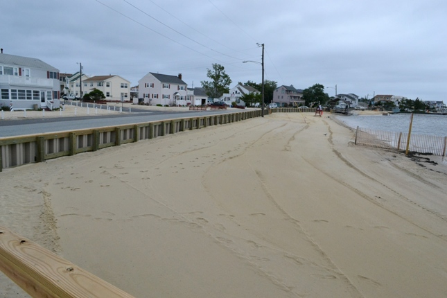
The funds will go to the continued restoration of bay front street end, street repairs, rebuilding beach walkways, parks and recreation department and the renting of the trailers that now house the municipal offices, said Hartman at the meeting.