Crime & Safety
WATCH: Waves Expose Beach Wall; Coastal Flood Warning In Effect In Ocean County As Joachin Moves Away
As high tide approaches in the early afternoon, those in low-lying areas should expect flooding, forecasters say.



Ocean County officials are warning residents of low-lying areas to move vehicles and other items to higher ground, after a coastal flood watch was upgraded to a warning overnight.
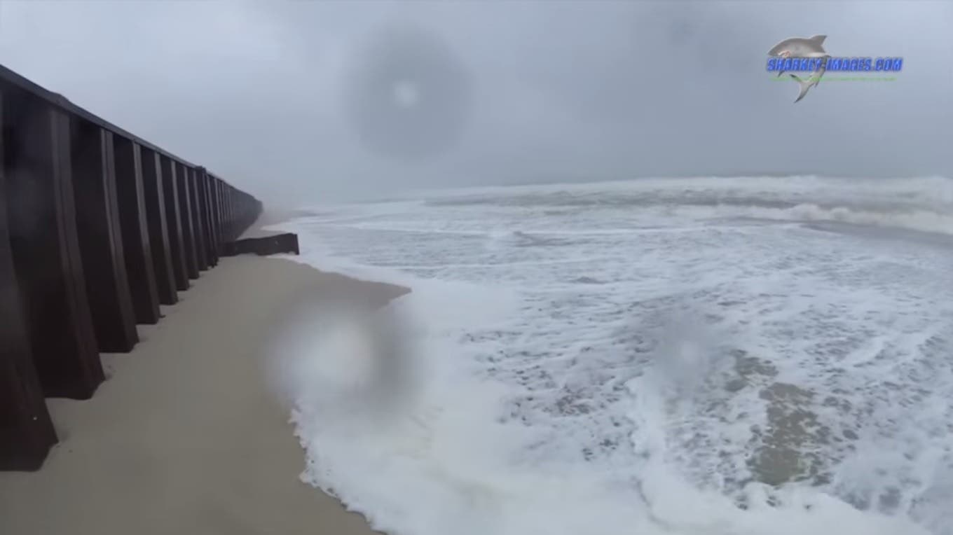
Brick Township officials closed the beachfront on Friday, warning residents and the curious to stay away due to the effect of the waves washing sand away from the steel revetment wall, exposing it.
“Sections of the revetment wall engineered to prevent wave impact on the barrier island and along the route 35 corridor are exposed, presenting a significant hazard,” the township said in an announcement.
Find out what's happening in Brickfor free with the latest updates from Patch.
Photos and video taken Friday by photographer Tim Sharkey show a few feet of the wall exposed as of the afternoon as the result of the nor-easter that passed through the area.
In Toms River, officials said the extra sand put in place to protect the dunes in Ortley Beach has been holding so far.
Find out what's happening in Brickfor free with the latest updates from Patch.
Paul Daley, coordinator of the Toms RIver Office of Emergency Management, posted a series of photos on Facebook Saturday morning from Ortley Beach that show the main dunes holding in place.
“The sand put in place to protect the dunes worked very well and as planned,” Daley wrote on the post. ”Regular dunes fully intact. A few more tide cycles with fingers crossed.”
The photos show the waves have carved away some of the sand that was put in place over the last couple of days to create a second dune in front of the main dunes. A significant drop is seen from the boardwalk to the edge of the waves. But the main dunes themselves are in good shape, Daley said.
The township has designated the parking lots at Castle Park, at the corner of Oak and North Bay avenues across from the police department, as a place to park vehicles to get them away from the water.
National Weather Service forecasters said the coastal flood warning, in effect through 6 p.m. Sunday, means there is a strong likelihood of widespread moderate tidal flooding through multiple high tide cycles.
“A building surge combined with 6- to 10-foot breaking waves and periods of moderate rain will contribute to the tidal inundation flooding,” the warning says.
High tide is expected early Saturday afternoon, with back-bay tides following three to four hours later.
Numerous roads are expected to flood and minor to moderate property damage is possible, the forecasters said.
Joaquin’s most recent track, projected as of 11 a.m. Saturday, shows the storm continuing to track east.
Photo and video courtesy of Tim Sharkey of Sharkey-Images.com
Get more local news delivered straight to your inbox. Sign up for free Patch newsletters and alerts.