Weather
Arctic Blast Heading To NJ: Latest Timeline For Season's Lowest Temps
The Arctic blast could bring near-record low temperatures to the region, forecasters said.

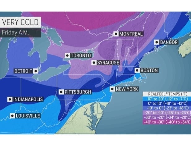
NEW JERSEY — Be sure to bundle up over the next couple of days as New Jersey is expected to see a drastic and dangerous drop in temperatures on Friday and Saturday.
A shift in the polar vortex is allowing an arctic cold front to sweep through the New Jersey region early Friday morning bringing "the coldest temperatures of the calendar year thus far," according to US National Weather Service Philadelphia/Mount Holly.
Bitter and blustery northwest winds are also expected as temperatures drop into the teens Friday night and even into the single digits for far northern parts of New Jersey.
Find out what's happening in Bridgewaterfor free with the latest updates from Patch.
"The polar vortex, which is a storm at the jet stream level of the atmosphere, has kept frigid air pent up above the Arctic Circle for much of the winter. When the polar vortex remains strong as it has been, frigid air cannot escape the Arctic. However, in recent days the polar vortex has weakened and stretched just enough to allow the bitterly cold air to move southward across North America," according to AccuWeather.
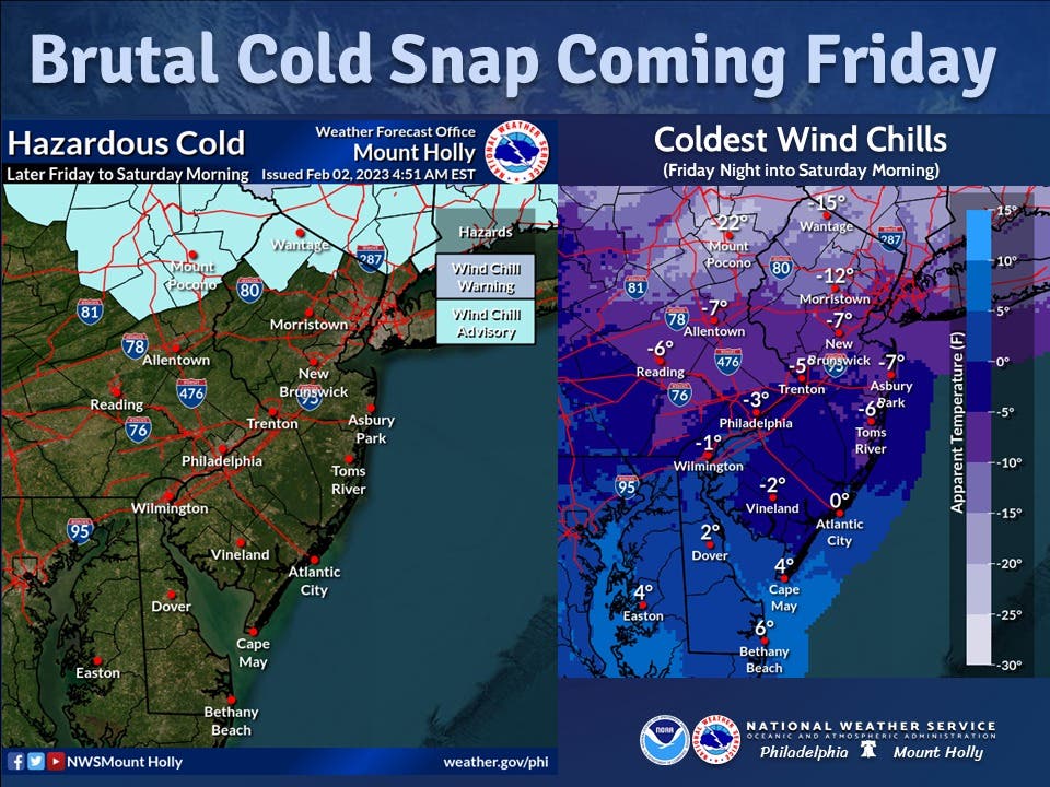
Along with frigid temperatures, residents can expect winds with gusts over 30 mph across the entire area much of Friday, with some brisk winds even persisting overnight into Saturday morning, according to NWS.
Find out what's happening in Bridgewaterfor free with the latest updates from Patch.
"Very cold wind chills will result. Make sure you dress warmly, with plenty of layers, along with thick hat and gloves to limit exposed skin when venturing outside," according to US National Weather Service Philadelphia/Mount Holly.
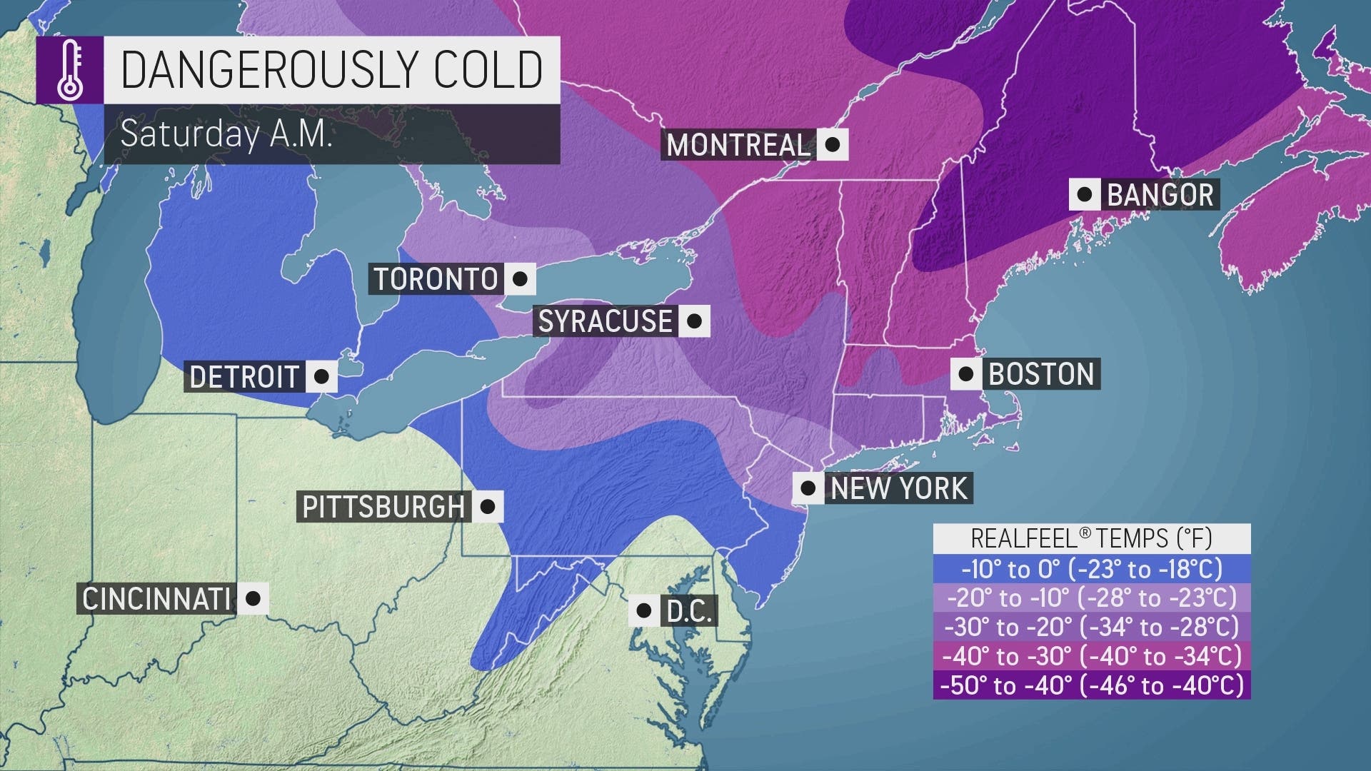
Low temperatures in the single digits and teens are expected to remain into Saturday morning.
It's also possible that snow squalls could hit the region.
"Dry air in place will try to combat the extent of the snow squall band and may reduce it to harmless flurries or perhaps snow that does not reach the ground," AccuWeather meteorologist Brian Wimer said.
Current predictions from AccuWeather call for squalls in parts of eastern Pennsylvania, and perhaps on the edge of the greater Philadelphia area. However, the outlet warns that this could shift, and impact more of the region.
Here is a look at the upcoming forecast:
Thursday: Sunny, with a high near 40. Southwest wind 10 to 15 mph.
Thursday Night: Partly cloudy, with a low around 23. Southwest wind around 10 mph becoming northwest after midnight. Winds could gust as high as 20 mph.
Friday: Mostly sunny, with a temperature falling to around 16 by 5 p.m. Wind chill values as low as -2. Blustery, with a northwest wind 20 to 25 mph, with gusts as high as 35 mph.
Friday Night: Mostly clear, with a low around 8. Wind chill values as low as -7. Blustery, with a northwest wind 15 to 20 mph, with gusts as high as 30 mph.
Saturday: Mostly sunny, with a high near 27. West wind around 10 mph.
Saturday Night: Partly cloudy, with a low around 19.
Sunday: Partly sunny, with a high near 45.
Sunday Night: Mostly cloudy, with a low around 31.
Get more local news delivered straight to your inbox. Sign up for free Patch newsletters and alerts.