Health & Fitness
Cool Start, Very Warm Finish to the Week
Could there be frost in some spots this week? Find out in the PatchCast for May 13-19.
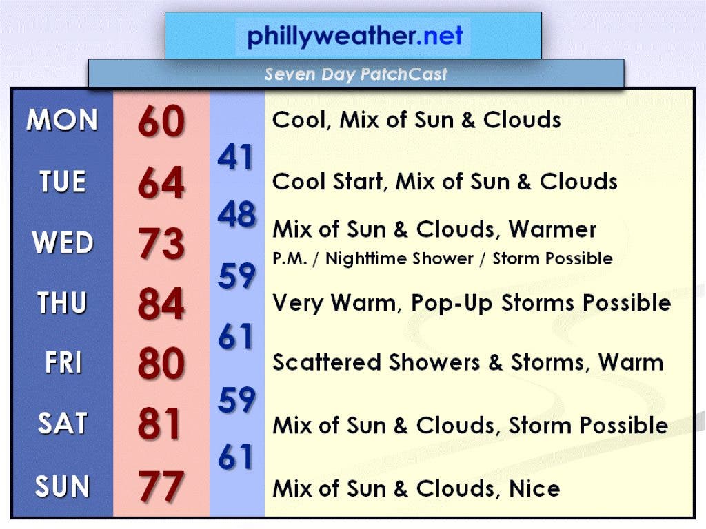
There is going to be a bit of a chill in the air for the beginning of this week. In fact, there may even be some frost in the coolest suburbs (Millville, the Pine Barrens, etc.) Monday morning and more likely Tuesday morning.
Monday will be a cool day with highs struggling to reach 60 degrees. Skies will feature a mix of sun and clouds. Tuesday will start near 40 degrees in the morning and rise to a high in the low to mid 60s. Skies will also feature a mix of sun and clouds.
We'll start to warm up on Wednesday, but a shower or thunderstorm threat will have to be introduced into the forecast for Wednesday afternoon and Wednesday night, due to a warm frontal passage. Highs on Wednesday will be nearly 10 degrees warmer than Tuesday.
Find out what's happening in Collingswoodfor free with the latest updates from Patch.
Behind the warm front, Thursday will be the warmest day of the week with highs reaching the mid 80s. Pop-up thunderstorms will be possible through the day, but it will not be a wash-out. Scattered showers and thunderstorms are possible on Friday, but it will remain warm with a high around 80.
A leftover shower or thunderstorm is possible to start the weekend, but 80 degrees or better still looks likely for a high. Sunday, as of now, looks like a dry day with a mix of sun and clouds. Temperatures will be pleasant, too, in the mid to upper 70s.
Find out what's happening in Collingswoodfor free with the latest updates from Patch.
Be sure to check Phillyweather.net throughout the week for updated forecasts.