Health & Fitness
Warmer but Unsettled This Week
Will it warm up as we move into the first week of May? Find out in my seven-day PatchCast for South Jersey!
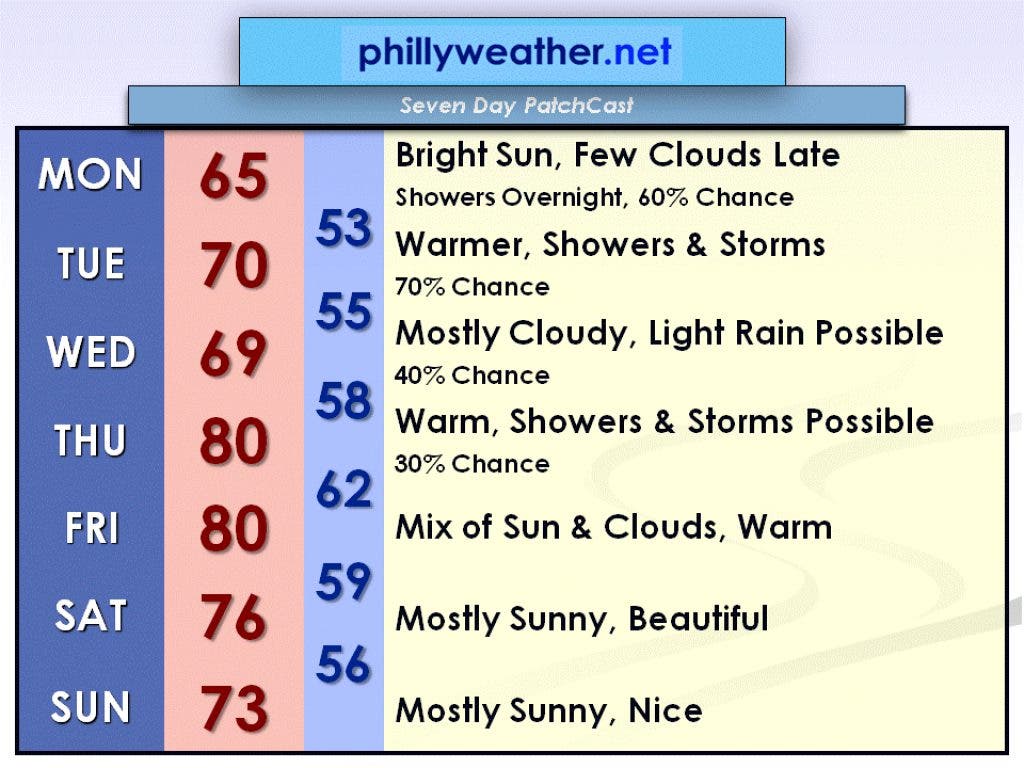
We will be under high pressure today to start the week, but things will be changing after that. A series of low pressure systems will move through the area through Thursday, bringing with them the chance for showers and thunderstorms. However, this week will be significantly warmer than last week when we spent a few days in the 50s.
Under today's high pressure, bright sun is expected, but a few clouds will move in late this afternoon in advance of the first low pressure system. The high temperature will be in the mid-60s. Showers arrive late tonight, most likely after 2 a.m. Showers will continue into Tuesday, and by Tuesday afternoon some thunderstorms are also possible. Tuesday will be warmer, however, with a high temperature near 70 degrees.
Another low pressure system moves in on Wednesday. It will be a mostly cloudy day with some light rain possible. The high temperature once again will be near 70 degrees. On Thursday, a different low pressure system will slide by to our north and could set off a few showers on thunderstorms. Thursday will be warm with a high temperature near 80 degrees.
Find out what's happening in Collingswoodfor free with the latest updates from Patch.
High pressure will try to build back in on Friday. A mix of sun and clouds is expected with a high temperature right around 80 degrees. As of now, the weekend looks nice. Under high pressure on Saturday and Sunday, mostly sunny skies are expected with high temperatures in the lower to mid-70s.
Be sure to check in with Phillyweather.net throughout the week in case any changes need to be made to this forecast. Have a great week!