Crime & Safety
70-MPH Gusts Possible In Camden County Amid Severe Thunderstorm Watch
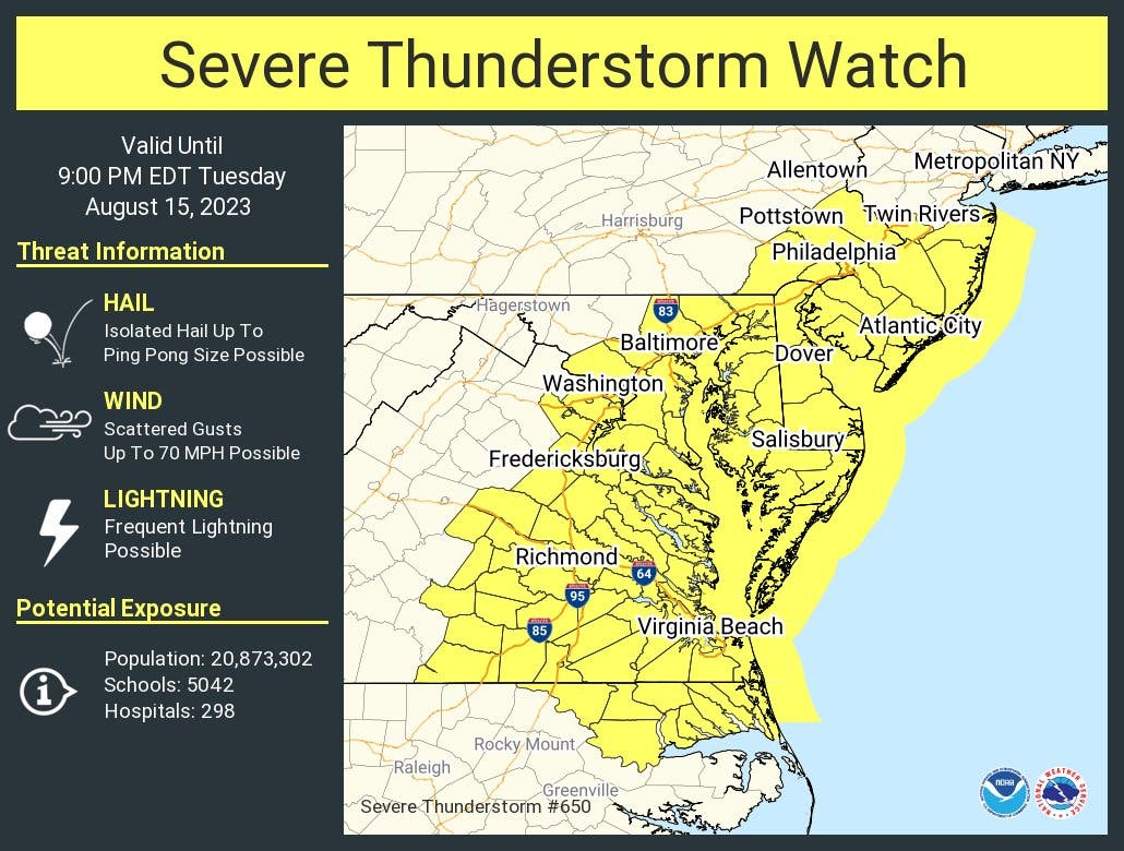
Hail and frequent lightning could also become factors in the region, forecasters said.

CAMDEN COUNTY, NJ — Officials placed Camden County under a severe thunderstorm watch Tuesday afternoon, with heavy storms potentially hitting the region into the evening.
The thunderstorm watch includes New Jersey's 10 southernmost counties and remains valid until 9 p.m. Tuesday. Scattered gusts could reach up to 70 mph, said the National Weather Service (NWS). Frequent lightning and isolated hail as big as ping pong balls are also possible, the agency says.
The watch area extends as far south as North Carolina.
Find out what's happening in Gloucester Townshipfor free with the latest updates from Patch.
Here's the NWS's latest forecast for Camden County:
- Tuesday afternoon: Partly sunny with a chance of showers and thunderstorms. Some thunderstorms may be severe with damaging winds, large hail, and heavy rainfall. Hot. Near steady temperature in the upper 80s. West winds 5 to 10 mph. Chance of rain 50 percent.
- Tuesday night: Mostly cloudy. A chance of showers and thunderstorms in the evening, then a slight chance of showers after midnight. Patchy fog after midnight. Some thunderstorms may be severe with damaging winds, large hail, and heavy rainfall. Humid with lows around 70. North winds around 5 mph. Chance of rain 50 percent.
- Wednesday: Patchy fog in the morning. Mostly sunny. Hot with highs in the mid 80s. Northwest winds around 5 mph, becoming west around 5 mph in the afternoon.
- Wednesday night: Partly cloudy. Humid with lows in the upper 60s. Southwest winds around 5 mph.
Find out what's happening in Gloucester Townshipfor free with the latest updates from Patch.
Get more local news delivered straight to your inbox. Sign up for free Patch newsletters and alerts.