Crime & Safety
Odor Still Wafting From South Jersey Wildfire's Aftermath: When Will It Stop?
As the smoky smell persists, forest fire officials told Patch how it's happening with the fire under control and how long it may persist.

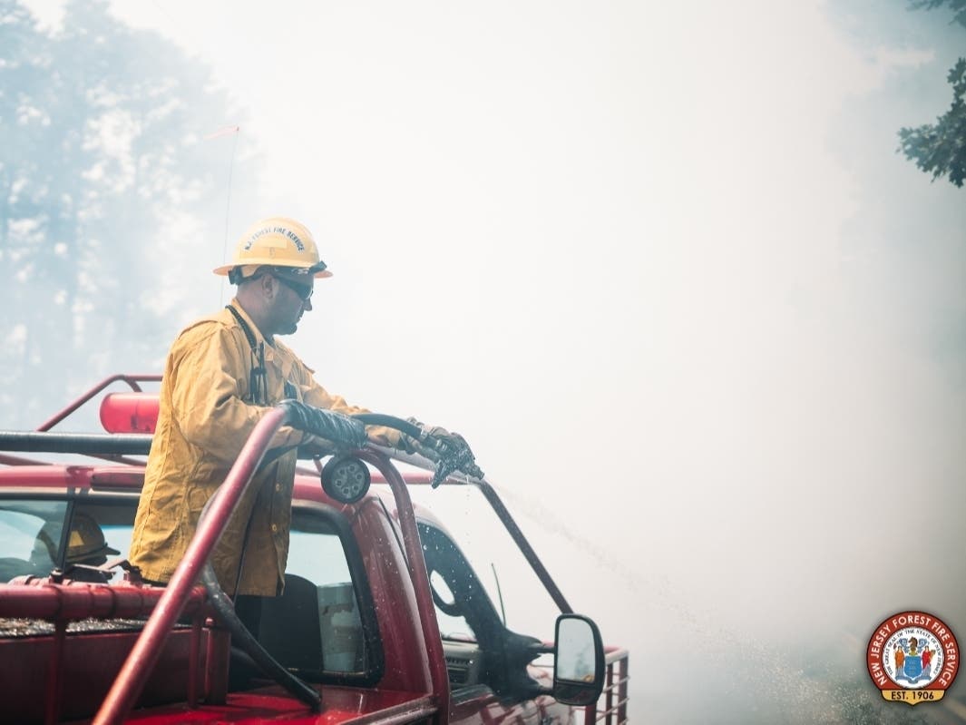
SOUTH JERSEY — Last week's wildfire in South Jersey has been under control for several days. But its smoky odor continues to travel through local communities and may linger for some time, according to state officials.
That scent will likely linger until the fire area receives substantial rainfall, officials told Patch.
The fire was detected Aug. 20 in Wharton State Forest, in the area of Jackson Road and the shuttered Atco Dragway in Waterford Township. Crews contained 95 percent of the wildfire by Aug. 22. But that night, the wind shifted eastward. So the smoke — and its scent — began pushing west into more populated areas, according to the New Jersey Forest Fire Service.
Find out what's happening in Gloucester Townshipfor free with the latest updates from Patch.
Several municipalities — including Cherry Hill, Evesham and Berlin — have reported the strong odor from the wildfire smoke in recent days. The Berlin Police Department reported the smoky odor in the borough on Monday.
What's that smell exactly? It's pine, cedar and oak smoke remains from the wildfire, according to the Forest Fire Service, which answered Patch's inquiries via a spokesperson for its parent agency — the New Jersey Department of Environment Protection.
Find out what's happening in Gloucester Townshipfor free with the latest updates from Patch.
At 10 a.m. Wednesday, officials declared the wildfire 100 percent contained at 1,778 acres. The fire was under control by 10:30 a.m. the next day. Crews remain on-scene to patrol the fire area and mop up remaining hotspots. When the containment efforts neared completion last week, the Forest Fire Service advised that smoke may remain visible for an extended period of time.
After the wind shifted last week, the Forest Fire Service received numerous smoke-investigation calls. The wind remained easterly as of Monday, pushing the smoke west into populated areas.
"There are many factors to smoke travel including wind direction and humidity," the Forest Fire Service said via a spokesperson. "The New Jersey Forest Fire Service does not track how far the smoke from New Jersey wildfires travel, however, it is not uncommon to smell wildfire smoke many miles away from the source."
South Jersey's air quality remains healthy as of Tuesday, according to AirNow. But people with respiratory issues who can smell the smoke in their area should keep windows closed and limit strenuous outdoor activity, the Forest Fire Service says.
It's uncertain how much any upcoming storms will help. Forecasters expect scattered showers in Waterford Township on Tuesday, with rain chances increasing overnight. But after Wednesday afternoon, the National Weather Service expects relatively dry conditions in the area through at least Labor Day.
Here's the National Weather Service's latest forecast for the fire area:
- Tuesday: Scattered showers. Cloudy, with a high near 78. East wind 5 to 10 mph. Chance of precipitation is 40 percent. New precipitation amounts between a tenth and quarter of an inch possible.
- Tuesday night: Isolated showers, then scattered showers and thunderstorms after 2 a.m. Cloudy, with a low around 70. East wind around 5 mph becoming calm in the evening. Chance of precipitation is 30 percent. New rainfall amounts between a tenth and quarter of an inch, except higher amounts possible in thunderstorms.
- Wednesday: Scattered showers and thunderstorms, mainly before 2 p.m. Cloudy, then gradually becoming mostly sunny, with a high near 85. Southwest wind 5 to 10 mph becoming northwest in the afternoon. Chance of precipitation is 40 percent. New rainfall amounts between a tenth and quarter of an inch, except higher amounts possible in thunderstorms.
- Wednesday night: Mostly cloudy, with a low around 61. North wind 5 to 10 mph.
- Thursday: Partly sunny, with a high near 77. Northeast wind around 10 mph.
- Thursday night: Partly cloudy, with a low around 57.
- Friday: Sunny, with a high near 78.
- Friday night: Mostly clear, with a low around 54.
- Saturday: Sunny, with a high near 81.
- Saturday night: Mostly clear, with a low around 59.
- Sunday: Sunny, with a high near 86.
- Sunday night: Mostly clear, with a low around 63.
- Labor Day: Sunny, with a high near 90.
Get more local news delivered straight to your inbox. Sign up for free Patch newsletters and alerts.