Weather
With Up To 4 Inches Of Rain Predicted, Hoboken Says Avoid Travel At One Specific Time
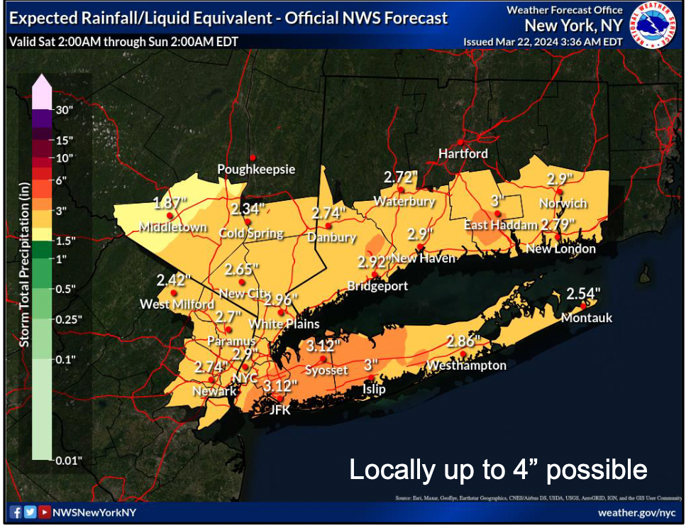
As a pre-Easter nor'easter could bring 4 inches of rain to the Hoboken area, the city gave guidance. See when the rain will be heaviest.

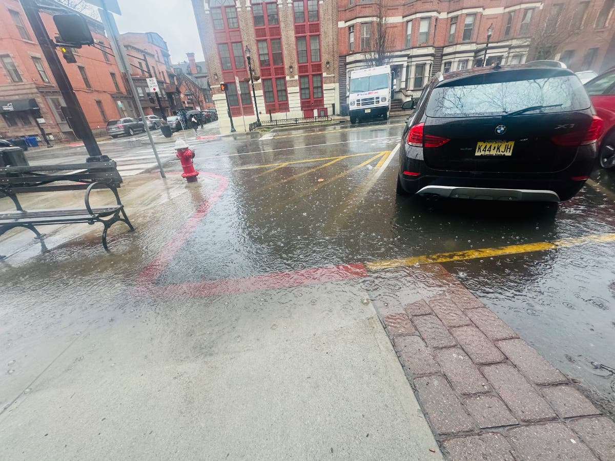
HUDSON COUNTY, NJ — A nor'easter is expected to soak Hudson County in rain from early Saturday morning to late at night, with the heaviest showers from around 1-5 p.m. Forecasters say that as much as 4 inches of rain may fall.
"This is expected to result in flooding of low lying and poor drainage areas, especially during the Saturday night high-tide cycle, which is at approximately 8:45 p.m. in the Hoboken area," the city of Hoboken wrote. "Residents are advised to avoid travel during the height of this storm, if possible."
The city made discounted parking available and said that travel is best avoided during the Saturday night high tide, issuing further guidance here.
Find out what's happening in Hobokenfor free with the latest updates from Patch.
If heavy rain falls in a short period, several rivers and streams in North Jersey will have minor flooding, the NWS says.
A flood watch is in effect from Saturday at 8 a.m. to Sunday at 2 a.m.
Find out what's happening in Hobokenfor free with the latest updates from Patch.
Get Updates With These Links
Forecasting weather is an imperfect science, so it's best to be prepared, then to check the most up-to-date numbers. Use the links below.
- See the flood maps and flooding prediction summary here.
- Where is it actually raining? Keep an eye on the radar here.
- See a current map of all watches and warnings in New Jersey here.
- See Hoboken's high tide times here.
See the updated NWS forecasts, watches, and warnings for North Jersey:
What about the rivers? This NWS map of the United States will show the potential for flooding.
Get more local news delivered straight to your inbox. Sign up for free Patch newsletters and alerts.


