Weather
Excessive Rainfall Risk 'High' For Hudson County Due To Ida: NWS
A briefing Wednesday morning puts Hudson County in a "high risk" area for flash floods due to Tropical Depression Ida.

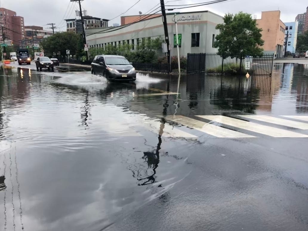

HUDSON COUNTY, NJ — A new briefing from the National Weather Service on Wednesday morning puts Hudson County and North Jersey in a "high risk" area for excessive rainfall due to Tropical Depression Ida. See the briefing here. The designation means there's a high risk of "severe, widespread flash flooding" potentially including areas that don't normally flood.
The area is now under a flash flood watch from 8 a.m. Wednesday to 2 p.m. Thursday. See all watches and warnings for the area here.
Want breaking news when it happens in your Hudson County town? Sign up for occasional breaking news alerts, and/or get a free daily newsletter at 6 a.m. each morning with local news. Sign up with your preferences here.
Find out what's happening in Hobokenfor free with the latest updates from Patch.
The forecast says:
Wednesday: Showers, with thunderstorms also possible after 4pm. High near 75. Northeast wind 5 to 11 mph. Chance of precipitation is 90 percent. New rainfall amounts between a quarter and half of an inch possible.
Find out what's happening in Hobokenfor free with the latest updates from Patch.
Wednesday night: Showers and possibly a thunderstorm. Some of the storms could produce gusty winds and heavy rain. Low around 62. East wind 11 to 14 mph becoming north after midnight. Winds could gust as high as 31 mph. Chance of precipitation is 100 percent. New rainfall amounts between 3 and 4 inches possible.
Thursday: Rain likely, mainly before 11am. Cloudy, then gradually becoming mostly sunny, with a high near 73. North wind 13 to 15 mph, with gusts as high as 30 mph. Chance of precipitation is 60 percent. New precipitation amounts between a quarter and half of an inch possible.
- To track the storm on the National Hurricane Center site, click here.
- See the potential rainfall map here.
- See the forecast for Hudson County here.
Intersections In Jersey City And Hoboken That May Flood
Jersey City has released a list of 14 "repeat flooding" intersections during past storms. See that list here.
The intersections in Hoboken that are most likely to flood include:
- 1st and Marshall
- 1st and Harrison
- 2nd and Harrison
- 3rd and Harrison
- 4th and Harrison
- 4th and Monroe
- 3rd and Jackson
- 4th and Jackson
- 9th and Monroe
- 9th and Madison
- 10th and Madison
- 1st and Clinton
- 3rd and Clinton
- Henderson and Newark
- Grove and Newark
Floods This Summer
While some may consider flash floods just an inconvenience, these floods have proved fatal to drivers (sometimes trapping parents and children in their cars as water rises) and to children playing near small streams.
Low-lying Hudson County is known to experience flooding during severe downpours. Last month, a flash flood trapped shoppers in a supermarket parking lot. READ MORE: Flash Flooding Traps Shoppers In Hoboken Lot
And Tropical Storm Henri flooded several Hoboken intersections a week ago.
Severe storms are becoming more frequent. In fact, Hurricane Elsa in July 2021 was the earliest E-named storm in modern weather history.
Want breaking news when it happens in your town? Sign up for occasional breaking news alerts, and/or get a free daily newsletter at 6 a.m. each morning with local news. Sign up with your preferences here.
Got news? Email caren.lissner@patch.com. Got photos? Please include express written permission from the photographer for us to use them. To be the first to get free news alerts with breaking stories in your town, or to get a free local newsletter each morning, sign up for Patch breaking news alerts or daily newsletters.
Get more local news delivered straight to your inbox. Sign up for free Patch newsletters and alerts.