Weather
Final Rain Total Released For Hoboken As New Storm On The Way
How high were the wind gusts, and what time this weekend will the next storm arrive in Hoboken, and what about snow next week? Find out.

HUDSON COUNTY, NJ — As rain drenched Hoboken on Tuesday night and winds whipped up, a flood gate closed downtown, but waters had receded by Wednesday morning.
That said, a new storm is on the way to end the week — yet with weaker wind gusts.
Winds of 55 MPH were clocked at Teterboro airport on Tuesday night, the NWS said. High winds continued in Hoboken into late Wednesday. A high wind warning was to expire at 8 p.m.
Find out what's happening in Hobokenfor free with the latest updates from Patch.
The next rainstorm is expected to bring 1-2 inches starting after 1 a.m. early Saturday morning, the NWS says. Winds could gust up as high as 39 MPH.
"Strong winds and widespread minor to moderate flood impacts likely Friday night into Saturday," says a hazardous weather outlook for Hudson County.
Find out what's happening in Hobokenfor free with the latest updates from Patch.
High tide in Hoboken will be at 9:42 a.m. Saturday, at 5.2 feet.
New 1st Ward Councilman Paul Presinzano reported seeing the flood gates down at 9:30 p.m. Tuesday night.
As opposed to numerous schools to the west of Hudson County — where rivers rose well above flood stage Wednesday — schools opened on time in Hoboken and streets were relatively flood-free.
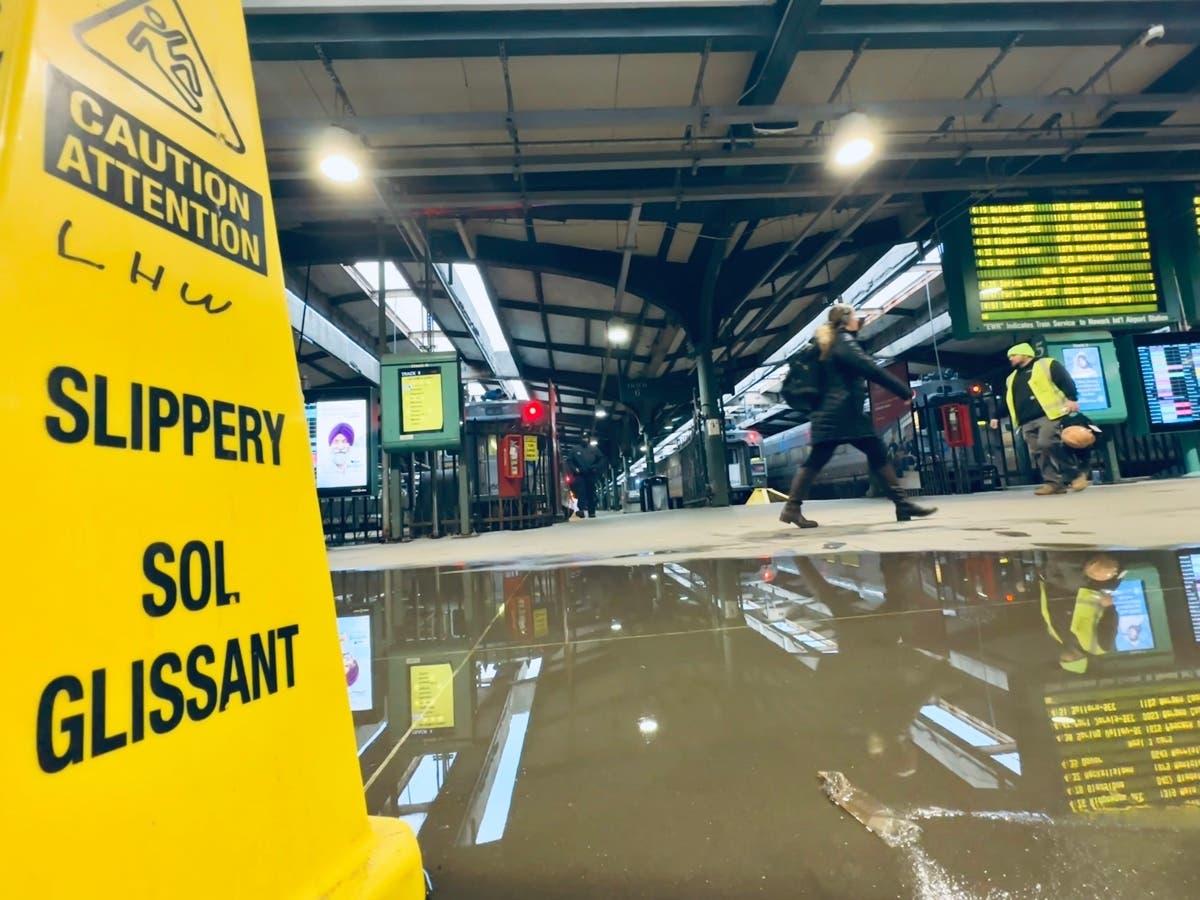
The international media posted photos of flooding in the train station on Wednesday.
See where river flooding is currently occurring in New Jersey and future predictions on this handy map.
But What About Snow?
Forecasters say there's a chance of a snowfall in Hudson County late Monday into Tuesday, with an accumulation of up to 4 inches. Whether the snow sticks depends on the temperatures.
Rainfall Report
A spotter for the NWS reported that Hoboken had gotten 2.35 inches of rain by Wednesday morning. See other New Jersey towns' totals here.
Further northwest in the state, rivers in both Essex and Bergen County reached well above flood stage. The Saddle River rose to 10.24 feet on Wednesday. Flood stage is 5.5.
Track The Coming Storms With These Links
Keep an eye on the radar here.
Check for all watches and warnings in New Jersey here.
See the updated NWS forecasts, watches, and warnings for North Jersey:
This NWS map of the United States shows potential river flooding. Come back to Patch for updates.
Get more local news delivered straight to your inbox. Sign up for free Patch newsletters and alerts.


