Weather
Flood Advisory, High Wind Warning For Hoboken: See When Flooding Is Most Likely
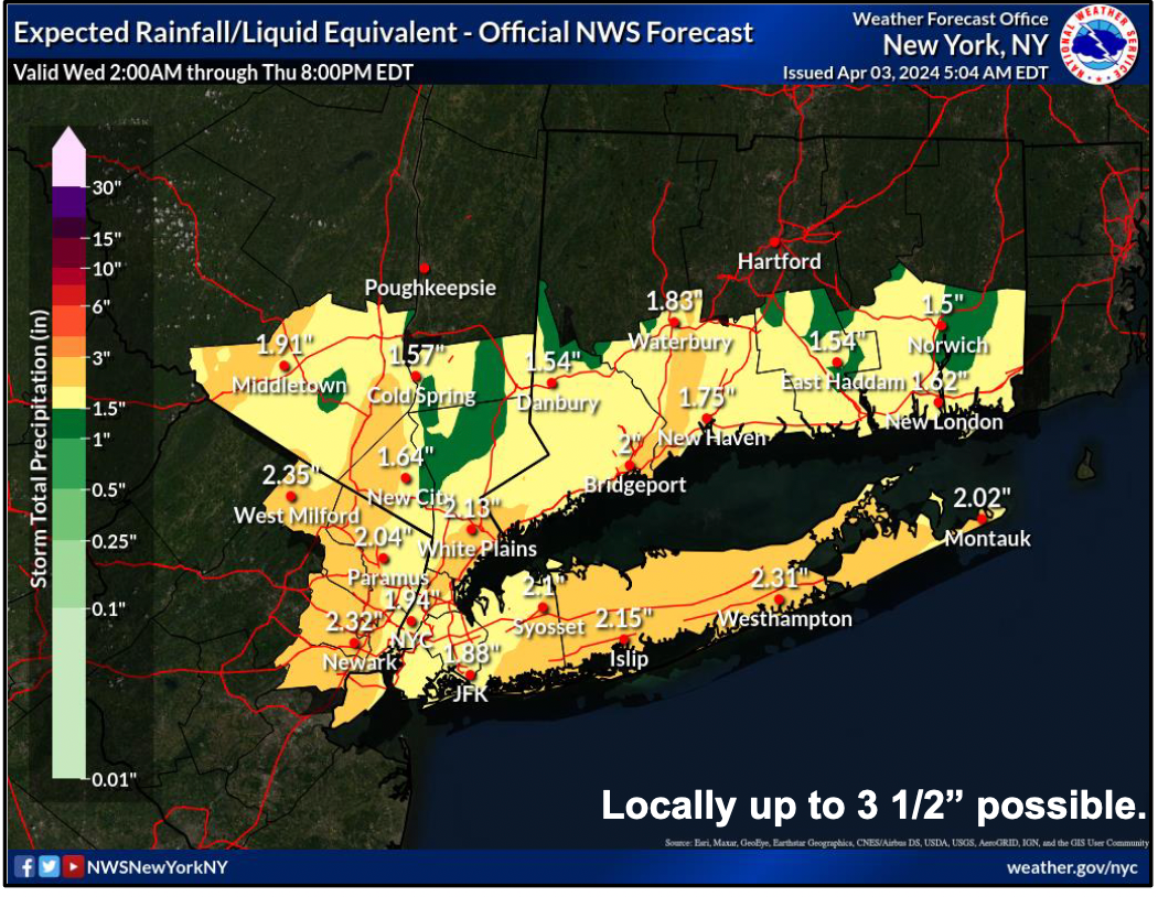
As much as 2 inches of rain and 48 MPH wind gusts are predicted for Hoboken. See when the tide will be high and flooding is most likely.


HOBOKEN, NJ — With as much as two inches of rain and high wind gusts in the forecast through Thursday, the National Weather Service has issued a flood watch and wind warning.
High tide in Hoboken, when flooding is most likely, will be at 4:46 p.m. Wednesday, and 5:09 a.m. Thursday morning. However, the highest tides are still relatively low this week as compared to next week.
On Wednesday, an inch of rain may fall during the day, and possibly another inch at night. See the updated briefing below.
Find out what's happening in Hobokenfor free with the latest updates from Patch.
A host of watches and warnings are up, including a coastal flood advisory from Wednesday at 2 p.m. until Thursday at 7 a.m., and a high wind warning from 11 a.m. Wednesday through 6 a.m. Thursday.
And a briefing on the coastal storm was updated by the National Weather Service at 6:30 Wednesday morning:
Find out what's happening in Hobokenfor free with the latest updates from Patch.
Get Updates With These Links
Forecasting weather is an imperfect science, so it's best to be prepared, then to check the most up-to-date numbers:
- Keep an eye on the radar here.
- See a current map of all watches and warnings in New Jersey here.
See the updated NWS forecasts, watches, and warnings for North Jersey:
What about the rivers? This NWS map of the United States will show the potential for flooding.
Get more local news delivered straight to your inbox. Sign up for free Patch newsletters and alerts.


