Weather
New Snowfall Map Issued Friday With Higher Totals For Hoboken
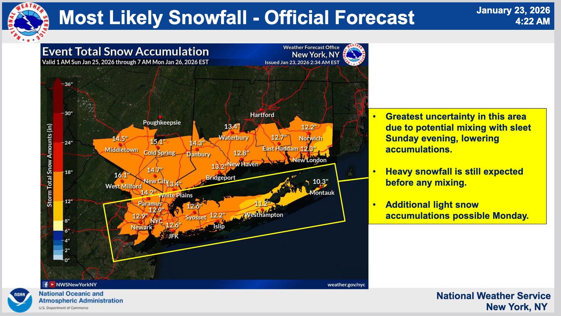
Hoboken is under a winter storm watch and cold weather advisory. See the new snowfall map.

HOBOKEN, NJ — The National Weather Service has issued a winter storm watch for Hoboken from 3 a.m. Sunday to 6 p.m. on Monday. Anywhere from 7-11 inches may fall Sunday, with 2-4 more inches possible Monday before noon, the NWS says.
The map shows how much could fall during the two days of the storm.
Guidance From City
Find out what's happening in Hobokenfor free with the latest updates from Patch.
Hudson County is also under a cold weather advisory from Friday at 10 p.m. until Saturday at 10 a.m., with wind chill values from 0 and 10 degrees on Friday night, and wind gusts up to 30 MPH.
On Thursday, the city sent out a preliminary advisory, saying to expect the next one Friday. They wrote, "The city currently has at least 325 tons of salt on hand, and the city’s and County’s combined fleet of more than 20 plows, salt spreaders, and multi-purpose vehicles is on standby."
Find out what's happening in Hobokenfor free with the latest updates from Patch.
Check for an update on cancellations, predictions, and preparations in Hoboken Patch on Friday. And use the links below for the most up-to-date forecasts and radar.
Track Storms Here
- See the latest local NWS forecast and watches for Hudson County here.
- Keep an eye on the local radar here.
- Check out the Accuweather Minutecast here.
- See a current map of all watches and warnings in New Jersey here.
- The NOAA (National Oceanic and Atmospheric Administration) keeps us informed about larger weather events. Follow them here.
Updated NWS forecasts, watches, and warnings in each county:
What about the rivers? This NWS map of the United States will show the potential for river flooding.
Get more local news delivered straight to your inbox. Sign up for free Patch newsletters and alerts.