Weather
NJ Weather: Hazardous Weather Outlook Issued For Stormy Weekend
Weather resembling a nor'easter is possible, including thunderstorms. Power outages and strong winds are possible. Here's what to expect.

Looks like another weekend washout in New Jersey, with thunderstorms, heavy flooding and possible flash flooding in the forecast. AccuWeather says these storms could resemble a nor'easter.
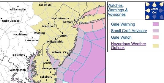
A hazardous weather outlook has been issued for the entire state, with the National Weather Service saying that a period of unsettled weather with chances for showers and thunderstorms is in the forecast for this weekend and through midweek.
There is the potential for locally heavy rainfall Saturday into Sunday which could lead to flash flooding, according to the National Weather Service.
Find out what's happening in Hobokenfor free with the latest updates from Patch.
The combination of rain and breezy conditions may seem more like a nor'easter from the spring or autumn in places such as Norfolk, Virginia; Ocean City, Maryland; Atlantic City, New Jersey; New York City and Boston, according to AccuWeather.
Here are the alerted areas:
Find out what's happening in Hobokenfor free with the latest updates from Patch.
Already, there were some problems at New Jersey beaches. Read more: 13 Monmouth County Ocean Beaches Close Because Of 'Garbage'
The rain can be heavy enough to cause a period of urban flooding, according to AccuWeather. Increasing winds along the coast are likely to create rough surf and strong rip currents.
The combination of drenching rain and gusty winds could cause sporadic power outages, especially where strong thunderstorms become intertwined with the storm system, according to AccuWeather
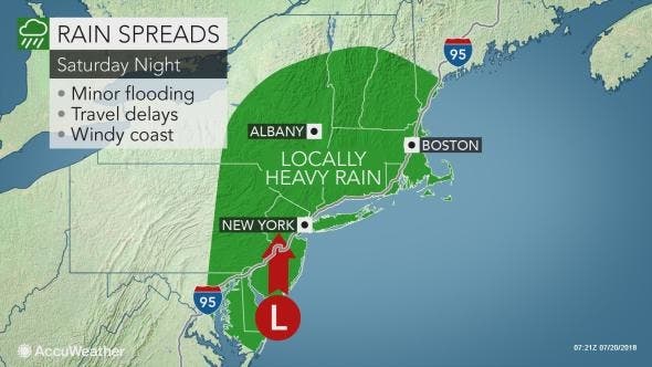
During Saturday night the heavy rain will spread northward across eastern and central Pennsylvania, New Jersey, southeastern New York state and southern New England, according to AccuWeather.
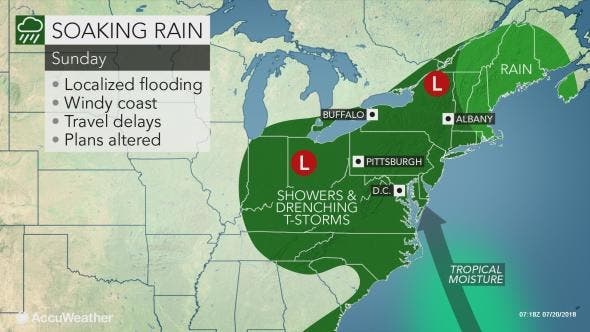
On Sunday, the rainstorm will spread across much of western, central and northern New York state and much of the balance of New England. But it's also supposed to heavily impact New Jersey, according to AccuWeather.
People with outdoor plans or heading to the beach this weekend should be prepared for wet weather during part of their trip, according to AccuWeather. The combination of rain and poor visibility may cause vehicle traffic to slow to a crawl at times. Airline delays due to a low cloud ceiling are likely as well at times.
Here is the forecast:
- Friday: Sunny, with a high near 84. Calm wind becoming southeast 5 to 8 mph in the afternoon.
- Friday night: Mostly clear, with a low around 63. Southeast wind 3 to 7 mph.
- Saturday: A chance of showers before 2pm, then a chance of showers and thunderstorms between 2pm and 5pm, then showers likely and possibly a thunderstorm after 5pm. Mostly cloudy, with a high near 78. East wind 10 to 16 mph. Chance of precipitation is 60%. New rainfall amounts between a tenth and quarter of an inch, except higher amounts possible in thunderstorms.
- Saturday night: Showers and possibly a thunderstorm before 2am, then showers likely. Low around 67. East wind 13 to 16 mph. Chance of precipitation is 80%. New rainfall amounts between three quarters and one inch possible.
- Sunday: Showers likely, with thunderstorms also possible after 8am. Mostly cloudy, with a high near 85. Southeast wind 9 to 13 mph. Chance of precipitation is 60%. New rainfall amounts between a tenth and quarter of an inch, except higher amounts possible in thunderstorms.
- Sunday night: Showers likely and possibly a thunderstorm. Cloudy, with a low around 73. Chance of precipitation is 60%. New rainfall amounts between a quarter and half of an inch possible.
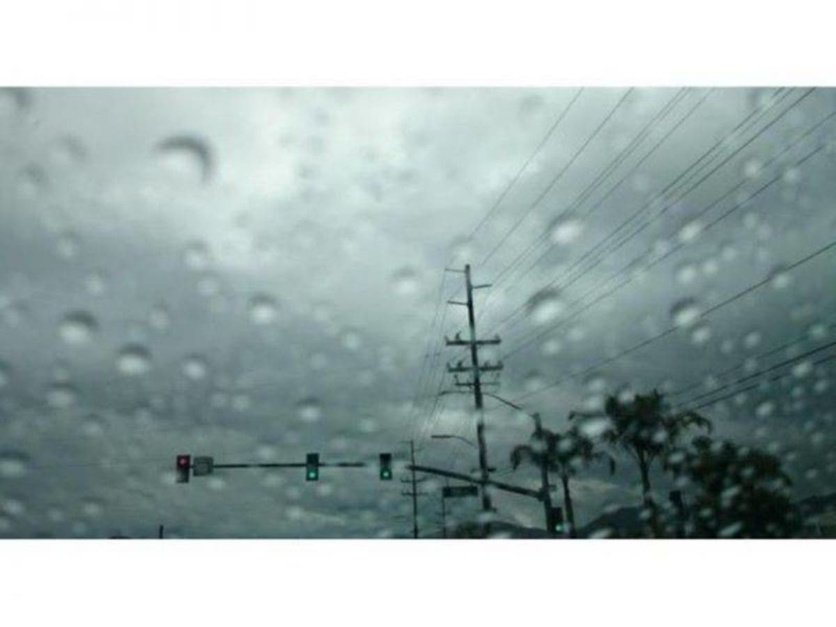
Tom Davis photo
Get more local news delivered straight to your inbox. Sign up for free Patch newsletters and alerts.


