Weather
Weather Watches Issued Across NJ As Tornadoes, Flash Flooding Hit The Forecast
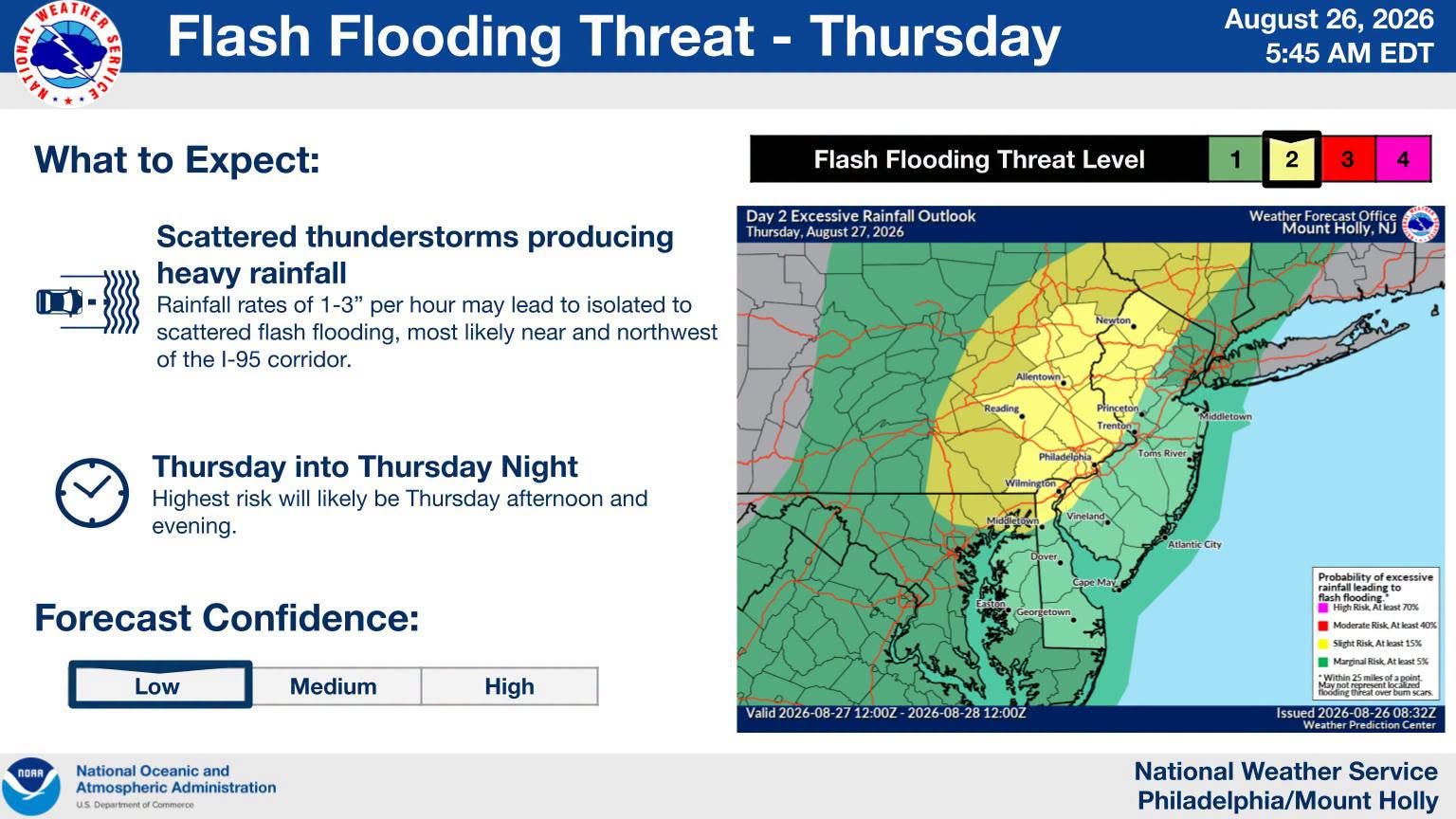
An isolated tornado and up to 5 inches of rain are possible in some areas Thursday as severe storms strike New Jersey.


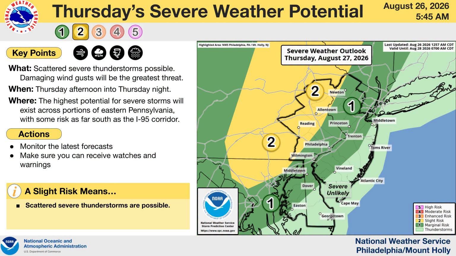
An isolated tornado, damaging winds and localized flash flooding are threats Thursday afternoon into the night as severe thunderstorms are set to lash the Garden State, according to the latest forecast.
Flood watches will be in place in Sussex, Morris, Middlesex, Hunterdon, Somerset, western Monmouth, Mercer, Gloucester, Camden, northwestern Burlington, Passaic, Bergen, Essex and Union counties Thursday.
One to 2 inches of rain is possible, with 3 to 5 inches possible locally, according to the National Weather Service.
Find out what's happening in Hobokenfor free with the latest updates from Patch.
An isolated tornado is possible along and west of the I-95 corridor, forecasters said.
Much of New Jersey is under a "marginal risk" for severe storms, with the shore unlikely to see anything severe.
Find out what's happening in Hobokenfor free with the latest updates from Patch.
"Showers and possibly some thunderstorms will start moving into western areas before daybreak and continue through the day," National Weather Service forecasters said.
Humidity will rise before the rain moves in.
"Widespread flash flooding still seems unlikely, but the localized threat has increased," forecasters said.
A cold front is set to move in Friday, though forecasters are not entirely sure of its impact.
"The timing of this cold front will be critical in the risk for
thunderstorm hazards," National Weather Service forecasters said. "There are differences between models in both the timing, and if this will be a single cold front, or an initial cold front with a reinforcing shot of cold air advection coming in behind it."
Get more local news delivered straight to your inbox. Sign up for free Patch newsletters and alerts.