Weather
Update: Tornado Map Released As Severe Weather Batters NJ
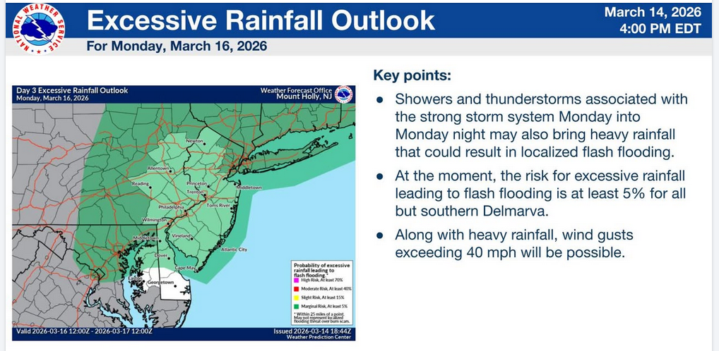
Excessive rainfall, a tornado threat, and even snow is in the forecast as a storm bears down on New Jersey Monday.

"Strong to severe" storms moving through New Jersey Monday may include thundershowers, flash floods, excessive rainfall, tornadoes and an eventual change to snow, forecasters say.
"Meteorologists are sounding the alarm for a widespread multiday severe risk stretching across the central and eastern United States from Sunday afternoon into Monday," said Accuweather. "Over a dozen states will be at risk for severe thunderstorms."
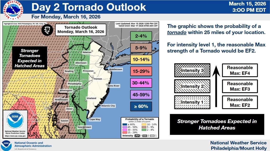
The threat for significant severe weather across portions of the area for Monday continues to increase, according to the National Weather Service.
Find out what's happening in Hobokenfor free with the latest updates from Patch.
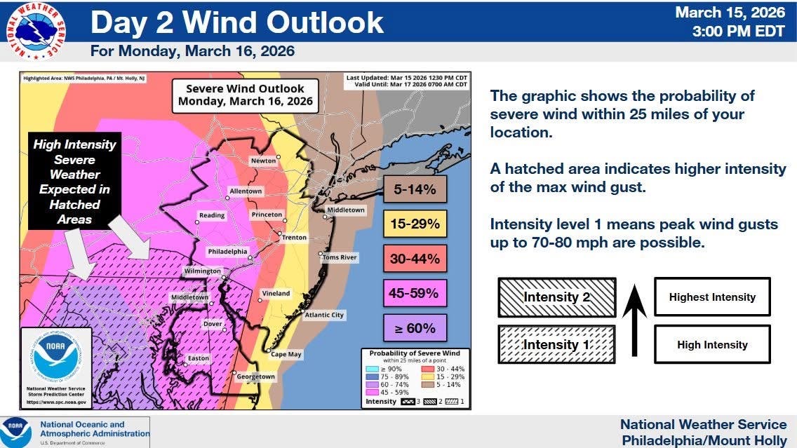
“Damaging winds are the biggest threat but there could also be a few tornadoes,” forecasters said Sunday evening.
Rain will fall much of the day on Monday, the NWS said.
Find out what's happening in Hobokenfor free with the latest updates from Patch.
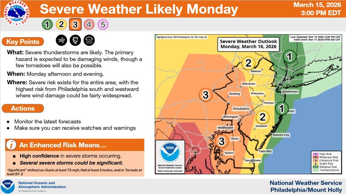
"There is an increasing potential for strong to severe thunderstorms Monday along and ahead of a strong cold front," the NWS said. "Localized flash flooding will also be possible."
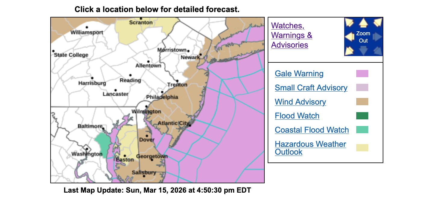
A wind advisory begins at 2 p.m. Monday in part of the state, with gusts of up to 45 MPH.
Commuting Concerns
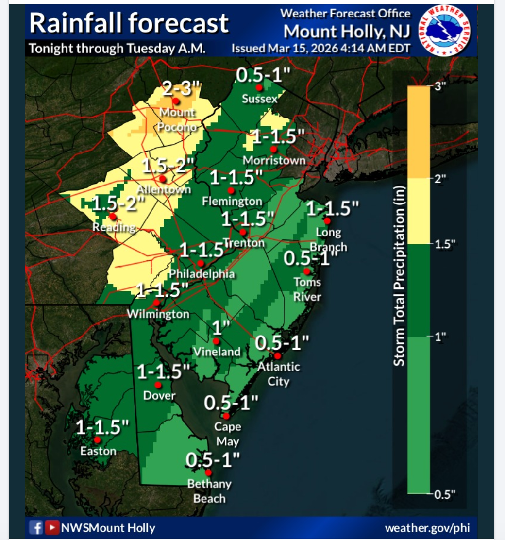
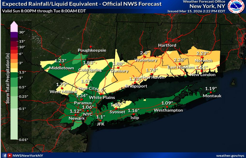
"While Sunday will be dry, rains will begin Sunday night," the NWS noted. "These are the forecasted rain totals through Tuesday morning."
Heavy rain and wind on Monday could cause problems on roads and airports.
"Downpours reducing visibility and causing ponding on roadways can also impact the [Monday] evening commute," Accuweather said. "Ground stops can also occur at airports throughout the region."
Forecasters noted that the "March Megastorm" — which is expected to bring blizzard conditions to the Midwest on Monday — will likely impact the Northeast.
"Wind gusts of 40-60 mph are expected across the central and eastern U.S. Sunday and Monday, from New Mexico to Maine," they said. "These winds alone can create hazardous travel for high-profile vehicles and may bring down tree limbs and power lines, especially in areas already weakened by recent storms."
Storms won't let up in the evening on Monday.
"As far as timing, there will be some showers and storms around during the day tomorrow, especially in the afternoon," the NWS said. "Some of these could be severe but the greatest threat for more widespread significant severe weather will be in the evening as a line of storms moves across the area from west to east."
Snow Later
The cold front may lead to snow overnight into Tuesday as temperatures drop into the 30s. There's a more than 50 percent chance of snow in North Jersey, the NWS says.
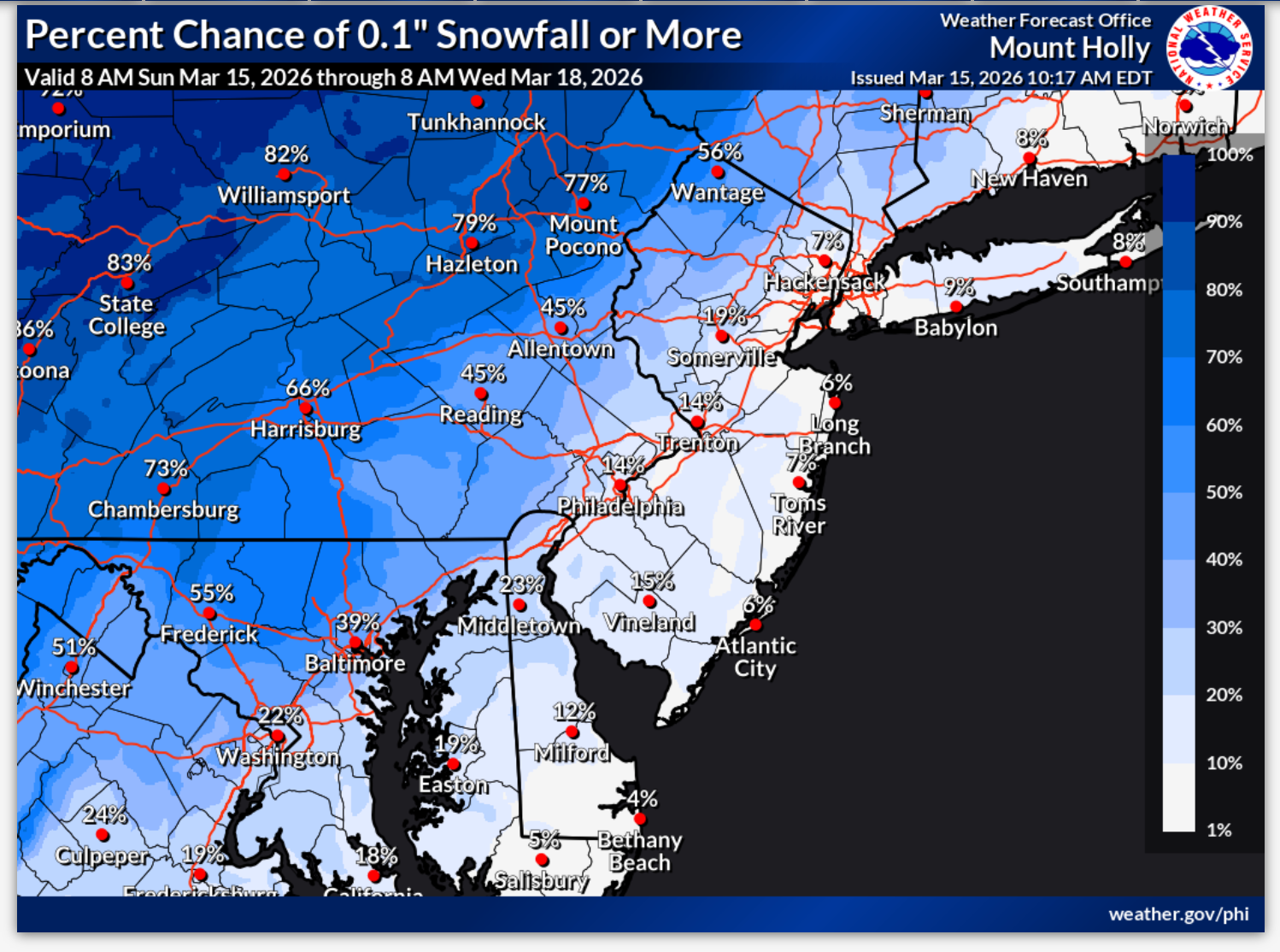
While forecasters don't predict much accumulation, they expect flurries or snow showers in North Jersey into early Tuesday, ending by 8 a.m.
Temperatures will continue to tumble.
"A much colder air mass settles in for Tuesday with temperatures struggling to reach 40 degrees in some areas," the NWS said. "A gusty westerly wind will also add a chill factor with wind chill values down into the upper teens to low 20s early Tuesday morning."
Get more local news delivered straight to your inbox. Sign up for free Patch newsletters and alerts.