Weather
Winter Storm Watch: Expected Snow Totals Increase For Hoboken Area
What's the deal with the snow forecast? See the accumulation map below for the Hoboken area.

HUDSON COUNTY, NJ — While early predictions said that the Hoboken area would get only an 1-2 inches of snow on Tuesday morning, the forecast has changed dramatically.
Forecasters now say the region could get 5-9 inches Tuesday morning, with temperatures dropping and rain changing to snow after 7 a.m.
Hudson County is under a winter storm watch starting at 4 a.m. Tuesday.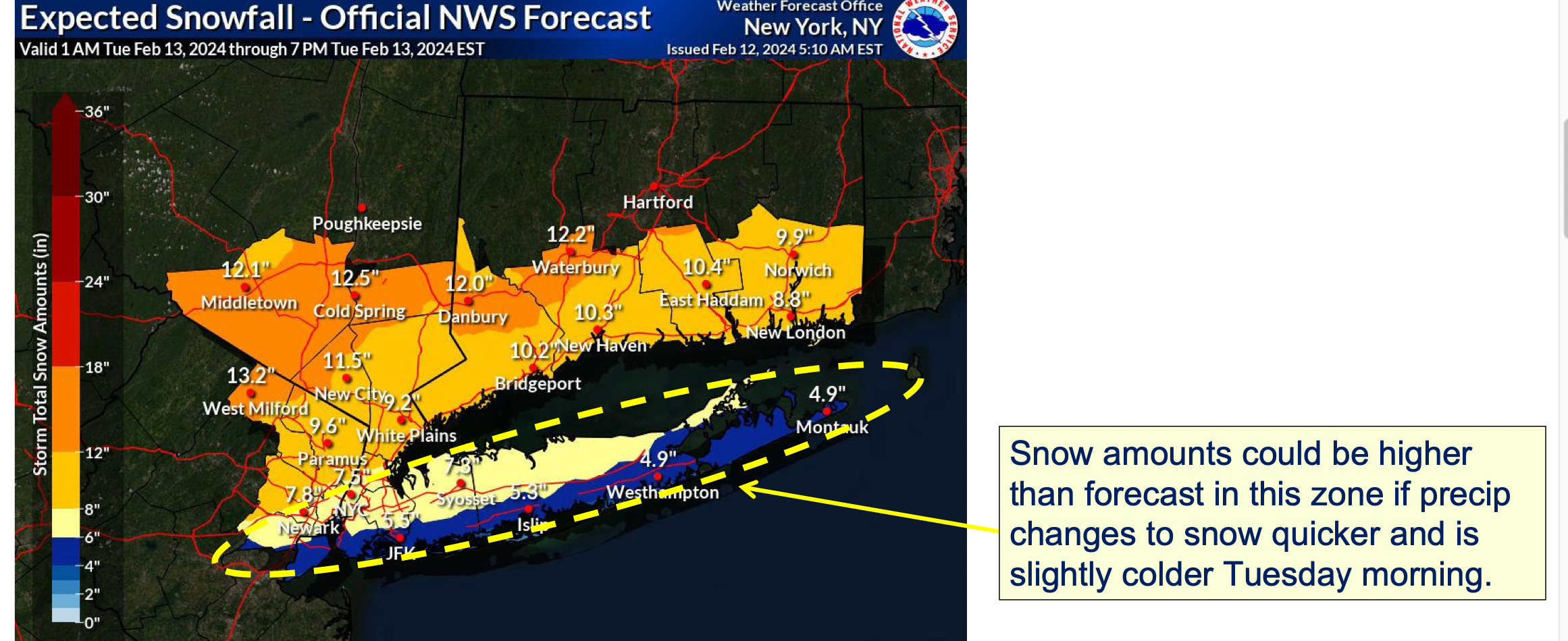
Find out what's happening in Hobokenfor free with the latest updates from Patch.
Get The Most Recent Updates With links
Keep an eye on the radar here.
Find out what's happening in Hobokenfor free with the latest updates from Patch.
Check for all watches and warnings in New Jersey here.
See the updated NWS forecasts, watches, and warnings for North Jersey:
What about the rivers? This NWS map of the United States will show the potential for flooding.
Get more local news delivered straight to your inbox. Sign up for free Patch newsletters and alerts.