Weather
Thunderstorms And Possible Flooding In Hoboken Forecast Monday: See Timing, Maps
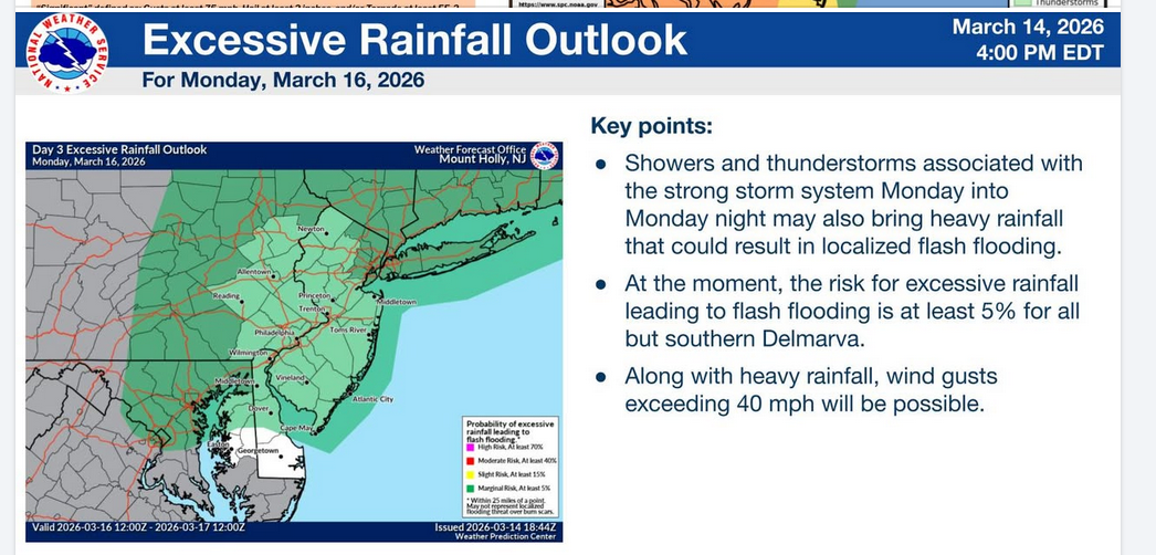
Excessive rainfall and possible flash floods are in the forecast for Hoboken on Monday. See the timing and maps.

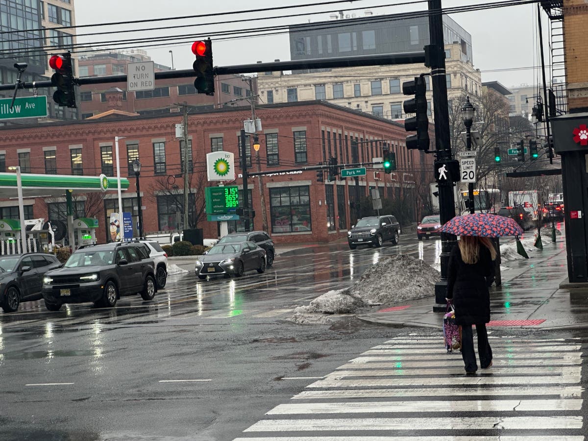
HOBOKEN, NJ — A day of rain and high winds in could include thunderstorms and flash flooding on Monday, the National Weather Service says.
"There is an increasing potential for strong to severe thunderstorms Monday along and ahead of a strong cold front," the NWS said. "Localized flash flooding will also be possible."
Hoboken officials have said that flash flooding can occur when more than 0.8 inches of rain fall in an hour.
Find out what's happening in Hobokenfor free with the latest updates from Patch.
High tide times also play a part in flooding. In Hoboken, high tide will occur Monday 7:17 a.m., 7:14 p.m., and then Tuesday at 7:57 a.m. Jersey City tide times are here.
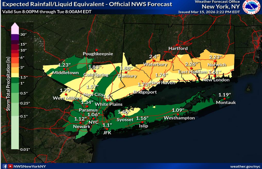
A half-inch of rain is expected to fall in Hudson County early Monday morning, followed by up to another half inch during the day and the same late at night.
Find out what's happening in Hobokenfor free with the latest updates from Patch.
Storms are expected to be strongest on Monday night.
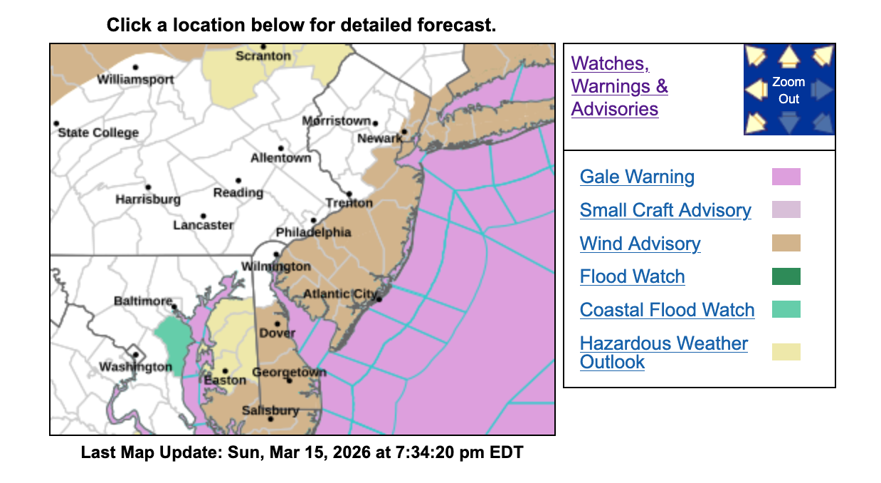
Like all of the New Jersey coastline, Hudson County will be under a wind advisory starting at 2 p.m. Monday until 7 a.m. Tuesday, with gusts as high as 46 MPH possible in Hoboken.
Links To Track Storms
- Keep an eye on the radar here.
- Check out the Accuweather Minutecast here.
- See a current map of all watches and warnings in New Jersey here.
- The NOAA (National Oceanic and Atmospheric Administration) keeps us informed about larger weather events. Follow them here.
Updated NWS forecasts, watches, and warnings in each county:
Get more local news delivered straight to your inbox. Sign up for free Patch newsletters and alerts.