Weather
Updated Map Shows Snowfall Potential For Hoboken, Jersey City
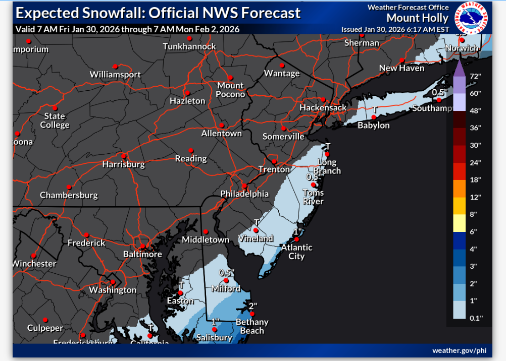
A new snowfall probability map was posted by the National Weather Service.

HUDSON COUNTY, NJ — Weather forecasters say a "bomb cyclone" may be headed for the East Coast on Sunday, with coastal areas like North Carolina and New England particularly vulnerable.
Hudson County is further inland and may be spared the worst of the storm, even with a 30 percent chance of snow on Sunday, the National Weather Service said.
A revised prediction early Friday morning shows that forecasters believe North Jersey will be spared the storm.
Find out what's happening in Hobokenfor free with the latest updates from Patch.
Bombogenesis is a cyclone that rapidly intensifies over 24 hours (see the definition here).
Still, Hudson County remains under a cold weather advisory through 10 a.m. Friday. morning, with wind chill values between 0 and -10.
Find out what's happening in Hobokenfor free with the latest updates from Patch.
- See the latest local NWS forecast and watches here.
- Keep an eye on the local radar here.
- Check out the Accuweather Minutecast here.
- See a current map of all watches and warnings in New Jersey here.
- The NOAA (National Oceanic and Atmospheric Administration) keeps us informed about larger weather events. Follow them here.
Updated NWS forecasts, watches, and warnings in each county:
What about the rivers? This NWS map of the United States will show the potential for river flooding.
Get more local news delivered straight to your inbox. Sign up for free Patch newsletters and alerts.