Weather
Heavy Rain, Flash Flood Risk In North Jersey Wednesday
A flash flood watch remains in effect until early Thursday morning in a region still reeling from Ida's deluge last week.

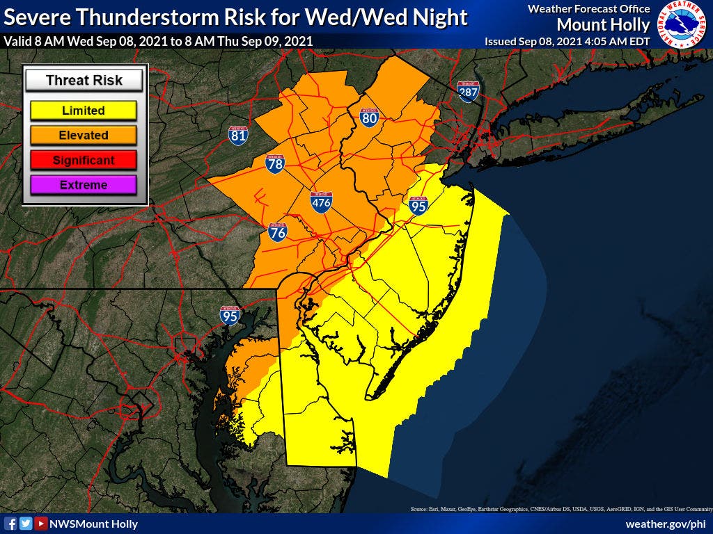
NORTH JERSEY — North Jersey has a high probability of rain and a "slight" risk of severe storms and flash flooding Wednesday, according to the National Weather Service. The agency issued a flash flood watch for the region that runs until early Thursday morning.
The additional storm comes just a day after President Joe Biden visited New Jersey to witness the devastation from Hurricane Ida's remnants. Last week's storm may play a role in potential flooding Wednesday, Gov. Phil Murphy warned.
"With grounds still saturated from Ida and rivers running high, rain brings the potential for flooding," Murphy said. "Please stay safe and never drive through flooded areas."
Find out what's happening in Livingstonfor free with the latest updates from Patch.
Damaging wind gusts are the main threat for a potential thunderstorm, according to officials. The storm could bring gusts greater than 60 mph, with isolated tornadoes possible, according to the National Weather Service. (Ida created seven known tornados in Pennsylvania and New Jersey.)
The most likely window for flash flooding will occur from 4 p.m. Wednesday to 2 a.m. Thursday, according to the National Weather Service. The primary window of concern is 10 p.m. to 2 a.m.
Find out what's happening in Livingstonfor free with the latest updates from Patch.
Forecasters predict some areas, such as Newark (0.64 inches of rain) will get less than an inch of precipitation. The National Weather Service projects West Milford in Passaic County will receive 1.17 inches.
But because the grounds remain heavily saturated, it could only take 1 or 2 inches of rain to create additional inundation in flood-prone areas, according to the National Weather Service.
Here's the forecast for the Newark Liberty International Airport as of Wednesday morning, according to the National Weather Service:
- Wednesday: A 30 percent chance of showers and thunderstorms, mainly after 4pm. Mostly sunny, with a high near 85. South wind 10 to 14 mph.
- Wednesday night: Showers and thunderstorms. Some of the storms could produce gusty winds and heavy rain. Low around 68. South wind 5 to 11 mph. Chance of precipitation is 80%. New rainfall amounts between a half and three quarters of an inch possible.
- Thursday: A 30 percent chance of showers, mainly before 2pm. Mostly cloudy, with a high near 79. Northwest wind 3 to 6 mph.
- Thursday night: Partly cloudy, with a low around 62. Northwest wind around 6 mph.
Get more local news delivered straight to your inbox. Sign up for free Patch newsletters and alerts.