Weather
New Jersey Weather UPDATE: Weekend Winter Storm Warnings, Watch Issued
UPDATED: A winter storm watch has been issued as more snow is expected to impact New Jersey this weekend - and the threat has increased.

UPDATE: Winter storm warnings have now been issued. Read more here: New Jersey Weather: Hour-By-Hour Forecast Of Weekend Snowstorm As Threat Upgraded
ORIGINAL STORY: Time for round two: A "winter storm watch" has been issued for parts of New Jersey as more snow is expected to impact all of the state this weekend.
Just a day after 1 to 3 inches fell across the state, the National Weather Service has issued a winter storm watch for Ocean, eastern Burlington and Atlantic counties because "there is a potential for significant snow that may impact travel."
Find out what's happening in Long Valleyfor free with the latest updates from Patch.
In Cape May County, that alert was upgraded to a "winter storm warning" by mid-day Friday.
Indeed, the National Weather Service says there is the potential for 5 inches or more in these areas on Saturday morning. The next round will begin to overspread late Friday and continue into late Saturday afternoon.
Find out what's happening in Long Valleyfor free with the latest updates from Patch.
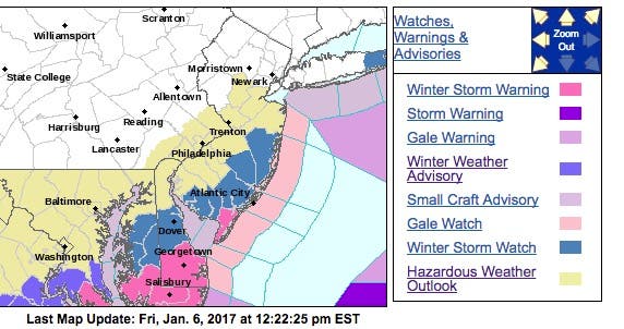
Other counties — Union, Middlesex, Monmouth, Mercer, western Burlington, Camden, Gloucester, Salem and Cumberland — were issued a hazardous weather alert.
The alert says the storm's track is uncertain, and these areas along the I-95 corridor could have anywhere from heavy to light accumulations. Nearly all areas of New Jersey are expected to get some layer of snow.
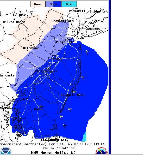
The National Weather Service says it's possible that Middlesex, Monmouth and all of South Jersey could get heavy accumulations at 10 a.m. Saturday:
The storm is part of a larger system moving through the south, according to AccuWeather.
In much of this area, the storm will begin as rain, but a transition to snow is in store with a period of sleet or freezing rain in some locations. People should be prepared for snow-covered and icy roads during Friday night and into Saturday. An accumulation ranging from 1 to 6 inches will occur along the Interstate 85 and I-77 corridors.
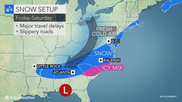
"Fortunately, the icy and snowy conditions will not develop in the I-85 corridor on south and east until after the Friday afternoon commute, which should allow millions to get home," AccuWeather Meteorologist Maggie Samuhel said in a release. "However, people on the road in this area Friday night and Saturday are likely to experience dangerous travel conditions and will run the risk of getting stuck."
Here is the forecast:
- Friday: Mostly cloudy, with a high near 35. Northwest wind 8 to 11 mph.
- Friday night: A slight chance of snow after 4am. Mostly cloudy, with a low around 17. North wind 6 to 8 mph. Chance of precipitation is 20 percent.
- Saturday: Snow, mainly before 4pm. High near 27. North wind 11 to 14 mph. Chance of precipitation is 80 percent. New snow accumulation of 1 to 3 inches possible.
- Saturday night: A chance of snow before 7 p.m. Mostly cloudy during the early evening, then gradual clearing, with a low around 13. Northwest wind around 14 mph. Chance of precipitation is 30%. New snow accumulation of less than a half inch possible.
- Sunday: Mostly sunny, with a high near 26. Breezy, with a west wind 13 to 20 mph, with gusts as high as 31 mph.
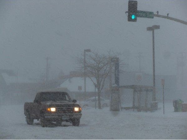
Patch file photo
Get more local news delivered straight to your inbox. Sign up for free Patch newsletters and alerts.