Community Corner
Not What We Want to Hear: Manchester, Get Ready For Some Rain, Maybe Even Snow
Wintery weather is possible with the low temperatures predicted for the area

Yes, it’s time to bundle up. Just in time for the weekend, a polar air mass has moved into the area, according to Steven DiMartino of the blog NY NJ PA Weather.
The cold temperatures are bringing with them rain and possibly snow for the region, and the cold temperatures are expected to linger through the weekend.
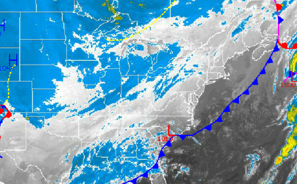
Clear skies to scattered cloud cover can be expected through Thursday evening as high pressure builds into the Philadelphia and New York City metropolitan areas from the Great Lakes. Winds will be from the northwest and north at 5 to 15 mph, increasing to 10 to 20 mph by nighttime. Temperatures will rise into the upper 40s to lower 50s along the immediate coast.
Find out what's happening in Manchesterfor free with the latest updates from Patch.
An area of low pressure developing along the North Carolina coast will lift northeast through the New Jersey coastal waters into Friday morning and toward New England by the afternoon. Periods of rain and snow can be expected with some minor accumulations on cold surfaces of a trace to a half an inch possible, especially over the interior. Winds will back to the northwest at 10 to 20 mph. Temperatures will fall into the mid- to upper 20s over the interior and upper 20s to lower 30s along the coast.
High pressure will be in control Friday night on through Sunday with clear skies to scattered cloud cover. Winds will be from the northwest through the period at 5 to 15 mph. Temperatures will remain well below normal, with lows in the upper 20s to lower 30s and highs to the low 40s.
Find out what's happening in Manchesterfor free with the latest updates from Patch.
Get more local news delivered straight to your inbox. Sign up for free Patch newsletters and alerts.