Community Corner
Warm Daytime Temperatures, Melting Snow May Lead To Icy Roads After Sunset
The National Weather Service has posted a hazardous weather outlook for Central Jersey: icy roads possible Monday night.

Temperatures are expected to drop below freezing Monday night, and that means surfaces left wet by melting snow may turn to ice.
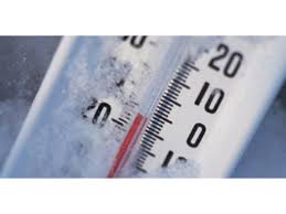
The National Weather Service has posted an alert about the possibility of icy spots in Central Jersey Monday night, when the low temperature will drop to about 19 degrees.
On Tuesday, snow and sleet are expected in the afternoon, and that precipitation will change over to rain Tuesday night and Wednesday, the weather service said.
Find out what's happening in Matawan-Aberdeenfor free with the latest updates from Patch.
Rain could be heavy at times and some localized flooding is possible. More snow is possible Wednesday night and Thursday.
Get more local news delivered straight to your inbox. Sign up for free Patch newsletters and alerts.