Weather
Weather Watches Issued As Storms Move Into NJ
The work week will not look the same as the weekend, forecasters said.


A slew of flood watches have been issued across the Garden State Sunday night into Monday, according to the National Weather Service.
The watches are for Sussex, Passaic, Hudson, Bergen, Camden, Essex, Gloucester, Hunterdon, Mercer, Middlesex, Monmouth, Morris, Salem, Somerset, Burlington, Union, and Warren counties.
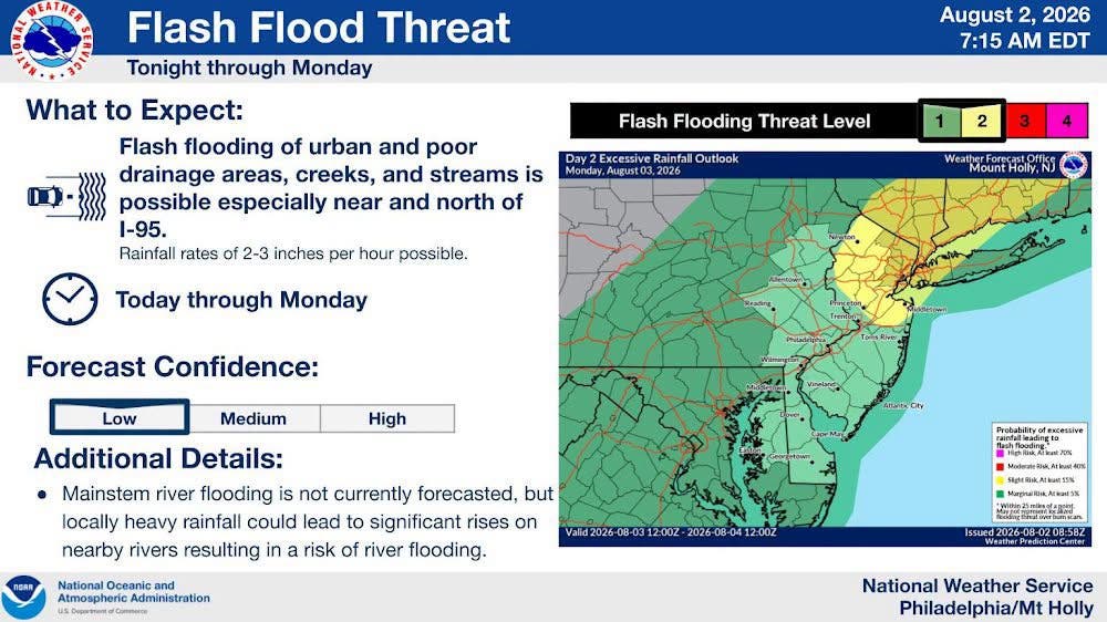
Locally heavy rainfall rates of 1-3" per hour may cause flash flooding of urban and poor drainage areas, creeks, and streams, forecasters said.
While flash flooding is anticipated to be the primary threat from any thunderstorms through Monday, isolated severe thunderstorms could produce localized wind damage.
Find out what's happening in Mendham-Chesterfor free with the latest updates from Patch.
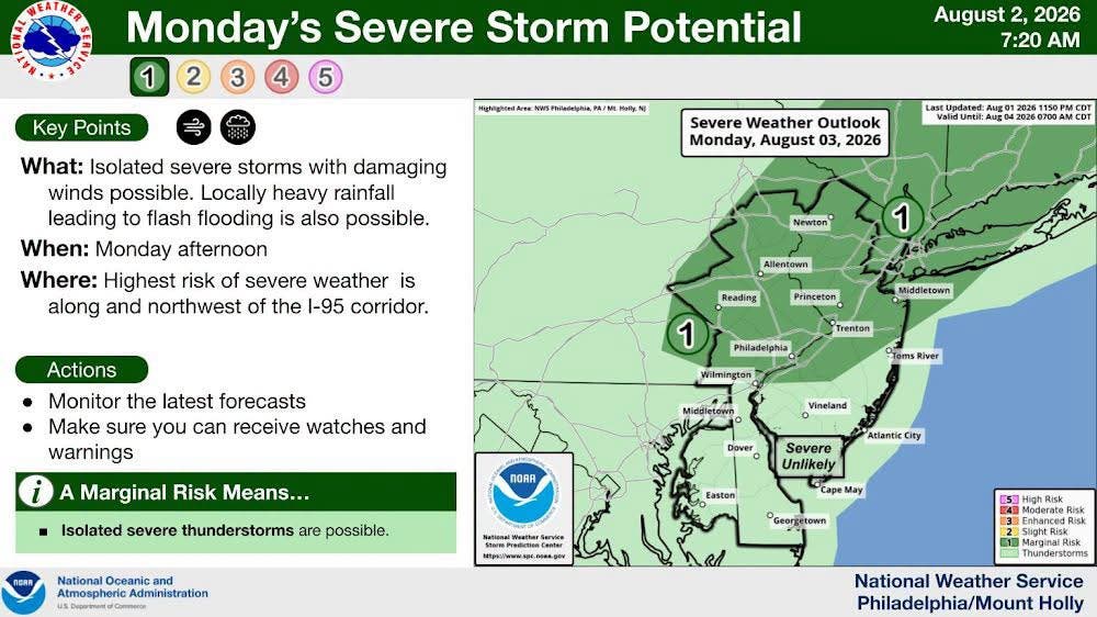
Forecasters reported that multiple rounds of showers and thunderstorms are expected to develop across the area, with the greatest concern centered on the overnight hours Sunday into Monday.
The National Weather Service said locally heavy rainfall could lead to flash flooding in urban and poor drainage areas, along with creeks and streams. Isolated severe thunderstorms with damaging winds are also possible. According to the forecast, the greatest risk of flash flooding and severe storms will be along and northwest of I-95.
Find out what's happening in Mendham-Chesterfor free with the latest updates from Patch.
The agency said, “An active weather pattern will take shape during the coming work week beginning Sunday night into Monday.” It also reported, “Multiple rounds of showers and thunderstorms are expected to develop across the region beginning as early as Sunday afternoon, but the greatest period of concern is overnight Sunday night through Monday.”
In a Sunday morning update, the National Weather Service said, “Multiple rounds of showers and thunderstorms are expected through tomorrow. The main hazards are heavy rain leading to flash flooding, damaging winds, and cloud-to-ground lightning.”
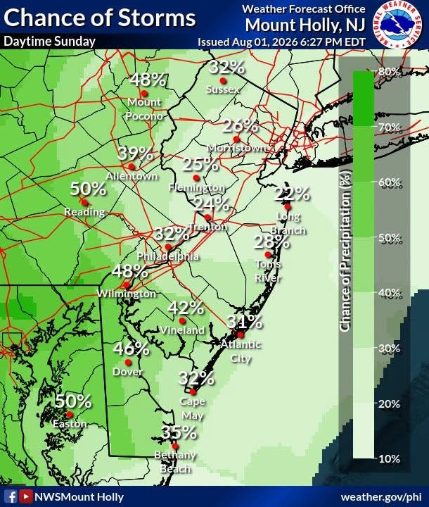
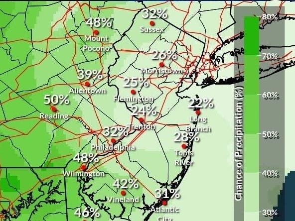
Sunday’s daytime forecast calls for mostly cloudy skies and increasing humidity, with high temperatures mainly in the low to mid 80s. While chances for showers and thunderstorms are expected to increase during the afternoon and evening, the forecast says most places should remain dry during the daytime hours. Storm coverage is then expected to increase Sunday night into Monday.
For residents, the main impacts are the potential for flash flooding in low-lying and poor drainage spots, along with the chance for damaging winds and lightning in stronger storms. The forecast points to an elevated risk period overnight and into the start of the work week.
The next key window in the forecast is Sunday night through Monday, when the National Weather Service says the most widespread storm activity and the highest concern for flooding and severe weather are expected.
Get more local news delivered straight to your inbox. Sign up for free Patch newsletters and alerts.