Weather
Possible Severe NJ Weather: Hazardous Weather Outlook Issued
Strong winds and storms are possible. Here's where.


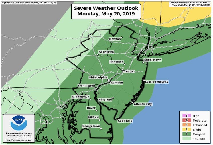
Strong winds and storms are possible as severe weather is again expected to hit New Jersey on Monday.
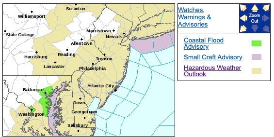
The National Weather Service has issued a hazardous weather outlook for nearly the entire state, saying scattered thunderstorms with gusty winds and locally heavy rains are possible.
Michael Gorse, an NWS meteorologist, said the severe weather is mostly likely to take place in Burlington County and south, with damaging, 60-mph wind gusts possible.
Find out what's happening in Ocean Cityfor free with the latest updates from Patch.
In Bergen County, a few of the stronger storms could produce large hail and damaging winds. Locally heavy rain will also be possible, resulting in mainly urban and poor drainage flooding.
Here are the alerted areas:
Find out what's happening in Ocean Cityfor free with the latest updates from Patch.
Gorse estimated that there is a 50 percent chance of stormy weather in South Jersey. Much of that bad weather is possible after 5 p.m.
Temperatures are also expected to approach 90 degrees across the state on Monday.
Here is the forecast:
- Monday afternoon: Partly sunny, with a high near 87. Southwest wind around 17 mph.
- Monday night: Scattered showers and thunderstorms before 11pm. Partly cloudy, with a low around 54. Southwest wind 8 to 10 mph becoming northwest after midnight. Chance of precipitation is 30%. New precipitation amounts of less than a tenth of an inch, except higher amounts possible in thunderstorms.
- Tuesday: Sunny, with a high near 71. Northwest wind 13 to 15 mph.
- Tuesday night: Mostly clear, with a low around 50. Northwest wind 7 to 10 mph.
- Wednesday: Mostly sunny, with a high near 73. North wind 7 to 9 mph.
Get more local news delivered straight to your inbox. Sign up for free Patch newsletters and alerts.