Weather
Update On Hurricane Jose's Latest Track: Should NJ Worry?
The big question is: Will the storm that's spinning in the Atlantic Ocean ultimately impact New Jersey?

There's yet another storm in the Atlantic Ocean that could make landfall in the Northeast. But even if it doesn't, New Jersey should brace for some kind of impact from Hurricane Jose, forecasters say.
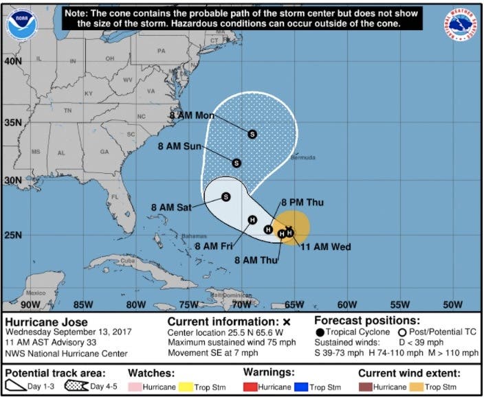
Jose, currently a Category 1 hurricane, was churning about 500 miles to the east-northeast of the Bahamas on Wednesday, moving in a circular pattern to the south, and then the northwest, before it's expected to head in a direction pointed toward the Northeast this weekend.
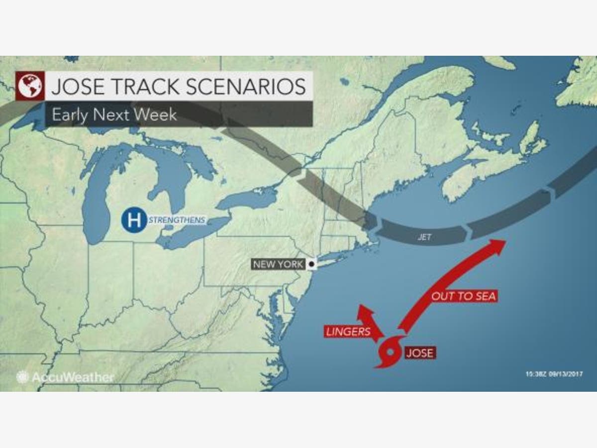
Steering winds, however, will diminish in the vicinity of Jose and will lead to a few scenarios for the path of the storm that will likely push it out to sea, according to an AccuWeather release.
Find out what's happening in Ocean Cityfor free with the latest updates from Patch.
"Jose could remain at sea and pose no direct threat to land," AccuWeather Hurricane Expert Dan Kottlowski.
In this at-sea scenario, the Northeastern states will be in for an extended period of sunny and warm weather.
Find out what's happening in Ocean Cityfor free with the latest updates from Patch.
However, while landfall in the U.S. is unlikely, it is possible Jose could get close enough to throw clouds, rain and gusty winds as far west as the immediate mid-Atlantic and southern New England coasts, according to AccuWeather.
And, of course, the track could change — just as Superstorm Sandy did in 2012, when it appeared headed out to sea before making a due-east track change.
The Weather Channel noted that a "small amount of forecast guidance" shows Jose stalling again next week, while potentially moving closer to the U.S. East Coast.
"All interests along the U.S. East Coast from the Carolinas northward should continue to monitor Jose well into next week for any forecast changes," according to The Weather Channel.
Nearly all models, however, have the storm eventually moving to the north and east.
Pasta sauce all warmed up and ready to go? Great. Here is your morning serving of 00Z GFS 'spaghetti' plot for #Jose. pic.twitter.com/ogEcwPGsne
— Gary Szatkowski (@GarySzatkowski) September 12, 2017
Regardless of Jose’s exact path, seas will be churned up from the Bahamas and Bermuda to the U.S. East Coast and later Nova Scotia and Newfoundland, according to AccuWeather.
Swimmers should be extra cautious. The strength and frequency of rip currents will increase at a time when many lifeguards are no longer on duty and people might head to the beach, according to AccuWeather.
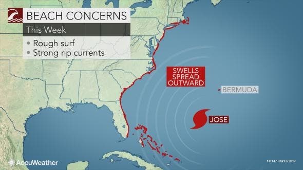
AccuWeather also warned that beach erosion caused by Irma along the southern Atlantic Seaboard and persistent winds from non-tropical systems in the mid-Atlantic could be exacerbated.
AccuWeather photo
Get more local news delivered straight to your inbox. Sign up for free Patch newsletters and alerts.