Weather
Coastal Storm, 50-MPH Winds Expected In NJ
Winds as strong as 50-mph could arrive as a coastal storm is expected to impact NJ, forecasters say.

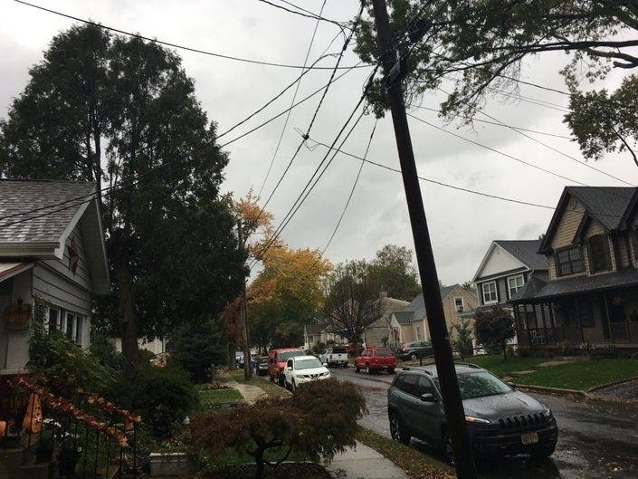
NEW JERSEY – A coastal storm is expected to impact New Jersey this weekend, packing 40- to 50-mph winds and possibly causing "widespread" flooding by Sunday night, forecasters say.
Read the update: Update On Coastal Storm, 50-MPH Winds Expected In NJ
The National Weather Service has issued a hazardous weather outlook for eight New Jersey counties, saying the rough weather is expected to begin with rain on Saturday and possibly linger until Monday morning. Those counties are Middlesex, Monmouth, Atlantic, Ocean, Cape May, Cumberland, Salem and eastern Burlington.
Find out what's happening in Point Pleasantfor free with the latest updates from Patch.
While some minor coastal flooding is possible during Saturday's high tide, a more widespread coastal flooding event is probable around the time of Sunday's high tide and possibly lingering into Monday's high tide, according to the National Weather Service.
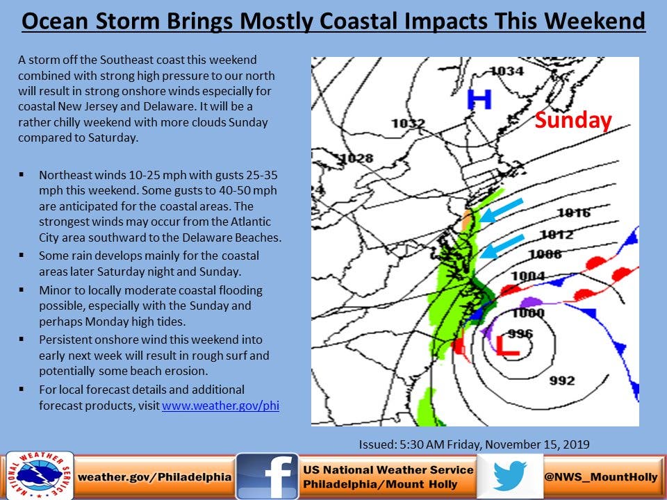
Northeast wind gusts should reach 40 to perhaps 50 mph Saturday and Sunday, especially along the Atlantic coast, with areas from the Atlantic City region southward to the Delaware Beaches potentially receiving the strongest winds. A wind advisory may be needed for at least parts of the area, the NWS says.
Find out what's happening in Point Pleasantfor free with the latest updates from Patch.
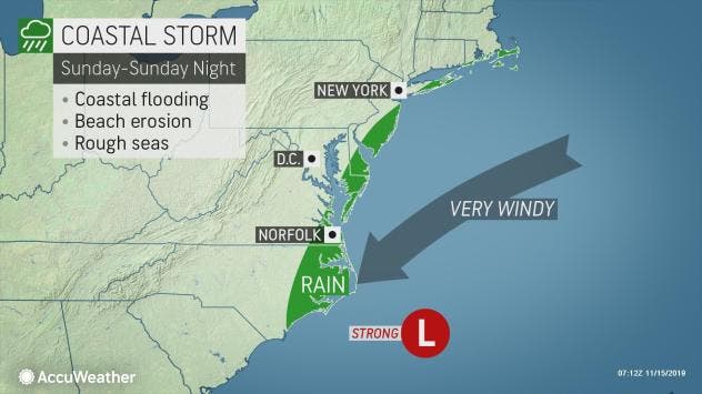
AccuWeather is calling the storm a "nor'easter," saying its impacts will expand to the coastal Northeast later this weekend to early next week.
Gale warnings are in effect along the coastline from South Carolina to New Jersey and storm watches are in place along the North Carolina coast, which was recently battered by Hurricane Dorian, according to AccuWeather.
The difference in pressure between the strengthening storm and high pressure over the interior Northeast will create strong winds from the northeast and north, according to AccuWeather.
Enough wind, waves and above-normal tides are in store to cause significant chill, minor coastal flooding and some beach erosion from Maryland and Delaware to New Jersey, southeastern New York state and eastern Massachusetts from the storm.
Here is the forecast:
- Friday afternoon: Mostly sunny, with a high near 52. West wind around 6 mph.
- Friday night: Partly cloudy, with a low around 28. Northwest wind 5 to 14 mph becoming north after midnight.
- Saturday: Sunny, with a high near 41. Breezy, with a northeast wind 20 to 23 mph, with gusts as high as 34 mph.
- Saturday night: A chance of rain after 1am. Mostly cloudy, with a low around 34. Breezy, with a northeast wind 15 to 20 mph, with gusts as high as 31 mph. Chance of precipitation is 30%. New precipitation amounts of less than a tenth of an inch possible.
- Sunday: A chance of rain. Cloudy, with a high near 48. Breezy, with a northeast wind 18 to 23 mph, with gusts as high as 37 mph. Chance of precipitation is 50%. New precipitation amounts of less than a tenth of an inch possible.
- Sunday night: Rain likely, mainly between 10pm and 1am. Cloudy, with a low around 39. Breezy. Chance of precipitation is 60%. New precipitation amounts of less than a tenth of an inch possible.
- Monday: A chance of rain. Cloudy, with a high near 47. Chance of precipitation is 50%.
Get more local news delivered straight to your inbox. Sign up for free Patch newsletters and alerts.


