Weather
First Chance Of Snow Sneaks Into NJ Forecast: Here's Where
UPDATE: Here's when and how it will affect you in 12 NJ counties. The s-word (snow) has entered the forecast. Here's where.


UPDATE: The National Weather Service updated its forecast Monday to show that the possibility of snow in Sussex, Morris, Warren and Passaic counties on Thursday night and Friday morning has increased.
NEW JERSEY – The work week will start with near-freezing temperatures and it may end with the first snow of the season falling in New Jersey.
Areas of frost are likely in New Jersey before 8 a.m. Monday. The week then looks mostly dry until we get to Thursday night into Friday.
Find out what's happening in Point Pleasantfor free with the latest updates from Patch.
That's when we're supposed to get snow, and it's in the forecast in 12 New Jersey counties: Bergen, Hudson, Essex, Warren, Passaic, Sussex, Morris, Middlesex, Monmouth, Somerset, Union and Sussex counties.
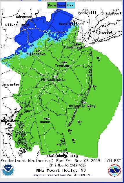
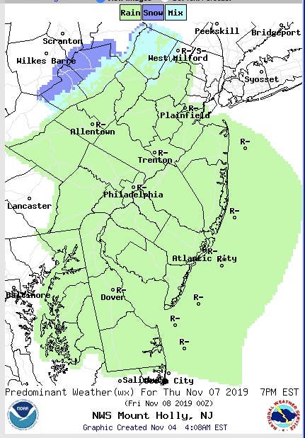
The snow will develop in several stages. Here is the forecast at 7 p.m. on Thursday:
Find out what's happening in Point Pleasantfor free with the latest updates from Patch.
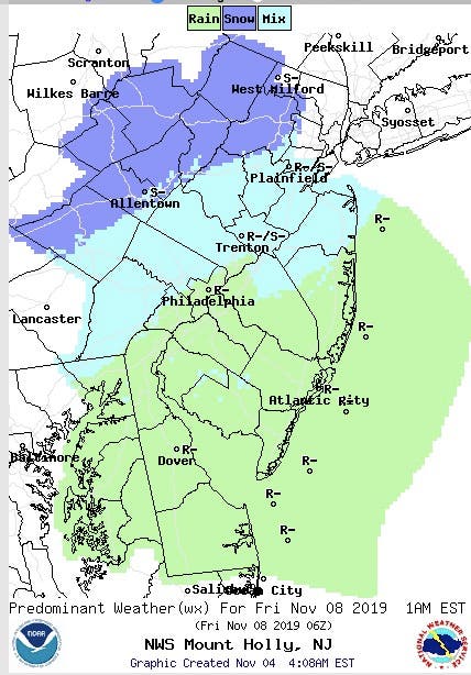
Here is the forecast at 1 a.m. on Friday:
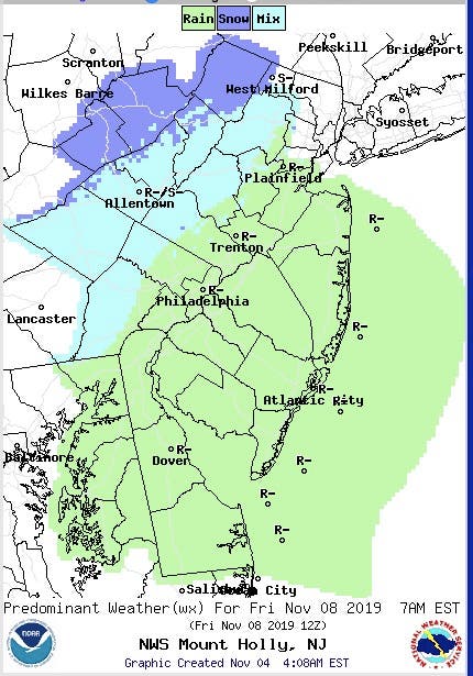
Here is the forecast at 7 a.m. on Friday:
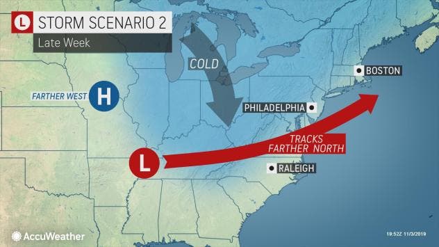
"For the end of the week, we`ll be watching the development of a southern stream storm which is expected to develop across the southern Plains," the National Weather Service says. "Model guidance is somewhat divided on this system's movement."
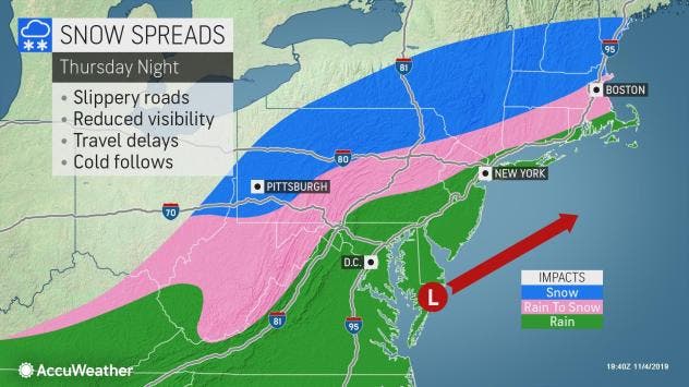
For the moment, the weather service says there will be a chance of snow showers on Thursday night and Friday morning..
A LOT of uncertainty, but we’re talking tonight about the potential for the first flakes of the season for some by late week! @CBSPhilly pic.twitter.com/u32RPAb0AQ
— Lauren Casey (@LaurenCBS3) November 4, 2019
A storm budding in the south-central U.S. earlier in the week will take aim at the East Coast, and could deliver both heavy rain and wintry weather, according to AccuWeather.
An active pattern will continue to bring several storms from the center of the country to the Eastern Seaboard throughout the week, according to AccuWeather. The presence of many moving parts makes for a more long-term complex pattern.
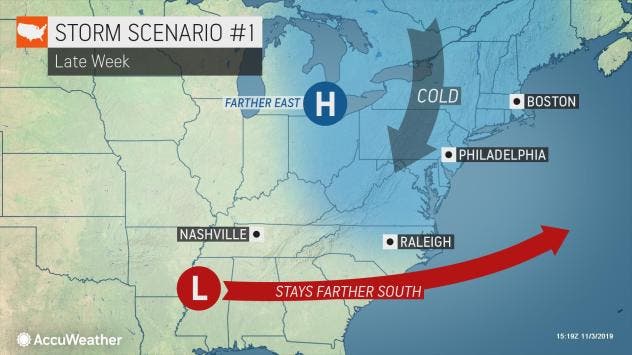
Residents will want to keep a close eye on this storm, and prepare for changeable conditions, according to AccuWeather. Snow falling in the mid-Atlantic is not unprecedented for early November.
Here is the forecast:
- Monday night: Mostly cloudy, with a low around 47. Southwest wind 5 to 7 mph.
- Tuesday: A 20 percent chance of showers after 11am. Mostly cloudy, with a high near 59. Southwest wind 5 to 7 mph.
- Tuesday night: Mostly cloudy, then gradually becoming clear, with a low around 39. Northwest wind around 8 mph.
- Wednesday: Sunny, with a high near 51. Northwest wind 6 to 8 mph.
- Wednesday night: Partly cloudy, with a low around 38.
- Thursday: A 50 percent chance of rain. Mostly cloudy, with a high near 54.
- Thursday night: A chance of rain (or snow in North Jersey). Mostly cloudy, with a low around 33. Chance of precipitation is 50%.
- FridayPartly sunny, with a high near 40
Get more local news delivered straight to your inbox. Sign up for free Patch newsletters and alerts.


