Weather
NJ Weather: Hazardous Weather Outlook, Strong Thunderstorms, Heat
The National Weather Service is preparing us for strong storms and severe heat in New Jersey. Downed power lines and trees possible.


New Jersey should soon be getting some of the strongest storms and most intense heat we've had in weeks. The National Weather Service has issued a hazardous weather outlook and a heat advisory for the next three days.
The National Weather Service alert says heavy, drenching rain leading to localized flooding is possible, along with gusty thunderstorms beginning Monday night. The worst storms are expected for Tuesday and Wednesday.
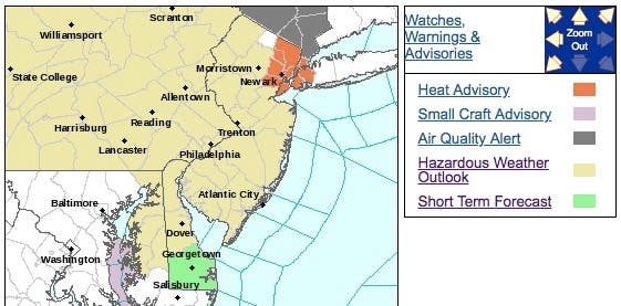
A heat advisory is in effect, too, for parts of New Jersey. The heat index is supposed to hit the upper 90s with actual temperatures in the lower 80s. The worst of it is expected to happen on Monday afternoon and Tuesday afternoon.
Find out what's happening in Point Pleasantfor free with the latest updates from Patch.
Here are the alerted areas:
From Monday afternoon into Monday night, locally drenching and gusty thunderstorms are forecast to "riddle" the region, AccuWeather Senior Meteorologist Alex Sosnowski said.
Find out what's happening in Point Pleasantfor free with the latest updates from Patch.
While flash flooding will be the primary threat, strong to in some cases damaging winds will be an additional danger with the storms. The greatest risk for severe weather is forecast to extent from southeastern New York and northern New Jersey to southern parts of New Hampshire, Vermont and Maine, according to AccuWeather.
In these areas, storms can become strong enough to bring down trees and power lines and cause property damage. "Cities at risk for localized flash flooding and neighborhood power outages include Detroit, Cleveland, Cincinnati, Pittsburgh, Toronto, Buffalo, New York, and Charleston, West Virginia," Sosnowski said.
Motorists and airline passengers should be prepared for delays during their afternoon and evening commutes, according to AccuWeather. The zone of drenching storms will slowly move eastward on Tuesday, threatening to disrupt travel and outdoor plans from Maine to Maryland and Virginia.
Extreme heat can cause illness and death among at-risk population who cannot stay cool. The heat and humidity may cause heat stress during outdoor exertion or extended exposure, according to the NWS.
-1531746079-2189.jpg)
Here is the forecast:
- Monday: A slight chance of showers and thunderstorms after 2pm. Mostly sunny, with a high near 91. Southwest wind 3 to 6 mph. Chance of precipitation is 20%.
- Monday night: A chance of showers and thunderstorms, mainly before 11pm. Mostly cloudy, with a low around 74. South wind around 8 mph. Chance of precipitation is 30%. New rainfall amounts of less than a tenth of an inch, except higher amounts possible in thunderstorms.
- Tuesday: Showers and thunderstorms, mainly after 3pm. Some of the storms could produce heavy rain. High near 88. Southwest wind 7 to 10 mph. Chance of precipitation is 80%. New rainfall amounts between a quarter and half of an inch possible.
- Tuesday night: Showers and thunderstorms, mainly before 3am. Some of the storms could produce heavy rain. Low around 67. Light and variable wind becoming north 6 to 11 mph after midnight. Chance of precipitation is 80%. New rainfall amounts between a half and three quarters of an inch possible.
- Wednesday: A slight chance of showers and thunderstorms before 9am. Mostly sunny, with a high near 86. North wind 6 to 8 mph. Chance of precipitation is 20%.
Chris Sheldon photo
Get more local news delivered straight to your inbox. Sign up for free Patch newsletters and alerts.


