Weather
Update On Snow, Wintry Weather In NJ Holiday Weekend Forecast
Here's the latest on the wintry mess that's expected to hit New Jersey this weekend, as another storm looms.

NEW JERSEY – The National Weather Service has released more details on the wintry weather that's expected to hit New Jersey this weekend. So it's not too late to adjust your plans if you're planning to travel Sunday.
The NWS has issued a hazardous weather outlook for all of New Jersey, saying the next system could bring a wintry mix of precipitation Sunday morning before changing to rain later in the day. Accumulation numbers have also been released (see below).
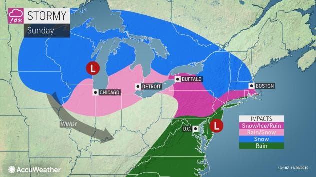
The storm originated in the West and wrought havoc for Thanksgiving travelers in the days leading up to the holiday. It will now make its presence felt and bring a new round of travel woes this weekend to those in the northeastern United States, according to AccuWeather.
Find out what's happening in Point Pleasantfor free with the latest updates from Patch.
The storm system from the Midwest is forecast to crawl into the region spanning Saturday, Saturday night and Sunday, according to AccuWeather. This means that motorists venturing along the Interstates 80 and 78 corridors may encounter slippery conditions.
Roads that appear wet may be icy, especially but not limited to bridges, overpasses and areas that are sheltered from direct sunlight, according to AccuWeather.
Find out what's happening in Point Pleasantfor free with the latest updates from Patch.
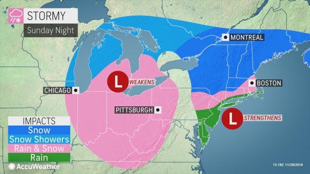
Some areas will even get some accumulation of snow by Sunday night:
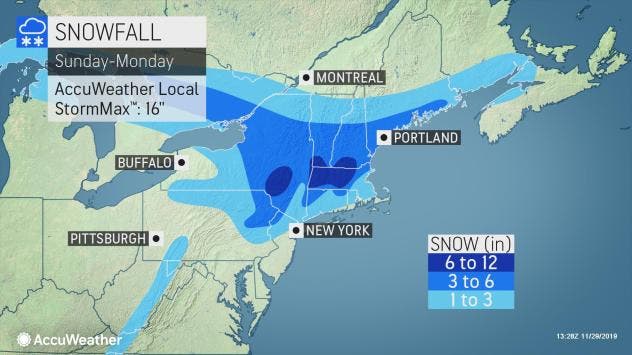
Rain, however, may wash away much of that accumulation before a larger and more potent system is expected to hit the area Monday. Here is what the combined impact of the snow and wintry weather will have Sunday and Monday:
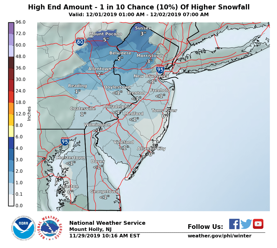
Here is the high-end expectation of snow for Sunday and Monday:
Here is the forecast:
- Friday: Sunny, with a high near 44. Northwest wind 9 to 11 mph.
- Friday night: Partly cloudy, with a low around 26. North wind 6 to 8 mph.
- Saturday: Mostly sunny, with a high near 44. Northwest wind around 7 mph.
- Saturday night: A chance of snow, mainly after 4 a.m. Mostly cloudy, with a low around 29. Light and variable wind becoming northeast around 6 mph after midnight. Chance of precipitation is 30 percent. Little or no snow accumulation expected.
- Sunday: A chance of rain, snow, and sleet before 10 a.m., then rain. High near 44. East wind 5 to 14 mph. Chance of precipitation is 90 percent. New snow and sleet accumulation of less than a half inch possible.
- Sunday night: Rain. Low around 35. Chance of precipitation is 80 percent. New precipitation amounts between a tenth and quarter of an inch possible.
- Monday: Rain likely. Cloudy, with a high near 41. Chance of precipitation is 70 percent.
- Monday night: A chance of rain and snow before 1 a.m., then a chance of snow. Cloudy, with a low around 28. Chance of precipitation is 40 percent.
- Tuesday: Mostly sunny, with a high near 41.
Get more local news delivered straight to your inbox. Sign up for free Patch newsletters and alerts.


