Seasonal & Holidays
Snow, Thunderstorms, Record-High Temperatures All Possible This Week: NJ’s Latest Forecast
A week of "rollercoaster" weather in New Jersey could include record-high temperatures followed by rain and snow, forecasters say.

Potentially record-setting high temperatures in much of the state through Wednesday may be followed by thunderstorms and even snow, say forecasters.
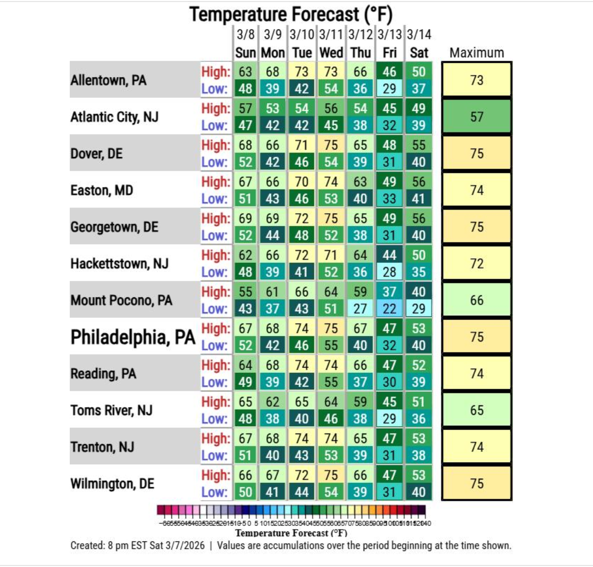
"Here's a closer look at our temperature rollercoaster within the next week," the National Weather Service said. "A warmer pattern will start Sunday, peaking Tuesday and Wednesday when 70s are most likely to occur. A strong cold frontal system will pass through sometime Thursday, then we get a reality check with temperatures falling closer to normal again."
Monday will start off full of sunshine, with highs reaching 70 in parts of the state.
Find out what's happening in Ridgewood-Glen Rockfor free with the latest updates from Patch.
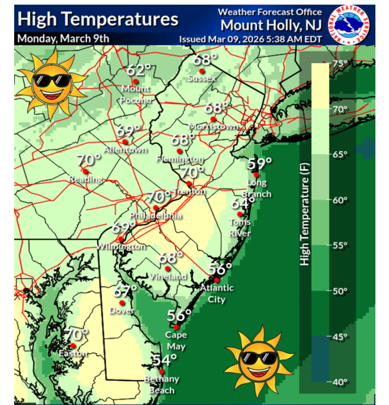
"Warmth will spread from the Midwest to the Atlantic Coast Monday," Accuweather said. "Some record highs dating back to the early 1900s may be matched or topped. Widespread highs in the 60s and 70s are expected across the Northeast."
While the weather will remain partly sunny on Tuesday and Wednesday, beware of dense fog at night, the NWS notes.
Find out what's happening in Ridgewood-Glen Rockfor free with the latest updates from Patch.
Storms Roll In
A cold front will clash with the warmer weather, resulting in rain and possibly thundershowers Wednesday night into Thursday, forecasters say.
As the weekend approaches, temperatures will tumble, dropping as low as 28 on Friday in parts of the state.
In fact, there's a chance of rain and snow in the northern parts of the state Thursday and Friday, the NWS predicts.
"Seasonable temperatures late week into the weekend with a couple disturbances bringing some more unsettled weather," they noted.
End Of 'Climatological' Winter
Those who long to put their snow shovel away have some promising news. The National Weather Service said Sunday night that the state has emerged from the coldest three months of the year, or climatological winter.
"We've talked about astronomical spring (defined by the date of the equinox) and meteorological spring (defined as the three months with significant warming)," they wrote.
"Today, however, we reach the end of local climatological winter... the 3 month period with the coldest average temperatures. We made it!"
Get more local news delivered straight to your inbox. Sign up for free Patch newsletters and alerts.