Weather
N.J. Weather: Winter Storm Watch Issued Ahead Of New Jersey Nor'easter
Heavy snow and strong winds are expected as part of the "major" storm and nor'easter.

The National Weather Service has issued a "winter storm watch" that will be in effect for almost all of New Jersey from Monday evening through Tuesday evening.
The watch will be in effect from 8 p.m. Monday until 8 p.m. Tuesday. Only the southern tip of the state has received a hazardous weather outlook.
Find out what's happening in Toms Riverfor free with the latest updates from Patch.
Click here to stay up-to-date on storm developments by subscribing to your local Patch emails.
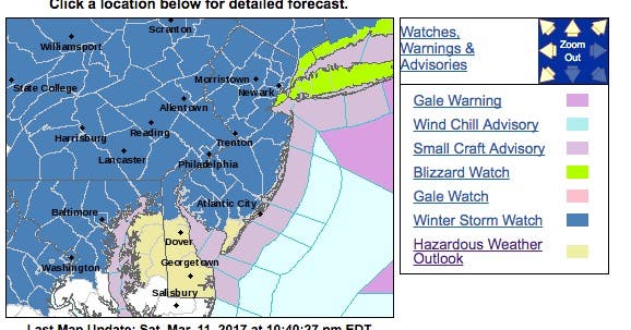
Here is the map of the alerted areas:
Find out what's happening in Toms Riverfor free with the latest updates from Patch.
Here is what is expected:
- LOCATIONS...Eastern Pennsylvania, all but far southeastern New Jersey, northern Delaware, and the northern portions of the Eastern Shore of Maryland.
- HAZARD TYPES...Heavy snow and strong winds.
- ACCUMULATIONS...Potential for storm total snowfall greater than 6 inches. However, there remains uncertainty in exact totals as a sharp gradient will exist between the heaviest snowfall and locations where very little snow may occur. Changes to the forecast track of the storm can result in substantial changes in the total accumulations.
- TIMING...Snow begins Monday evening from southwest to northeast across the watch area. Snow will continue on Tuesday with potential for transition to a wintry mix or rain southeast of I-95. Any wintry mix or rain may transition back to snow Tuesday evening before diminishing Tuesday night.
- IMPACTS...Heavy snow may cause significant travel disruptions.
- WINDS...Northeast 10 to 20 mph with gusts up to 40 mph. The highest winds should occur southeast of the I-295 corridor.
- PRECAUTIONARY/PREPAREDNESS ACTIONS...A winter storm watch means there is a potential for significant snow...sleet...or ice accumulations that may impact travel.

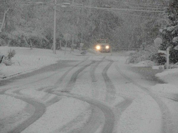
Patch file photo
Get more local news delivered straight to your inbox. Sign up for free Patch newsletters and alerts.


