Weather
When Will Wayne's Heatwave End: Here's The Forecast
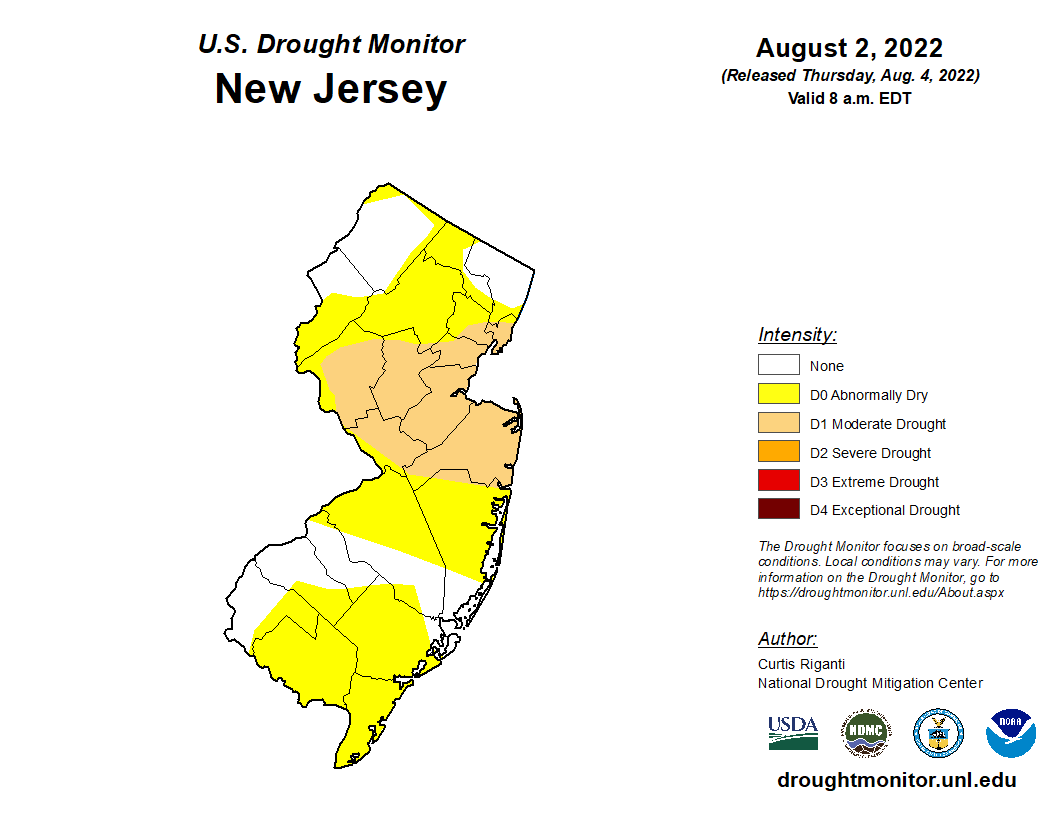
Much of the Wayne area has been 'abnormally dry,' leading to drought concerns amid this summer's stretches of hot, dry weather.

WAYNE, NJ — A heatwave that has elevated drought concerns around Wayne and New Jersey could end soon, according to forecasters.
An intense stretch of sweltering temperatures hit New Jersey last week — peaking on Thursday for much of the Northeast. But a cold front could lower the heat in the region soon, according to AccuWeather.
Wayne remains under a heat advisory until 8 p.m. Tuesday. The National Weather Service predicted heat index values — how hot the temperature "feels" — in the low 100s during that span for northeast New Jersey. The agency projects a heat index value of 102 on Tuesday.
Find out what's happening in Waynefor free with the latest updates from Patch.
The agency forecasts a high of 95 degrees on Wednesday before a stretch of more manageable heat. That includes projected highs near 85 on Wednesday and Thursday and then highs near 80 on Friday and Saturday.
"By Friday, as some much less humid air arrives, daytime temperatures in the Northeast should range in the lower 80s," said AccuWeather Senior Meteorologist Carl Babinski.
Find out what's happening in Waynefor free with the latest updates from Patch.
Wayne's forecast shows chances of showers and thunderstorms from Tuesday through 2 p.m. Thursday. The rain and cooler weather could help New Jersey further itself from drought conditions.
Much of the Wayne area has been "abnormally dry," according to the National Drought Mitigation Center, which partners with federal agencies. Some of the state has been caught in a "moderate drought" pattern, according to the agency.
Passaic County saw less rain than usual from July 4 through Aug. 2. The National Weather Service measured 2.6 inches of precipitation during the stretch, down from the mean measurement of 4.4 inches during that span.
Here's the National Weather Service's latest Wayne forecast:
- Tuesday: A 40 percent chance of showers and thunderstorms after 2 p.m. Mostly sunny, with a high near 95. Heat index values as high as 102. Southwest wind 6 to 9 mph.
- Tuesday night: A 50 percent chance of showers and thunderstorms before 2 a.m. Mostly cloudy, with a low around 72. North wind 3 to 6 mph.
- Wednesday: A 50 percent chance of showers and thunderstorms after 8 a.m. Partly sunny, with a high near 85. Calm wind.
- Wednesday night: Showers likely and possibly a thunderstorm. Mostly cloudy, with a low around 69. Chance of precipitation is 60 percent. New rainfall amounts between a quarter and half of an inch possible.
- Thursday: A 30 percent chance of showers before 2 p.m. Partly sunny, with a high near 85.
- Thursday night: Partly cloudy, with a low around 64.
- Friday: Sunny, with a high near 80.
- Friday night: Mostly clear, with a low around 59.
- Saturday: Sunny, with a high near 80.
Get more local news delivered straight to your inbox. Sign up for free Patch newsletters and alerts.